TopoQuest Logo
Do you find TopoQuest useful?
Help keep TopoQuest running and adding new maps/features by donating!
Bitcoin:  19c7KJd3qBynnjoSw5npx9KScwjBe4ifkT
Litecoin:  LXs6TkuXGGXo1vDsWCkWVdjQX94eUKd6ui
Home View Maps Find Maps Find Places Resources & Links


Hedstrom Lake SE, Montana Topographic Map

USGS Map Title: Hedstrom Lake SE, MT
USGS Map MRC: 47106A1
DRG (GeoTIFF) Download: o47106a1.tif


Neighboring USGS Topographic Map Quads:


  Hedstrom Lake NW, MT  
47106B2
 

  Hedstrom Lake, MT  
47106B1
 

  Berry School, MT  
47105B8
 

  Tree Coulee School, MT  
47106A2
 

  Hedstrom Lake SE, MT  
47106A1
 

  Heitz School, MT  
47105A8
 

  Little Chalk Butte, MT  
46106H2
 

  Crow Rock, MT  
46106H1
 

  Combs Ranch, MT  
46105H8


Map MRC Location:

N48°
W107°
N48°
W106°
H8 H7 H6 H5 H4 H3 H2 H1
G8 G7 G6 G5 G4 G3 G2 G1
F8 F7 F6 F5 F4 F3 F2 F1
E8 E7 E6 E5 E4 E3 E2 E1
D8 D7 D6 D5 D4 D3 D2 D1
C8 C7 C6 C5 C4 C3 C2 C1
B8 B7 B6 B5 B4 B3 B2 B1
A8 A7 A6 A5 A4 A3 A2 A1
N47°
W107°
N47°
W106°

Hedstrom Lake SE, MT USGS 1:24K Topographic Map Preview:
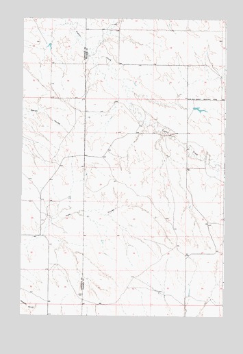
Hedstrom Lake SE, MT USGS Topographic Map
Click on map above to begin viewing in our Map Viewer.

This topographic map contains these locations and features:
Feature Name Type Latitude Longitude GNIS ID View Map
15N44E11DDBD01 WellWellN47.0644°W106.1109°820518View Map
15N44E24BCBC01 WellWellN47.0431°W106.0897°820372View Map
15N44E25CCAD01 WellWellN47.0211°W106.1036°820211View Map
15N45E04CBCC01 WellWellN47.0808°W106.0445°820624View Map
15N45E06AAAC01 WellWellN47.0900°W106.0684°820673View Map
15N45E09CDBA01 WellWellN47.0656°W106.0372°820524View Map
15N45E29AABC01 WellWellN47.0328°W106.0492°820296View Map
15N45E33CBAD01 WellWellN47.0106°W106.0397°820123View Map
16N44E25ABBD01 WellWellN47.1189°W106.0953°820855View Map
16N44E25BBAA01 WellWellN47.1197°W106.1045°820866View Map
16N44E25BBAB01 WellWellN47.1197°W106.0881°820865View Map
16N44E25BBAC01 WellWellN47.1192°W106.1045°820864View Map
16N45E29CDDB01 WellWellN47.1067°W106.0575°820772View Map
Chalk Butte CreekStreamN47.0897°W106.0311°1715801View Map
Elhard School (historical)SchoolN47.1203°W106.0125°1715689View Map
Graber Post Office (historical)Post OfficeN47.0072°W106.0111°1715655View Map
Graeber School (historical)SchoolN47.0194°W106.0122°1715698View Map
Slinker CreekStreamN47.0958°W106.0611°1715798View Map
Swift DamDamN47.0867°W106.0189°795508View Map

Note: Coordinates in the location and feature list above are referenced to NAD83 datum.


Copyright (C) 2008-2025 Ryan Niemi / Sunset Dynamics ... All Rights Reserved