TopoQuest Logo
Do you find TopoQuest useful?
Help keep TopoQuest running and adding new maps/features by donating!
Bitcoin:  19c7KJd3qBynnjoSw5npx9KScwjBe4ifkT
Litecoin:  LXs6TkuXGGXo1vDsWCkWVdjQX94eUKd6ui
Home View Maps Find Maps Find Places Resources & Links


Heitz School, Montana Topographic Map

USGS Map Title: Heitz School, MT
USGS Map MRC: 47105A8
DRG (GeoTIFF) Download: o47105a8.tif


Neighboring USGS Topographic Map Quads:


  Hedstrom Lake, MT  
47106B1
 

  Berry School, MT  
47105B8
 

  Watkins, MT  
47105B7
 

  Hedstrom Lake SE, MT  
47106A1
 

  Heitz School, MT  
47105A8
 

  Watkins SE, MT  
47105A7
 

  Crow Rock, MT  
46106H1
 

  Combs Ranch, MT  
46105H8
 

  Little Sheep Mountain, MT  
46105H7


Map MRC Location:

N48°
W106°
N48°
W105°
H8 H7 H6 H5 H4 H3 H2 H1
G8 G7 G6 G5 G4 G3 G2 G1
F8 F7 F6 F5 F4 F3 F2 F1
E8 E7 E6 E5 E4 E3 E2 E1
D8 D7 D6 D5 D4 D3 D2 D1
C8 C7 C6 C5 C4 C3 C2 C1
B8 B7 B6 B5 B4 B3 B2 B1
A8 A7 A6 A5 A4 A3 A2 A1
N47°
W106°
N47°
W105°

Heitz School, MT USGS 1:24K Topographic Map Preview:
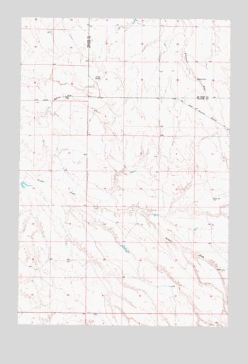
Heitz School, MT USGS Topographic Map
Click on map above to begin viewing in our Map Viewer.

This topographic map contains these locations and features:
Feature Name Type Latitude Longitude GNIS ID View Map
15N45E14CBAB01 WellWellN47.0556°W105.9992°820451View Map
15N45E24CDAB01 WellWellN47.0369°W105.9722°820340View Map
15N45E25DBBB01 WellWellN47.0264°W105.9697°820244View Map
15N46E03BDDD01 WellWellN47.0883°W105.8867°820662View Map
15N46E04ACBB01 WellWellN47.0878°W105.9070°820659View Map
15N46E04BBAA01 WellWellN47.0864°W105.9070°820652View Map
15N46E04BBBC01 WellWellN47.0919°W105.9170°820690View Map
15N46E06BCAC01 WellWellN47.0881°W105.9570°820661View Map
15N46E06BCAC02 WellWellN47.0883°W105.9570°820663View Map
15N46E09DBAD01 WellWellN47.0722°W105.9072°820554View Map
15N46E19CBDA01 WellWellN47.0389°W105.9559°820352View Map
15N46E20CCCA01 WellWellN47.0358°W105.9367°820326View Map
15N46E22BDDD01 WellWellN47.0419°W105.8861°820365View Map
15N46E27DDAB01 WellWellN47.0231°W105.8778°820223View Map
15N46E33BADC01 WellWellN47.0164°W105.9092°820164View Map
15N46E34BBDD01 WellWellN47.0164°W105.8914°820163View Map
16N45E26AAAC01 WellWellN47.1192°W105.9831°820863View Map
16N46E30AABB01 WellWellN47.1214°W105.9439°820875View Map
16N46E31BABB01 WellWellN47.1072°W105.9539°820775View Map
16N46E32BBAA01 WellWellN47.1067°W105.9336°820771View Map
Brewer WellWellN47.0519°W105.8853°769205View Map
Chalk ButteSummitN47.1006°W105.9561°769738View Map
East Branch Timber CreekStreamN47.0572°W105.9806°1715795View Map
Heitz School (historical)SchoolN47.0925°W105.9736°772317View Map
Hillside School (historical)SchoolN47.0628°W105.9117°1715707View Map
Lower DamDamN47.0583°W105.9872°796476View Map
McMullin Brothers Cooperative DamDamN47.0450°W105.9206°796478View Map
McMullin Brothers Detention DamDamN47.0400°W105.9206°796477View Map
McMullin Brothers Upper DamDamN47.0333°W105.9389°796479View Map
Middle Fork Timber CreekStreamN47.0572°W105.9806°1715796View Map
Pasture 7A WellWellN47.0228°W105.8775°775106View Map
Redwater WellWellN47.1003°W105.8956°775683View Map
Schlinker School (historical)SchoolN47.0911°W105.9922°1715732View Map
South Fork Timber CreekStreamN47.0464°W105.9711°1715797View Map

Note: Coordinates in the location and feature list above are referenced to NAD83 datum.


Copyright (C) 2008-2025 Ryan Niemi / Sunset Dynamics ... All Rights Reserved