TopoQuest Logo
Do you find TopoQuest useful?
Help keep TopoQuest running and adding new maps/features by donating!
Bitcoin:  19c7KJd3qBynnjoSw5npx9KScwjBe4ifkT
Litecoin:  LXs6TkuXGGXo1vDsWCkWVdjQX94eUKd6ui
Home View Maps Find Maps Find Places Resources & Links


Combs Ranch, Montana Topographic Map

USGS Map Title: Combs Ranch, MT
USGS Map MRC: 46105H8
DRG (GeoTIFF) Download: o46105h8.tif


Neighboring USGS Topographic Map Quads:


  Hedstrom Lake SE, MT  
47106A1
 

  Heitz School, MT  
47105A8
 

  Watkins SE, MT  
47105A7
 

  Crow Rock, MT  
46106H1
 

  Combs Ranch, MT  
46105H8
 

  Little Sheep Mountain, MT  
46105H7
 

  Crow Rock SE, MT  
46106G1
 

  Twin Buttes School, MT  
46105G8
 

  Morehouse Creek, MT  
46105G7


Map MRC Location:

N47°
W106°
N47°
W105°
H8 H7 H6 H5 H4 H3 H2 H1
G8 G7 G6 G5 G4 G3 G2 G1
F8 F7 F6 F5 F4 F3 F2 F1
E8 E7 E6 E5 E4 E3 E2 E1
D8 D7 D6 D5 D4 D3 D2 D1
C8 C7 C6 C5 C4 C3 C2 C1
B8 B7 B6 B5 B4 B3 B2 B1
A8 A7 A6 A5 A4 A3 A2 A1
N46°
W106°
N46°
W105°

Combs Ranch, MT USGS 1:24K Topographic Map Preview:
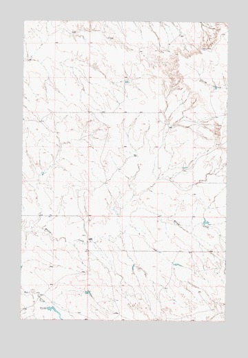
Combs Ranch, MT USGS Topographic Map
Click on map above to begin viewing in our Map Viewer.

This topographic map contains these locations and features:
Feature Name Type Latitude Longitude GNIS ID View Map
13N45E14ACCA01 WellWellN46.8842°W105.9889°819086View Map
13N45E14ACCB01 WellWellN46.8842°W105.9900°819087View Map
13N46E10ADAA01 WellWellN46.9003°W105.8753°819265View Map
13N46E10CBCA01 WellWellN46.8947°W105.8942°819222View Map
13N46E10CBCD01 WellWellN46.8942°W105.8942°819211View Map
14N45E24CBBD01 WellWellN46.9531°W105.9797°819629View Map
14N46E29BACC01 WellWellN46.9439°W105.9328°819543View Map
14N46E30DCCA01 WellWellN46.9339°W105.9467°819471View Map
Combs RanchLocaleN46.9094°W105.9589°770049View Map
Janitell Number 1 DamDamN46.9200°W105.9422°797421View Map
McDevlin Number 1 DamDamN46.9167°W105.8889°797481View Map
McMullin DamDamN46.9750°W105.9372°795736View Map
Pfaff Irrigation DamDamN46.8800°W105.9839°795338View Map
Pfaft Number 1 DamDamN46.8917°W105.9606°797482View Map
Washington School (historical)SchoolN46.9589°W105.9033°1715751View Map
Whites Creek School (historical)SchoolN46.9619°W105.9172°1715753View Map

Note: Coordinates in the location and feature list above are referenced to NAD83 datum.


Copyright (C) 2008-2025 Ryan Niemi / Sunset Dynamics ... All Rights Reserved