TopoQuest Logo
Do you find TopoQuest useful?
Help keep TopoQuest running and adding new maps/features by donating!
Bitcoin:  19c7KJd3qBynnjoSw5npx9KScwjBe4ifkT
Litecoin:  LXs6TkuXGGXo1vDsWCkWVdjQX94eUKd6ui
Home View Maps Find Maps Find Places Resources & Links


Heller Lake, Utah Topographic Map

USGS Map Title: Heller Lake, UT
USGS Map MRC: 40110E2
DRG (GeoTIFF) Download: o40110e2.tif


Neighboring USGS Topographic Map Quads:


  Mount Emmons, UT  
40110F3
 

  Bollie Lake, UT  
40110F2
 

  Rasmussen Lakes, UT  
40110F1
 

  Burnt Mill Spring, UT  
40110E3
 

  Heller Lake, UT  
40110E2
 

  Dark Canyon, UT  
40110E1
 

  Altonah, UT  
40110D3
 

  Neola NW, UT  
40110D2
 

  Neola, UT  
40110D1


Map MRC Location:

N41°
W111°
N41°
W110°
H8 H7 H6 H5 H4 H3 H2 H1
G8 G7 G6 G5 G4 G3 G2 G1
F8 F7 F6 F5 F4 F3 F2 F1
E8 E7 E6 E5 E4 E3 E2 E1
D8 D7 D6 D5 D4 D3 D2 D1
C8 C7 C6 C5 C4 C3 C2 C1
B8 B7 B6 B5 B4 B3 B2 B1
A8 A7 A6 A5 A4 A3 A2 A1
N40°
W111°
N40°
W110°

Heller Lake, UT USGS 1:24K Topographic Map Preview:
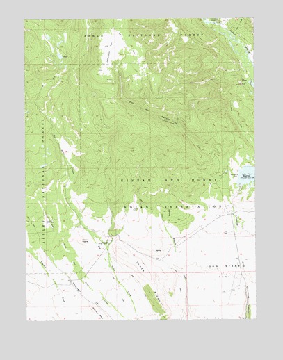
Heller Lake, UT USGS Topographic Map
Click on map above to begin viewing in our Map Viewer.

This topographic map contains these locations and features:
Feature Name Type Latitude Longitude GNIS ID View Map
Big SpringSpringN40.5986°W110.1326°1425557View Map
Big Spring Recreation AreaLocaleN40.5977°W110.1299°1425563View Map
Cedar View ReservoirReservoirN40.5591°W110.1302°1439597View Map
Clover CreekStreamN40.6188°W110.1399°1439818View Map
Clover Creek BridgeBridgeN40.6188°W110.1349°1455222View Map
Dark CanyonValleyN40.5805°W110.1657°1440267View Map
Dry Gulch Cattle CampLocaleN40.5402°W110.2388°1427551View Map
Dry Gulch Ranger StationLocaleN40.5322°W110.2060°1437971View Map
Dry Gulch Spring Number 3SpringN40.5224°W110.2415°1455244View Map
Hardinger DrawValleyN40.5019°W110.2015°1428524View Map
Heller LakeReservoirN40.6095°W110.2311°1428641View Map
Heller Lake DamDamN40.6083°W110.2307°1434836View Map
Jefferson ParkFlatN40.6124°W110.2029°1429134View Map
John Starr FlatFlatN40.5113°W110.1340°1442169View Map
Lower Dry Gulch BridgeBridgeN40.5380°W110.2174°1450114View Map
Pine Nut RidgeRidgeN40.5016°W110.2118°1431262View Map
Tower RidgeRidgeN40.5050°W110.1765°1433610View Map
Uinta Canyon CampgroundLocaleN40.6233°W110.1438°1433772View Map
Washs NippleSummitN40.5330°W110.2204°1433990View Map

Note: Coordinates in the location and feature list above are referenced to NAD83 datum.


Copyright (C) 2008-2025 Ryan Niemi / Sunset Dynamics ... All Rights Reserved