TopoQuest Logo
Do you find TopoQuest useful?
Help keep TopoQuest running and adding new maps/features by donating!
Bitcoin:  19c7KJd3qBynnjoSw5npx9KScwjBe4ifkT
Litecoin:  LXs6TkuXGGXo1vDsWCkWVdjQX94eUKd6ui
Home View Maps Find Maps Find Places Resources & Links


Henderson Ridge, Colorado Topographic Map

USGS Map Title: Henderson Ridge, CO
USGS Map MRC: 39108E5
DRG (GeoTIFF) Download: o39108e5.tif


Neighboring USGS Topographic Map Quads:


  Brushy Point, CO  
39108F6
 

  Razorback Ridge, CO  
39108F5
 

  Figure Four Spring, CO  
39108F4
 

  Calf Canyon, CO  
39108E6
 

  Henderson Ridge, CO  
39108E5
 

  Desert Gulch, CO  
39108E4
 

  Garvey Canyon, CO  
39108D6
 

  Middle Dry Fork, CO  
39108D5
 

  The Saddle, CO  
39108D4


Map MRC Location:

N40°
W109°
N40°
W108°
H8 H7 H6 H5 H4 H3 H2 H1
G8 G7 G6 G5 G4 G3 G2 G1
F8 F7 F6 F5 F4 F3 F2 F1
E8 E7 E6 E5 E4 E3 E2 E1
D8 D7 D6 D5 D4 D3 D2 D1
C8 C7 C6 C5 C4 C3 C2 C1
B8 B7 B6 B5 B4 B3 B2 B1
A8 A7 A6 A5 A4 A3 A2 A1
N39°
W109°
N39°
W108°

Henderson Ridge, CO USGS 1:24K Topographic Map Preview:
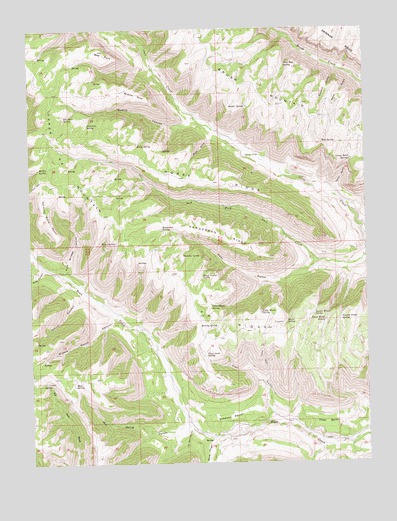
Henderson Ridge, CO USGS Topographic Map
Click on map above to begin viewing in our Map Viewer.

This topographic map contains these locations and features:
Feature Name Type Latitude Longitude GNIS ID View Map
4A RidgeRidgeN39.5361°W108.5554°172160View Map
Altenbern RanchLocaleN39.5883°W108.5409°172153View Map
Bear GulchValleyN39.5584°W108.5193°172169View Map
Bear Keg SpringSpringN39.6145°W108.5298°172159View Map
Bear PointCliffN39.6166°W108.5951°172163View Map
Blanc CanyonValleyN39.5070°W108.5587°174187View Map
Boyd GulchValleyN39.5939°W108.5579°172167View Map
Browns PointCliffN39.6055°W108.5840°172162View Map
Buck CanyonValleyN39.5565°W108.6212°172139View Map
Camp GulchValleyN39.5782°W108.5117°172166View Map
Camp Gulch SpringSpringN39.5872°W108.5059°172154View Map
Cedar BenchBenchN39.5116°W108.5159°172187View Map
Chimney Rock PointCliffN39.5722°W108.6201°172161View Map
Corral CanyonValleyN39.5484°W108.6057°172179View Map
Elk Horn SpringSpringN39.5996°W108.6124°172157View Map
Escalante BreaksRangeN39.6011°W108.5751°185615View Map
First Water SpringSpringN39.5448°W108.5589°172180View Map
Fourth Water SpringSpringN39.5412°W108.5103°172146View Map
Franklin SpringSpringN39.5976°W108.6037°172156View Map
Gasaway BenchBenchN39.5128°W108.5518°172185View Map
Henderson RidgeRidgeN39.5650°W108.5543°172173View Map
Henderson SpringSpringN39.5676°W108.5768°172149View Map
Horse RidgeRidgeN39.5822°W108.5698°172172View Map
Horse SpringSpringN39.5916°W108.5853°172152View Map
Huntley SpringSpringN39.5597°W108.5688°172148View Map
Kaiser SpringSpringN39.6025°W108.5449°172158View Map
Little Water SpringSpringN39.5432°W108.5399°172177View Map
McKey SpringSpringN39.5850°W108.6218°172151View Map
Middle Ranch CanyonValleyN39.5430°W108.5948°172178View Map
Moore SpringSpringN39.5405°W108.5306°172176View Map
Mud SpringSpringN39.5922°W108.5165°172155View Map
Mud SpringSpringN39.5225°W108.6097°172184View Map
Mud Spring CanyonValleyN39.5109°W108.5674°172186View Map
North GulchValleyN39.6108°W108.5043°172165View Map
Pole Bridge CanyonValleyN39.5548°W108.6123°172170View Map
Poverty SpringSpringN39.5390°W108.5571°172181View Map
Quakie CanyonValleyN39.5991°W108.5646°172171View Map
Sawmill GulchValleyN39.6134°W108.5112°172164View Map
Second Water SpringSpringN39.5426°W108.5204°172174View Map
Sheep Corral SpringSpringN39.5536°W108.5617°172147View Map
Third Water SpringSpringN39.5407°W108.5160°172175View Map
Toms SpringSpringN39.5637°W108.5938°172150View Map
Trail GulchValleyN39.5127°W108.5357°172183View Map
Trail Gulch SpringSpringN39.5312°W108.5606°172182View Map
Upper 4A MountainSummitN39.6078°W108.6159°202027View Map

Note: Coordinates in the location and feature list above are referenced to NAD83 datum.


Copyright (C) 2008-2025 Ryan Niemi / Sunset Dynamics ... All Rights Reserved