TopoQuest Logo
Do you find TopoQuest useful?
Help keep TopoQuest running and adding new maps/features by donating!
Bitcoin:  19c7KJd3qBynnjoSw5npx9KScwjBe4ifkT
Litecoin:  LXs6TkuXGGXo1vDsWCkWVdjQX94eUKd6ui
Home View Maps Find Maps Find Places Resources & Links


Herbine, Arkansas Topographic Map

USGS Map Title: Herbine, AR
USGS Map MRC: 33092G1
DRG (GeoTIFF) Download: o33092g1.tif


Neighboring USGS Topographic Map Quads:


  Rison, AR  
33092H2
 

  Calmer, AR  
33092H1
 

  Glendale, AR  
33091H8
 

  New Edinburg, AR  
33092G2
 

  Herbine, AR  
33092G1
 

  Cornerville, AR  
33091G8
 

  McKinney, AR  
33092F2
 

  Warren NE, AR  
33092F1
 

  Wilmar North, AR  
33091F8


Map MRC Location:

N34°
W93°
N34°
W92°
H8 H7 H6 H5 H4 H3 H2 H1
G8 G7 G6 G5 G4 G3 G2 G1
F8 F7 F6 F5 F4 F3 F2 F1
E8 E7 E6 E5 E4 E3 E2 E1
D8 D7 D6 D5 D4 D3 D2 D1
C8 C7 C6 C5 C4 C3 C2 C1
B8 B7 B6 B5 B4 B3 B2 B1
A8 A7 A6 A5 A4 A3 A2 A1
N33°
W93°
N33°
W92°

Herbine, AR USGS 1:24K Topographic Map Preview:
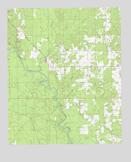
Herbine, AR USGS Topographic Map
Click on map above to begin viewing in our Map Viewer.

This topographic map contains these locations and features:
Feature Name Type Latitude Longitude GNIS ID View Map
Big CreekStreamN33.8176°W92.0910°46541View Map
Blakey CreekStreamN33.7512°W92.0551°46706View Map
Bridge CreekStreamN33.7854°W92.0688°46942View Map
Double CreekStreamN33.8404°W92.0763°48577View Map
Free Hill ChurchChurchN33.8212°W92.0488°49229View Map
HerbinePopulated PlaceN33.8212°W92.0340°57906View Map
Highway 35 Volunteer Fire DepartmentBuildingN33.8750°W92.1245°2116571View Map
Little Blakey CreekStreamN33.7684°W92.0410°51202View Map
Macedonia CemeteryCemeteryN33.8690°W92.1249°51556View Map
McKinney (historical)Populated PlaceN33.7784°W92.0474°60996View Map
Mile CreekStreamN33.8479°W92.0715°51960View Map
Mill BranchStreamN33.7904°W92.0718°51970View Map
PansyPopulated PlaceN33.8220°W92.0029°57149View Map
Pansy Volunteer Fire DepartmentBuildingN33.8465°W92.0187°2116928View Map
Prosperity CemeteryCemeteryN33.8179°W92.0335°53817View Map
Ripley (historical)Populated PlaceN33.8376°W92.0918°61115View Map
Schultz LakeReservoirN33.8342°W92.0488°80300View Map
Schultz Lake DamDamN33.8334°W92.0485°80299View Map
Sixteenth CreekStreamN33.7570°W92.0593°54883View Map
Township of HarperCivilN33.8212°W92.0288°63734View Map
Township of HurricaneCivilN33.7512°W92.0163°63736View Map
Vince BluffCliffN33.7857°W92.0679°55919View Map

Note: Coordinates in the location and feature list above are referenced to NAD83 datum.


Copyright (C) 2008-2024 Ryan Niemi / Sunset Dynamics ... All Rights Reserved