TopoQuest Logo
Do you find TopoQuest useful?
Help keep TopoQuest running and adding new maps/features by donating!
Bitcoin:  19c7KJd3qBynnjoSw5npx9KScwjBe4ifkT
Litecoin:  LXs6TkuXGGXo1vDsWCkWVdjQX94eUKd6ui
Home View Maps Find Maps Find Places Resources & Links


Calmer, Arkansas Topographic Map

USGS Map Title: Calmer, AR
USGS Map MRC: 33092H1
DRG (GeoTIFF) Download: o33092h1.tif


Neighboring USGS Topographic Map Quads:


  Kedron, AR  
34092A2
 

  Faith, AR  
34092A1
 

  Pinebergen, AR  
34091A8
 

  Rison, AR  
33092H2
 

  Calmer, AR  
33092H1
 

  Glendale, AR  
33091H8
 

  New Edinburg, AR  
33092G2
 

  Herbine, AR  
33092G1
 

  Cornerville, AR  
33091G8


Map MRC Location:

N34°
W93°
N34°
W92°
H8 H7 H6 H5 H4 H3 H2 H1
G8 G7 G6 G5 G4 G3 G2 G1
F8 F7 F6 F5 F4 F3 F2 F1
E8 E7 E6 E5 E4 E3 E2 E1
D8 D7 D6 D5 D4 D3 D2 D1
C8 C7 C6 C5 C4 C3 C2 C1
B8 B7 B6 B5 B4 B3 B2 B1
A8 A7 A6 A5 A4 A3 A2 A1
N33°
W93°
N33°
W92°

Calmer, AR USGS 1:24K Topographic Map Preview:
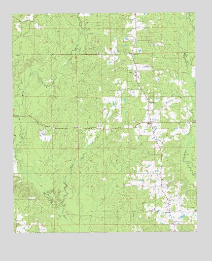
Calmer, AR USGS Topographic Map
Click on map above to begin viewing in our Map Viewer.

This topographic map contains these locations and features:
Feature Name Type Latitude Longitude GNIS ID View Map
Assembly of God ChurchChurchN33.8807°W92.0163°45960View Map
Brushy CreekStreamN33.9376°W92.1199°70860View Map
CalmerPopulated PlaceN33.9376°W92.0307°56947View Map
Center ChurchChurchN33.8929°W92.0190°47631View Map
FriendshipPopulated PlaceN33.9770°W92.0435°57022View Map
Friendship CemeteryCemeteryN33.9820°W92.0293°49250View Map
Kesterson LakeReservoirN33.8838°W92.0100°80298View Map
Kesterson Lake DamDamN33.8834°W92.0085°80297View Map
Kissee CreekStreamN33.8851°W92.0924°50887View Map
New Hope ChurchChurchN33.9318°W92.0954°52676View Map
Oak GrovePopulated PlaceN33.9490°W92.0324°58284View Map
RowellPopulated PlaceN33.8862°W92.0185°58551View Map
Sanders CreekStreamN33.9240°W92.0051°54557View Map
Township of MillerCivilN33.9498°W92.0632°63740View Map
Township of RowellCivilN33.8896°W92.0371°63744View Map
Union Grove ChurchChurchN33.9876°W92.1185°55814View Map
Woodlawn Census Designated PlaceCensusN33.9667°W92.0452°2582924View Map
Woodlawn Elementary SchoolSchoolN33.9668°W92.0413°2039328View Map
Woodlawn Fire Station 1BuildingN33.9672°W92.0363°2117333View Map
Woodlawn High SchoolSchoolN33.9677°W92.0409°2039329View Map
Woodlawn SchoolSchoolN33.9662°W92.0410°56524View Map

Note: Coordinates in the location and feature list above are referenced to NAD83 datum.


Copyright (C) 2008-2025 Ryan Niemi / Sunset Dynamics ... All Rights Reserved