TopoQuest Logo
Do you find TopoQuest useful?
Help keep TopoQuest running and adding new maps/features by donating!
Bitcoin:  19c7KJd3qBynnjoSw5npx9KScwjBe4ifkT
Litecoin:  LXs6TkuXGGXo1vDsWCkWVdjQX94eUKd6ui
Home View Maps Find Maps Find Places Resources & Links


Herington, Kansas Topographic Map

USGS Map Title: Herington, KS
USGS Map MRC: 38096F8
DRG (GeoTIFF) Download: o38096f8.tif


Neighboring USGS Topographic Map Quads:


  Navarre, KS  
38097G1
 

  Woodbine, KS  
38096G8
 

  Skiddy, KS  
38096G7
 

  Hope, KS  
38097F1
 

  Herington, KS  
38096F8
 

  Delavan, KS  
38096F7
 

  Ramona, KS  
38097E1
 

  Lost Springs, KS  
38096E8
 

  Burdick, KS  
38096E7


Map MRC Location:

N39°
W97°
N39°
W96°
H8 H7 H6 H5 H4 H3 H2 H1
G8 G7 G6 G5 G4 G3 G2 G1
F8 F7 F6 F5 F4 F3 F2 F1
E8 E7 E6 E5 E4 E3 E2 E1
D8 D7 D6 D5 D4 D3 D2 D1
C8 C7 C6 C5 C4 C3 C2 C1
B8 B7 B6 B5 B4 B3 B2 B1
A8 A7 A6 A5 A4 A3 A2 A1
N38°
W97°
N38°
W96°

Herington, KS USGS 1:24K Topographic Map Preview:
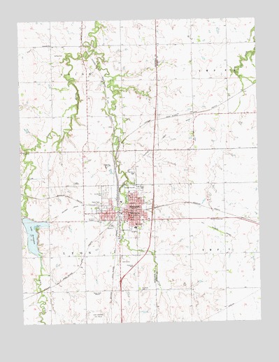
Herington, KS USGS Topographic Map
Click on map above to begin viewing in our Map Viewer.

This topographic map contains these locations and features:
Feature Name Type Latitude Longitude GNIS ID View Map
Agricultural Producers Grain Elevator Number 5LocaleN38.6767°W96.9504°2695293View Map
Biehler - Ecklund FarmsLocaleN38.6653°W96.8922°2726539View Map
Dickinson County Emergency Medical Services HeringtonBuildingN38.6798°W96.9414°2696586View Map
Faith Covenant FellowshipChurchN38.6709°W96.9432°2690723View Map
First Baptist ChurchChurchN38.6704°W96.9426°2689941View Map
First Christian ChurchChurchN38.6700°W96.9450°2689835View Map
First Church of GodChurchN38.6707°W96.9553°2689695View Map
Gentz FarmsLocaleN38.7275°W96.9469°2726544View Map
HeringtonPopulated PlaceN38.6711°W96.9425°476991View Map
Herington Area Chamber of CommerceBuildingN38.6717°W96.9432°2692611View Map
Herington City DamDamN38.6686°W96.9992°479927View Map
Herington City HallBuildingN38.6712°W96.9438°2693053View Map
Herington Country ClubLocaleN38.6500°W96.9457°2694568View Map
Herington Elementary SchoolSchoolN38.6877°W96.9409°2497598View Map
Herington FairgroundsLocaleN38.6623°W96.9432°2692609View Map
Herington Fire Department Station 1BuildingN38.6646°W96.9432°2111413View Map
Herington Fire Department Station 2BuildingN38.6696°W96.9527°2111414View Map
Herington Fire Department Station 3BuildingN38.6633°W96.9438°2111415View Map
Herington High SchoolSchoolN38.6866°W96.9412°480677View Map
Herington Historical MuseumBuildingN38.6635°W96.9434°2694322View Map
Herington Middle SchoolSchoolN38.6862°W96.9423°2497493View Map
Herington Municipal HospitalHospitalN38.6801°W96.9422°2499093View Map
Herington Police DepartmentBuildingN38.6646°W96.9432°2504082View Map
Herington Post OfficePost OfficeN38.6713°W96.9427°2693766View Map
Herington Public LibraryBuildingN38.6697°W96.9434°2694649View Map
Herington Senior CenterBuildingN38.6717°W96.9443°2692610View Map
Herington United Methodist ChurchChurchN38.6704°W96.9416°2689444View Map
Herington Wastewater PlantLocaleN38.6812°W96.9457°2691921View Map
Iglesia Temploy la HermosaChurchN38.6693°W96.9548°2690759View Map
Immanuel Lutheran CemeteryCemeteryN38.7393°W96.9843°2673247View Map
Immanuel Lutheran ChurchChurchN38.7399°W96.9833°476994View Map
Koepke Mobile ManorPopulated PlaceN38.6737°W96.9331°2694108View Map
Kohls CreekStreamN38.6731°W96.9995°476985View Map
Lake HeringtonReservoirN38.6635°W96.9943°476990View Map
Lime CreekStreamN38.7378°W96.9614°476986View Map
Mitchell Valley CemeteryCemeteryN38.6670°W96.8939°476989View Map
Morton FarmLocaleN38.7092°W96.9447°2726542View Map
New Life Church of GodChurchN38.6666°W96.9324°2690777View Map
Our Redeemer Lutheran ChurchChurchN38.6678°W96.9331°2690780View Map
Rock Island ChurchChurchN38.6712°W96.9422°2690651View Map
Sacred Heart FarmsLocaleN38.7367°W96.9081°2726538View Map
Saint John's Catholic ChurchChurchN38.6774°W96.9433°2690795View Map
Saint John's CemeteryCemeteryN38.6390°W96.9385°476988View Map
Saint John's Lutheran ChurchChurchN38.6958°W96.9986°2690796View Map
Saint Johns Lutheran CemeteryCemeteryN38.6955°W96.9996°2673252View Map
Saint Paul CemeteryCemeteryN38.7358°W96.9820°476993View Map
Saint Paul Lutheran ChurchChurchN38.6721°W96.9522°2689886View Map
Shady BrookPopulated PlaceN38.7394°W96.9831°484918View Map
Sunset Hill CemeteryCemeteryN38.6782°W96.9570°476992View Map
The MallLocaleN38.6708°W96.9450°481795View Map
Township of LyonCivilN38.6513°W96.9884°476984View Map
Township of UnionCivilN38.7397°W96.9830°476862View Map
Union Pacific Railroad Herington YardLocaleN38.6863°W96.9498°2692518View Map

Note: Coordinates in the location and feature list above are referenced to NAD83 datum.


Copyright (C) 2008-2025 Ryan Niemi / Sunset Dynamics ... All Rights Reserved