TopoQuest Logo
Do you find TopoQuest useful?
Help keep TopoQuest running and adding new maps/features by donating!
Bitcoin:  19c7KJd3qBynnjoSw5npx9KScwjBe4ifkT
Litecoin:  LXs6TkuXGGXo1vDsWCkWVdjQX94eUKd6ui
Home View Maps Find Maps Find Places Resources & Links


Navarre, Kansas Topographic Map

USGS Map Title: Navarre, KS
USGS Map MRC: 38097G1
DRG (GeoTIFF) Download: o38097g1.tif


Neighboring USGS Topographic Map Quads:


  Abilene, KS  
38097H2
 

  Chapman, KS  
38097H1
 

  Kansas Falls, KS  
38096H8
 

  Abilene SW, KS  
38097G2
 

  Navarre, KS  
38097G1
 

  Woodbine, KS  
38096G8
 

  Elmo, KS  
38097F2
 

  Hope, KS  
38097F1
 

  Herington, KS  
38096F8


Map MRC Location:

N39°
W98°
N39°
W97°
H8 H7 H6 H5 H4 H3 H2 H1
G8 G7 G6 G5 G4 G3 G2 G1
F8 F7 F6 F5 F4 F3 F2 F1
E8 E7 E6 E5 E4 E3 E2 E1
D8 D7 D6 D5 D4 D3 D2 D1
C8 C7 C6 C5 C4 C3 C2 C1
B8 B7 B6 B5 B4 B3 B2 B1
A8 A7 A6 A5 A4 A3 A2 A1
N38°
W98°
N38°
W97°

Navarre, KS USGS 1:24K Topographic Map Preview:
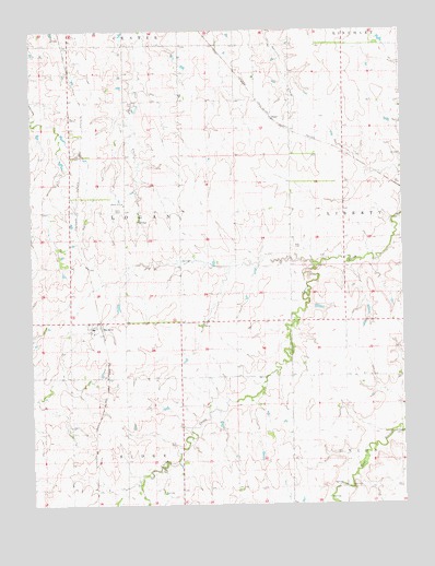
Navarre, KS USGS Topographic Map
Click on map above to begin viewing in our Map Viewer.

This topographic map contains these locations and features:
Feature Name Type Latitude Longitude GNIS ID View Map
Alida Pearl Co - Operative Association Grain Elevator Number 2LocaleN38.8519°W97.0442°2695324View Map
Hope Rural Fire Department Station 2BuildingN38.7971°W97.1050°2111428View Map
NavarrePopulated PlaceN38.7969°W97.1059°476858View Map
Navarre CemeteryCemeteryN38.7953°W97.1082°2673249View Map
North Central Kansas Co - Operative Association Grain Elevator Number 3LocaleN38.7969°W97.1021°2695275View Map
PearlPopulated PlaceN38.8517°W97.0442°484794View Map
Plimpton (historical)LocaleN38.7542°W97.0939°482136View Map
Riffel CemeteryCemeteryN38.8178°W97.0345°476859View Map
Scheiller CemeteryCemeteryN38.8669°W97.1109°476860View Map
Township of LoganCivilN38.8274°W97.0934°476856View Map

Note: Coordinates in the location and feature list above are referenced to NAD83 datum.


Copyright (C) 2008-2025 Ryan Niemi / Sunset Dynamics ... All Rights Reserved