TopoQuest Logo
Do you find TopoQuest useful?
Help keep TopoQuest running and adding new maps/features by donating!
Bitcoin:  19c7KJd3qBynnjoSw5npx9KScwjBe4ifkT
Litecoin:  LXs6TkuXGGXo1vDsWCkWVdjQX94eUKd6ui
Home View Maps Find Maps Find Places Resources & Links


Hernando, Mississippi Topographic Map

USGS Map Title: Hernando, MS
USGS Map MRC: 34089G8
DRG (GeoTIFF) Download: o34089g8.tif


Neighboring USGS Topographic Map Quads:


  Horn Lake, MS  
34090H1
 

  Pleasant Hill, MS  
34089H8
 

  Olive Branch, MS  
34089H7
 

  Frees Corners, MS  
34090G1
 

  Hernando, MS  
34089G8
 

  Lewisburg, MS  
34089G7
 

  Arkabutla East, MS  
34090F1
 

  Coldwater, MS  
34089F8
 

  Independence, MS  
34089F7


Map MRC Location:

N35°
W90°
N35°
W89°
H8 H7 H6 H5 H4 H3 H2 H1
G8 G7 G6 G5 G4 G3 G2 G1
F8 F7 F6 F5 F4 F3 F2 F1
E8 E7 E6 E5 E4 E3 E2 E1
D8 D7 D6 D5 D4 D3 D2 D1
C8 C7 C6 C5 C4 C3 C2 C1
B8 B7 B6 B5 B4 B3 B2 B1
A8 A7 A6 A5 A4 A3 A2 A1
N34°
W90°
N34°
W89°

Hernando, MS USGS 1:24K Topographic Map Preview:
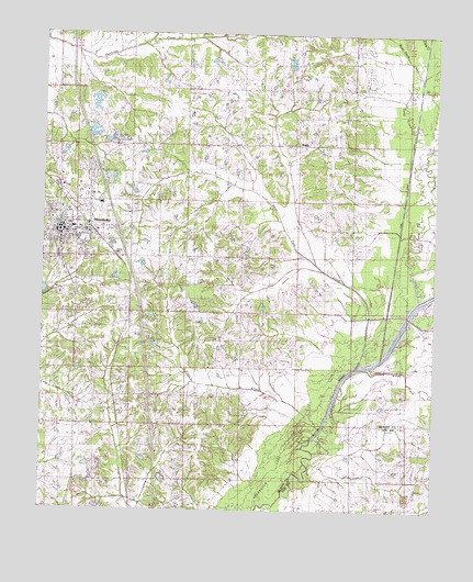
Hernando, MS USGS Topographic Map
Click on map above to begin viewing in our Map Viewer.

This topographic map contains these locations and features:
Feature Name Type Latitude Longitude GNIS ID View Map
Bakers ChapelChurchN34.8320°W89.9106°690461View Map
Bakers Chapel CemeteryCemeteryN34.8321°W89.9113°690218View Map
Bean Patch CreekStreamN34.8687°W89.8837°690220View Map
Bethlehem CemeteryCemeteryN34.8743°W89.9898°690223View Map
Bethlehem ChurchChurchN34.8748°W89.9934°690224View Map
BrightPopulated PlaceN34.8470°W89.9204°691729View Map
Camp CreekStreamN34.8051°W89.8801°690236View Map
Camp Creek CanalCanalN34.8312°W89.8849°690474View Map
Caney CreekStreamN34.7893°W89.8895°690239View Map
City of HernandoCivilN34.8496°W89.9920°2404688View Map
De Soto County Sheriff's OfficeBuildingN34.8213°W89.9947°2754281View Map
Dorothy Jones Pond DamDamN34.8634°W89.9218°690455View Map
Eagles Ridge AirportAirportN34.7967°W89.9170°2676381View Map
Ebenezer Baptist ChurchChurchN34.7523°W89.9759°690492View Map
Enon Springs Baptist ChurchChurchN34.8448°W89.9098°690275View Map
Enon Springs CemeteryCemeteryN34.8473°W89.9112°690274View Map
Enon Springs SchoolSchoolN34.8448°W89.9120°690276View Map
Farley CemeteryCemeteryN34.7843°W89.9723°690280View Map
First Presbyterian ChurchChurchN34.8234°W89.9887°690505View Map
First Regional LibraryBuildingN34.8240°W89.9956°690506View Map
Gateway Baptist ChurchChurchN34.8087°W89.9890°690508View Map
Grays CreekStreamN34.7732°W89.9126°690288View Map
Grays Creek Baptist ChurchChurchN34.7873°W89.9362°690311View Map
HernandoPopulated PlaceN34.8240°W89.9937°690292View Map
Hernando Church of ChristChurchN34.8293°W89.9945°690514View Map
Hernando City HallBuildingN34.8234°W89.9979°690515View Map
Hernando Community CenterBuildingN34.8176°W89.9998°690516View Map
Hernando Elementary SchoolSchoolN34.8307°W89.9818°690517View Map
Hernando Fire Department Station 1BuildingN34.8232°W89.9977°2665649View Map
Hernando Fire Department Station 2BuildingN34.8744°W89.9963°2666004View Map
Hernando Fire Department Station 3BuildingN34.8169°W89.9696°2666005View Map
Hernando High SchoolSchoolN34.8215°W89.9890°706985View Map
Hernando Industrial ParkLocaleN34.8187°W89.9770°690518View Map
Hernando Police DepartmentBuildingN34.8218°W89.9998°2754146View Map
Hernando Post OfficePost OfficeN34.8241°W89.9900°712184View Map
Hernando United Methodist ChurchChurchN34.8354°W89.9887°690521View Map
Holy Spirit Catholic ChurchChurchN34.8234°W89.9873°690526View Map
Interchange 280CrossingN34.8240°W89.9762°691461View Map
Jaybird CemeteryCemeteryN34.7870°W89.9356°690310View Map
Knights CemeteryCemeteryN34.8172°W89.9372°690319View Map
Knights ChurchChurchN34.8170°W89.9373°690956View Map
Knights SchoolSchoolN34.8176°W89.9373°690320View Map
Libscomb Pond DamDamN34.8384°W89.9734°690443View Map
LovePopulated PlaceN34.7534°W89.9701°690327View Map
Love CemeteryCemeteryN34.7604°W89.9693°690328View Map
Love ChurchChurchN34.7537°W89.9756°690329View Map
Love Fire DepartmentBuildingN34.7528°W89.9915°2425321View Map
Magnolia GroveBuildingN34.8248°W89.9870°690542View Map
McInguale Lake DamDamN34.8118°W89.9668°690436View Map
McIngvale Clock MuseumBuildingN34.8223°W89.9956°690546View Map
Morgan Grove ChurchChurchN34.7918°W89.9193°690340View Map
Morgan Grove SchoolSchoolN34.7915°W89.9201°690341View Map
New Bethany CemeteryCemeteryN34.8530°W89.9542°690354View Map
New Bethany CemeteryCemeteryN34.8537°W89.9543°690355View Map
New Bethany ChurchChurchN34.8534°W89.9540°690356View Map
Parkway Baptist ChurchChurchN34.8232°W89.9798°690573View Map
Possum Track ChurchChurchN34.7648°W89.9509°690384View Map
Ross Franks Pond DamDamN34.7918°W89.9618°690428View Map
Supervisor District 5CivilN34.8219°W89.9491°711842View Map
T Caffey Robertson Lake DamDamN34.8584°W89.9801°690453View Map
Tom Milan Pond DamDamN34.8334°W89.9684°690440View Map
W A Sanders Pond DamDamN34.8001°W89.9618°690432View Map
WVIM-FM (Coldwater)TowerN34.7784°W89.9731°680269View Map

Note: Coordinates in the location and feature list above are referenced to NAD83 datum.


Copyright (C) 2008-2024 Ryan Niemi / Sunset Dynamics ... All Rights Reserved