TopoQuest Logo
Do you find TopoQuest useful?
Help keep TopoQuest running and adding new maps/features by donating!
Bitcoin:  19c7KJd3qBynnjoSw5npx9KScwjBe4ifkT
Litecoin:  LXs6TkuXGGXo1vDsWCkWVdjQX94eUKd6ui
Home View Maps Find Maps Find Places Resources & Links


Heron Lake NE, Minnesota Topographic Map

USGS Map Title: Heron Lake NE, MN
USGS Map MRC: 43095H3
DRG (GeoTIFF) Download: o43095h3.tif


Neighboring USGS Topographic Map Quads:


  Westbrook, MN  
44095A4
 

  Storden, MN  
44095A3
 

  Jeffers, MN  
44095A2
 

  Heron Lake NW, MN  
43095H4
 

  Heron Lake NE, MN  
43095H3
 

  Harder Lake, MN  
43095H2
 

  Dundee, MN  
43095G4
 

  Heron Lake, MN  
43095G3
 

  Wilder, MN  
43095G2


Map MRC Location:

N44°
W96°
N44°
W95°
H8 H7 H6 H5 H4 H3 H2 H1
G8 G7 G6 G5 G4 G3 G2 G1
F8 F7 F6 F5 F4 F3 F2 F1
E8 E7 E6 E5 E4 E3 E2 E1
D8 D7 D6 D5 D4 D3 D2 D1
C8 C7 C6 C5 C4 C3 C2 C1
B8 B7 B6 B5 B4 B3 B2 B1
A8 A7 A6 A5 A4 A3 A2 A1
N43°
W96°
N43°
W95°

Heron Lake NE, MN USGS 1:24K Topographic Map Preview:
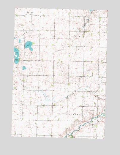
Heron Lake NE, MN USGS Topographic Map
Click on map above to begin viewing in our Map Viewer.

This topographic map contains these locations and features:
Feature Name Type Latitude Longitude GNIS ID View Map
Amo CemeteryCemeteryN43.9730°W95.3197°2051000View Map
Amo ChurchChurchN43.9733°W95.3200°639332View Map
Berry LakebedFlatN43.9958°W95.3547°639976View Map
Carey LakeLakeN43.9638°W95.3553°640890View Map
County Ditch Number TwentynineCanalN43.9036°W95.3456°641909View Map
County Ditch Number TwoCanalN43.9933°W95.3519°641772View Map
Heron Lake OutletStreamN43.8786°W95.2950°644911View Map
Judicial Ditch Number TwentyCanalN43.9641°W95.3064°645847View Map
Judicial Ditch Number TwentyeightCanalN43.9850°W95.2800°645877View Map
Little LakeLakeN43.9899°W95.2758°646830View Map
Long LakeLakeN43.9584°W95.3729°647124View Map
Pats Grove County ParkParkN43.8755°W95.2975°2051021View Map
Round LakeLakeN43.9497°W95.3706°650321View Map
Township of AmoCivilN43.9783°W95.2806°663430View Map
Township of SpringfieldCivilN43.8914°W95.2808°665671View Map
United Amo CemeteryCemeteryN43.9783°W95.2817°2050999View Map
United Amo ChurchChurchN43.9780°W95.2828°653519View Map

Note: Coordinates in the location and feature list above are referenced to NAD83 datum.


Copyright (C) 2008-2025 Ryan Niemi / Sunset Dynamics ... All Rights Reserved