TopoQuest Logo
Do you find TopoQuest useful?
Help keep TopoQuest running and adding new maps/features by donating!
Bitcoin:  19c7KJd3qBynnjoSw5npx9KScwjBe4ifkT
Litecoin:  LXs6TkuXGGXo1vDsWCkWVdjQX94eUKd6ui
Home View Maps Find Maps Find Places Resources & Links


Azurite Peak, Washington Topographic Map

USGS Map Title: Azurite Peak, WA
USGS Map MRC: 48120F7
DRG (GeoTIFF) Download: o48120f7.tif


Neighboring USGS Topographic Map Quads:


  Jack Mountain, WA  
48120G8
 

  Shull Mountain, WA  
48120G7
 

  Pasayten Peak, WA  
48120G6
 

  Crater Mountain, WA  
48120F8
 

  Azurite Peak, WA  
48120F7
 

  Slate Peak, WA  
48120F6
 

  Mount Logan, WA  
48120E8
 

  Mount Arriva, WA  
48120E7
 

  Washington Pass, WA  
48120E6


Map MRC Location:

N49°
W121°
N49°
W120°
H8 H7 H6 H5 H4 H3 H2 H1
G8 G7 G6 G5 G4 G3 G2 G1
F8 F7 F6 F5 F4 F3 F2 F1
E8 E7 E6 E5 E4 E3 E2 E1
D8 D7 D6 D5 D4 D3 D2 D1
C8 C7 C6 C5 C4 C3 C2 C1
B8 B7 B6 B5 B4 B3 B2 B1
A8 A7 A6 A5 A4 A3 A2 A1
N48°
W121°
N48°
W120°

Azurite Peak, WA USGS 1:24K Topographic Map Preview:
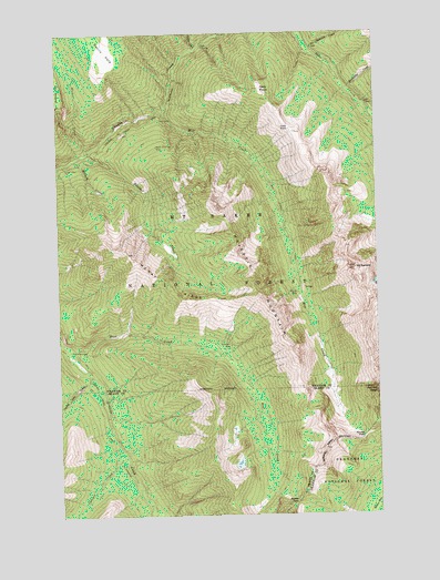
Azurite Peak, WA USGS Topographic Map
Click on map above to begin viewing in our Map Viewer.

This topographic map contains these locations and features:
Feature Name Type Latitude Longitude GNIS ID View Map
Azurite MineMineN48.6824°W120.7818°1516003View Map
Azurite PassGapN48.6451°W120.7568°1516004View Map
Azurite PeakSummitN48.6568°W120.7518°1516005View Map
Boulder CreekStreamN48.7193°W120.8640°1516821View Map
Cabinet CreekStreamN48.6401°W120.8498°1517197View Map
Cady PassGapN48.7254°W120.7843°1517207View Map
Cady PointCapeN48.7354°W120.7954°1517209View Map
Cedar CrossingPopulated PlaceN48.7468°W120.8182°1517559View Map
County Line CreekStreamN48.6615°W120.8634°1518204View Map
Devils ParkFlatN48.7451°W120.8559°1518715View Map
East CreekStreamN48.6685°W120.8721°1519081View Map
East Creek TrailheadLocaleN48.6679°W120.8723°1529707View Map
Fourmile CampLocaleN48.6676°W120.8715°1519734View Map
Friday CreekStreamN48.7457°W120.8204°1519811View Map
Gold Hill MineMineN48.6687°W120.8084°1520099View Map
Holmes CreekStreamN48.7174°W120.8698°1520871View Map
Majestic MountainSummitN48.6860°W120.7993°1522649View Map
McKay RidgeRidgeN48.6862°W120.8348°1522908View Map
Mebee PassGapN48.6279°W120.7840°1522983View Map
Mill CreekStreamN48.7296°W120.8337°1523151View Map
Mill Creek TrailTrailN48.6957°W120.7837°1523169View Map
Mount BallardSummitN48.6887°W120.7593°1516109View Map
Nickol CreekStreamN48.7190°W120.8643°1523654View Map
North American MineMineN48.7204°W120.8365°1523720View Map
Rockefeller CreekStreamN48.7351°W120.7621°1525154View Map
Rowley ChasmGapN48.7190°W120.8368°1530511View Map
Skeleton CreekStreamN48.7443°W120.7757°1525861View Map
South Fork Slate CreekStreamN48.7271°W120.7515°1526252View Map

Note: Coordinates in the location and feature list above are referenced to NAD83 datum.


Copyright (C) 2008-2025 Ryan Niemi / Sunset Dynamics ... All Rights Reserved