TopoQuest Logo
Do you find TopoQuest useful?
Help keep TopoQuest running and adding new maps/features by donating!
Bitcoin:  19c7KJd3qBynnjoSw5npx9KScwjBe4ifkT
Litecoin:  LXs6TkuXGGXo1vDsWCkWVdjQX94eUKd6ui
Home View Maps Find Maps Find Places Resources & Links


Washington Pass, Washington Topographic Map

USGS Map Title: Washington Pass, WA
USGS Map MRC: 48120E6
DRG (GeoTIFF) Download: o48120e6.tif


Neighboring USGS Topographic Map Quads:


  Azurite Peak, WA  
48120F7
 

  Slate Peak, WA  
48120F6
 

  Robinson Mountain, WA  
48120F5
 

  Mount Arriva, WA  
48120E7
 

  Washington Pass, WA  
48120E6
 

  Silver Star Mountain, WA  
48120E5
 

  McGregor Mountain, WA  
48120D7
 

  McAlester Mountain, WA  
48120D6
 

  Gilbert, WA  
48120D5


Map MRC Location:

N49°
W121°
N49°
W120°
H8 H7 H6 H5 H4 H3 H2 H1
G8 G7 G6 G5 G4 G3 G2 G1
F8 F7 F6 F5 F4 F3 F2 F1
E8 E7 E6 E5 E4 E3 E2 E1
D8 D7 D6 D5 D4 D3 D2 D1
C8 C7 C6 C5 C4 C3 C2 C1
B8 B7 B6 B5 B4 B3 B2 B1
A8 A7 A6 A5 A4 A3 A2 A1
N48°
W121°
N48°
W120°

Washington Pass, WA USGS 1:24K Topographic Map Preview:
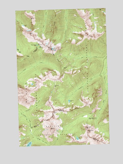
Washington Pass, WA USGS Topographic Map
Click on map above to begin viewing in our Map Viewer.

This topographic map contains these locations and features:
Feature Name Type Latitude Longitude GNIS ID View Map
Blue LakeLakeN48.5059°W120.6705°1516698View Map
Cutthroat CreekStreamN48.5665°W120.6301°1518437View Map
Cutthroat LakeLakeN48.5405°W120.6803°1518438View Map
Cutthroat PassGapN48.5546°W120.7001°1518439View Map
Cutthroat PeakPillarN48.5262°W120.7032°1518440View Map
Early Winters SpiresPillarN48.5126°W120.6554°1519068View Map
Early Winters TrailTrailN48.5271°W120.6573°1519069View Map
Flagg MountainSummitN48.6237°W120.6312°1519631View Map
Golden HornSummitN48.6035°W120.7321°1520115View Map
Granite PassGapN48.5710°W120.6859°1520237View Map
Hinkhouse PeakSummitN48.5374°W120.6562°1926877View Map
Holliway MountainSummitN48.6171°W120.7301°1520864View Map
Liberty Bell MountainSummitN48.5154°W120.6579°1522053View Map
Lone Fir CampgroundLocaleN48.5799°W120.6270°1529734View Map
Lower Snowy LakeLakeN48.5902°W120.7197°1522551View Map
Martha CreekStreamN48.5240°W120.6418°1522757View Map
Methow PassGapN48.5821°W120.7323°1523032View Map
Nugget LakesLakeN48.6107°W120.7407°1523929View Map
Rainy LakeLocaleN48.5176°W120.7357°1529732View Map
Rainy LakeLakeN48.5012°W120.7379°1524843View Map
Rainy PassGapN48.5179°W120.7348°1524844View Map
Rainy Pass TrailheadLocaleN48.5196°W120.7340°1529702View Map
Snowy LakesLakeN48.5915°W120.7207°1529476View Map
Snowy Lakes PassGapN48.5924°W120.7232°1526062View Map
Straight RidgeRidgeN48.6185°W120.6940°1526613View Map
The NeedlesPillarN48.5985°W120.6512°1527053View Map
Tower MountainSummitN48.5885°W120.7034°1527329View Map
Upper Snowy LakeLakeN48.5927°W120.7226°1527649View Map
Washington PassGapN48.5240°W120.6543°1527830View Map
Whistler MountainSummitN48.5154°W120.7076°1528042View Map
Willow CreekStreamN48.5465°W120.6279°1528187View Map

Note: Coordinates in the location and feature list above are referenced to NAD83 datum.


Copyright (C) 2008-2024 Ryan Niemi / Sunset Dynamics ... All Rights Reserved