TopoQuest Logo
Do you find TopoQuest useful?
Help keep TopoQuest running and adding new maps/features by donating!
Bitcoin:  19c7KJd3qBynnjoSw5npx9KScwjBe4ifkT
Litecoin:  LXs6TkuXGGXo1vDsWCkWVdjQX94eUKd6ui
Home View Maps Find Maps Find Places Resources & Links


Slate Peak, Washington Topographic Map

USGS Map Title: Slate Peak, WA
USGS Map MRC: 48120F6
DRG (GeoTIFF) Download: o48120f6.tif


Neighboring USGS Topographic Map Quads:


  Shull Mountain, WA  
48120G7
 

  Pasayten Peak, WA  
48120G6
 

  Mount Lago, WA  
48120G5
 

  Azurite Peak, WA  
48120F7
 

  Slate Peak, WA  
48120F6
 

  Robinson Mountain, WA  
48120F5
 

  Mount Arriva, WA  
48120E7
 

  Washington Pass, WA  
48120E6
 

  Silver Star Mountain, WA  
48120E5


Map MRC Location:

N49°
W121°
N49°
W120°
H8 H7 H6 H5 H4 H3 H2 H1
G8 G7 G6 G5 G4 G3 G2 G1
F8 F7 F6 F5 F4 F3 F2 F1
E8 E7 E6 E5 E4 E3 E2 E1
D8 D7 D6 D5 D4 D3 D2 D1
C8 C7 C6 C5 C4 C3 C2 C1
B8 B7 B6 B5 B4 B3 B2 B1
A8 A7 A6 A5 A4 A3 A2 A1
N48°
W121°
N48°
W120°

Slate Peak, WA USGS 1:24K Topographic Map Preview:
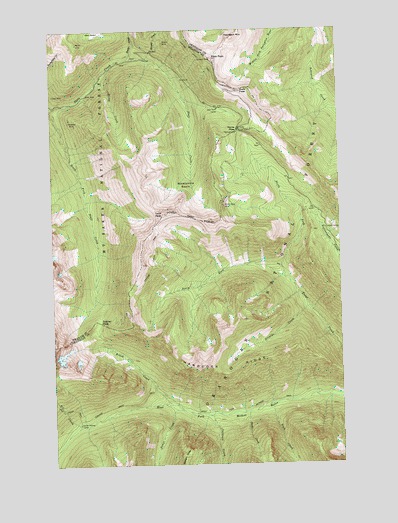
Slate Peak, WA USGS Topographic Map
Click on map above to begin viewing in our Map Viewer.

This topographic map contains these locations and features:
Feature Name Type Latitude Longitude GNIS ID View Map
Arralde CreekStreamN48.6701°W120.6404°1515955View Map
Brown Bear MineMineN48.6999°W120.6726°1516975View Map
Brush CreekStreamN48.6424°W120.7007°1517002View Map
Cataract CreekStreamN48.6390°W120.6829°1517490View Map
Deer Park CampLocaleN48.7274°W120.6779°1518649View Map
Dicky CreekStreamN48.7357°W120.7304°1518771View Map
Glacier PassGapN48.6662°W120.7312°1519987View Map
Goat MineMineN48.7312°W120.7498°1520040View Map
Grasshopper PassGapN48.6747°W120.7175°2087779View Map
Handcock RidgeRidgeN48.6546°W120.6890°1520496View Map
Harts PassGapN48.7207°W120.6701°1520587View Map
Harts Pass TrailheadLocaleN48.7204°W120.6698°1529706View Map
Haystack MountainSummitN48.7476°W120.6709°1520632View Map
Horse HeavenAreaN48.6354°W120.7323°1529967View Map
Horse Heaven CampLocaleN48.6368°W120.7404°1520932View Map
Illinois MineMineN48.7465°W120.7015°1521143View Map
Jet CreekStreamN48.6360°W120.7404°1521360View Map
Layout CampLocaleN48.6926°W120.6323°1521955View Map
Leap CreekStreamN48.6426°W120.6562°1521977View Map
Meadows CampgroundLocaleN48.7107°W120.6762°1529735View Map
Needle CreekStreamN48.6399°W120.6671°1523600View Map
Ninetynine BasinBasinN48.7057°W120.6918°1523680View Map
North Fork Trout CreekStreamN48.6787°W120.6507°1523872View Map
Rattlesnake CreekStreamN48.6479°W120.6262°1524884View Map
Slate PassGapN48.7329°W120.6684°1525916View Map
Slate PeakSummitN48.7421°W120.6801°1525917View Map
South Fork Trout CreekStreamN48.6787°W120.6509°1526278View Map
Tatie PeakSummitN48.6971°W120.7026°1526946View Map
Tower CreekStreamN48.6407°W120.6959°1527328View Map
West Fork Methow TrailTrailN48.6426°W120.6601°1527960View Map
Whistler MineMineN48.7235°W120.7432°1528041View Map

Note: Coordinates in the location and feature list above are referenced to NAD83 datum.


Copyright (C) 2008-2024 Ryan Niemi / Sunset Dynamics ... All Rights Reserved