TopoQuest Logo
Do you find TopoQuest useful?
Help keep TopoQuest running and adding new maps/features by donating!
Bitcoin:  19c7KJd3qBynnjoSw5npx9KScwjBe4ifkT
Litecoin:  LXs6TkuXGGXo1vDsWCkWVdjQX94eUKd6ui
Home View Maps Find Maps Find Places Resources & Links


Highland West, Wisconsin Topographic Map

USGS Map Title: Highland West, WI
USGS Map MRC: 43090A4
DRG (GeoTIFF) Download: o43090a4.tif


Neighboring USGS Topographic Map Quads:


  Blue River, WI  
43090B5
 

  Muscoda, WI  
43090B4
 

  Avoca, WI  
43090B3
 

  Castle Rock, WI  
43090A5
 

  Highland West, WI  
43090A4
 

  Highland East, WI  
43090A3
 

  Stitzer, WI  
42090H5
 

  Montfort, WI  
42090H4
 

  Linden, WI  
42090H3


Map MRC Location:

N44°
W91°
N44°
W90°
H8 H7 H6 H5 H4 H3 H2 H1
G8 G7 G6 G5 G4 G3 G2 G1
F8 F7 F6 F5 F4 F3 F2 F1
E8 E7 E6 E5 E4 E3 E2 E1
D8 D7 D6 D5 D4 D3 D2 D1
C8 C7 C6 C5 C4 C3 C2 C1
B8 B7 B6 B5 B4 B3 B2 B1
A8 A7 A6 A5 A4 A3 A2 A1
N43°
W91°
N43°
W90°

Highland West, WI USGS 1:24K Topographic Map Preview:
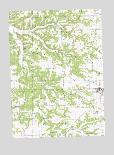
Highland West, WI USGS Topographic Map
Click on map above to begin viewing in our Map Viewer.

This topographic map contains these locations and features:
Feature Name Type Latitude Longitude GNIS ID View Map
Badger HollowValleyN43.0014°W90.4258°1561069View Map
Badger Hollow CreekStreamN43.0014°W90.4257°1577373View Map
Big RockPillarN43.0469°W90.4323°1561762View Map
Big Rock BranchStreamN43.0558°W90.4657°1561763View Map
Big SpringSpringN43.0775°W90.4129°1561774View Map
Big Spring BranchStreamN43.1039°W90.4735°1561776View Map
Blue River Mill SchoolSchoolN43.1075°W90.4860°1561955View Map
Blue River Valley ChurchChurchN43.1183°W90.4996°1561956View Map
Bohemian RidgeRidgeN43.0528°W90.4865°1562019View Map
Brick SchoolSchoolN43.0558°W90.4996°1562189View Map
Bronson CreekStreamN43.0061°W90.4451°1577380View Map
CentervillePopulated PlaceN43.0169°W90.4285°1577540View Map
Farmers RidgeRidgeN43.0997°W90.4346°1564860View Map
Farmers Ridge SchoolSchoolN43.0964°W90.4146°1564861View Map
HighlandPopulated PlaceN43.0467°W90.3798°1566387View Map
Highland Ambulance ServiceBuildingN43.0469°W90.3800°2698304View Map
Highland Elementary SchoolSchoolN43.0532°W90.3754°2715713View Map
Highland High SchoolSchoolN43.0532°W90.3754°2715809View Map
Highland Police DepartmentBuildingN43.0456°W90.3797°2759526View Map
Highland Volunteer Fire DepartmentBuildingN43.0464°W90.3796°2697653View Map
Highland Wastewater Treatment FacilityLocaleN43.0514°W90.3928°2709377View Map
Irish HollowValleyN43.0485°W90.4487°1840505View Map
Red Oak RidgeRidgeN43.0780°W90.4496°1572147View Map
Red Oak SchoolSchoolN43.0675°W90.4385°1572148View Map
Saint Johns ChurchChurchN43.0567°W90.4993°1573009View Map
Sixmile BranchStreamN43.1033°W90.4929°1574216View Map
Sunset RockPillarN43.0561°W90.4562°1575121View Map
Town of Castle RockCivilN43.0748°W90.4882°1582929View Map
Village of HighlandCivilN43.0474°W90.3802°1583387View Map

Note: Coordinates in the location and feature list above are referenced to NAD83 datum.


Copyright (C) 2008-2024 Ryan Niemi / Sunset Dynamics ... All Rights Reserved