TopoQuest Logo
Do you find TopoQuest useful?
Help keep TopoQuest running and adding new maps/features by donating!
Bitcoin:  19c7KJd3qBynnjoSw5npx9KScwjBe4ifkT
Litecoin:  LXs6TkuXGGXo1vDsWCkWVdjQX94eUKd6ui
Home View Maps Find Maps Find Places Resources & Links


Blue River, Wisconsin Topographic Map

USGS Map Title: Blue River, WI
USGS Map MRC: 43090B5
DRG (GeoTIFF) Download: o43090b5.tif


Neighboring USGS Topographic Map Quads:


  Mount Zion, WI  
43090C6
 

  Boaz, WI  
43090C5
 

  Richland Center, WI  
43090C4
 

  Boscobel, WI  
43090B6
 

  Blue River, WI  
43090B5
 

  Muscoda, WI  
43090B4
 

  Long Hollow, WI  
43090A6
 

  Castle Rock, WI  
43090A5
 

  Highland West, WI  
43090A4


Map MRC Location:

N44°
W91°
N44°
W90°
H8 H7 H6 H5 H4 H3 H2 H1
G8 G7 G6 G5 G4 G3 G2 G1
F8 F7 F6 F5 F4 F3 F2 F1
E8 E7 E6 E5 E4 E3 E2 E1
D8 D7 D6 D5 D4 D3 D2 D1
C8 C7 C6 C5 C4 C3 C2 C1
B8 B7 B6 B5 B4 B3 B2 B1
A8 A7 A6 A5 A4 A3 A2 A1
N43°
W91°
N43°
W90°

Blue River, WI USGS 1:24K Topographic Map Preview:
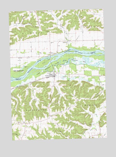
Blue River, WI USGS Topographic Map
Click on map above to begin viewing in our Map Viewer.

This topographic map contains these locations and features:
Feature Name Type Latitude Longitude GNIS ID View Map
0.4 ReservoirReservoirN43.2350°W90.5285°1793258View Map
1.28 ReservoirReservoirN43.2500°W90.6135°1793544View Map
Beulah CemeteryCemeteryN43.1416°W90.6079°1561662View Map
Black School (historical)SchoolN43.1272°W90.5196°1840560View Map
Blue Mountain OrchardLocaleN43.1625°W90.5342°2709194View Map
Blue RiverPopulated PlaceN43.1883°W90.5668°1561952View Map
Blue RiverStreamN43.1967°W90.5648°1561953View Map
Blue River Bluffs State Natural AreaParkN43.1772°W90.5957°1989129View Map
Blue River CemeteryCemeteryN43.1894°W90.5768°1561954View Map
Blue River Fire and RescueBuildingN43.1861°W90.5685°2697904View Map
Blue River Sand Barrens State Natural AreaParkN43.1944°W90.5329°1989130View Map
Blue River Wastewater Treatment FacilityLocaleN43.1903°W90.5719°2709264View Map
Brimstone Group H855 DamDamN43.2350°W90.5285°1793257View Map
Brimstone HollowValleyN43.2173°W90.5441°1562214View Map
Byrds CreekPopulated PlaceN43.2200°W90.5485°1562494View Map
Byrds CreekStreamN43.2130°W90.5465°1562495View Map
Byrds Creek Stock FarmLocaleN43.2342°W90.5512°1957703View Map
Cooper HillSummitN43.2361°W90.5529°1577232View Map
Coumbe CemeteryCemeteryN43.2078°W90.5857°1563438View Map
Coumbe IslandIslandN43.1978°W90.5810°1563439View Map
Cross SloughGutN43.1975°W90.5685°1563559View Map
Eagle Valley FarmLocaleN43.2236°W90.5187°1958067View Map
Fennimore ForkStreamN43.1350°W90.5179°1564908View Map
Garner LakeLakeN43.1951°W90.6085°1565421View Map
Glen Eagle FarmLocaleN43.2433°W90.5376°1958069View Map
Greenwood CemeteryCemeteryN43.2180°W90.5715°1565861View Map
Haskins School (historical)SchoolN43.2380°W90.6187°1840591View Map
Heberlin School (historical)SchoolN43.1480°W90.5743°1840571View Map
Jones SloughGutN43.1989°W90.5504°1567276View Map
Kite School (historical)SchoolN43.2211°W90.5279°1840597View Map
Oak RidgeRidgeN43.1522°W90.5560°1570674View Map
Peterson G9917 DamDamN43.2500°W90.6135°1793543View Map
Pine Grove Stock and Dairy FarmLocaleN43.2158°W90.5282°1958071View Map
Pleasant Lawn Stock FarmLocaleN43.2267°W90.5112°1958072View Map
Pleasant ValleyValleyN43.1721°W90.5021°1571637View Map
Port AndrewPopulated PlaceN43.2072°W90.5673°1571794View Map
Sand PrairiePopulated PlaceN43.2053°W90.6115°1577810View Map
Sand PrairieFlatN43.2072°W90.6051°1573698View Map
Sand Prairie CemeteryCemeteryN43.2058°W90.6021°1834422View Map
School Number 2 (historical)SchoolN43.2067°W90.6165°1957758View Map
School Number 4 (historical)SchoolN43.2197°W90.5673°1957761View Map
South Lawn Stock FarmLocaleN43.2155°W90.5210°1958077View Map
Steamboat IslandIslandN43.2097°W90.5426°1574837View Map
Strawberry RidgeRidgeN43.2372°W90.5854°1574978View Map
Studenberg HollowValleyN43.1789°W90.6014°1574992View Map
Tisdale HomesteadLocaleN43.2150°W90.5501°1957749View Map
Top T FarmsLocaleN43.1511°W90.5761°2709198View Map
Town of RichwoodCivilN43.2405°W90.6114°1584031View Map
Town of WatterstownCivilN43.1552°W90.6014°1584368View Map
Tyler School (historical)SchoolN43.1411°W90.6068°1840577View Map
Upper Byrds Creek School (historical)SchoolN43.2419°W90.5582°1840609View Map
Valley FarmLocaleN43.2036°W90.6204°1957751View Map
Village of Blue RiverCivilN43.1851°W90.5715°1582839View Map

Note: Coordinates in the location and feature list above are referenced to NAD83 datum.


Copyright (C) 2008-2024 Ryan Niemi / Sunset Dynamics ... All Rights Reserved