TopoQuest Logo
Do you find TopoQuest useful?
Help keep TopoQuest running and adding new maps/features by donating!
Bitcoin:  19c7KJd3qBynnjoSw5npx9KScwjBe4ifkT
Litecoin:  LXs6TkuXGGXo1vDsWCkWVdjQX94eUKd6ui
Home View Maps Find Maps Find Places Resources & Links


Hillsdale, New York Topographic Map

USGS Map Title: Hillsdale, NY
USGS Map MRC: 42073B5
DRG (GeoTIFF) Download: o42073b5.tif


Neighboring USGS Topographic Map Quads:


  Stottville, NY  
42073C6
 

  Chatham, NY  
42073C5


  Claverack, NY  
42073B6
 

  Hillsdale, NY  
42073B5


  Ancram, NY  
42073A6
 

  Copake, NY  
42073A5


Map MRC Location:

N43°
W74°
N43°
W73°
H8 H7 H6 H5 H4 H3 H2 H1
G8 G7 G6 G5 G4 G3 G2 G1
F8 F7 F6 F5 F4 F3 F2 F1
E8 E7 E6 E5 E4 E3 E2 E1
D8 D7 D6 D5 D4 D3 D2 D1
C8 C7 C6 C5 C4 C3 C2 C1
B8 B7 B6 B5 B4 B3 B2 B1
A8 A7 A6 A5 A4 A3 A2 A1
N42°
W74°
N42°
W73°

Hillsdale, NY USGS 1:24K Topographic Map Preview:
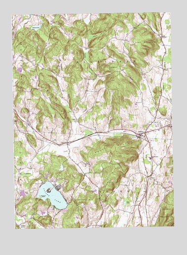
Hillsdale, NY USGS Topographic Map
Click on map above to begin viewing in our Map Viewer.

This topographic map contains these locations and features:
Feature Name Type Latitude Longitude GNIS ID View Map
B Flat Farm AirportAirportN42.1394°W73.6098°2443570View Map
Black Grocery BridgeBridgeN42.1543°W73.5198°944132View Map
Bloody HillSummitN42.1765°W73.6104°944276View Map
Center HillSummitN42.1412°W73.5673°946194View Map
Collins CemeteryCemeteryN42.2140°W73.5219°947154View Map
Copake Country ClubLocaleN42.1485°W73.6078°2615378View Map
Copake LakeLakeN42.1439°W73.5953°947410View Map
Copake LakePopulated PlaceN42.1393°W73.5823°1852895View Map
Copake Lake Census Designated PlaceCensusN42.1416°W73.5903°2389356View Map
Copake Lake Seaplane BaseAirportN42.1431°W73.5907°977971View Map
CraryvillePopulated PlaceN42.1748°W73.5829°947711View Map
Craryville Post OfficePost OfficeN42.1750°W73.5845°2617879View Map
Craryville Volunteer Fire CompanyBuildingN42.1735°W73.5825°2734755View Map
East HillsdalePopulated PlaceN42.1831°W73.5010°949125View Map
Goose PondLakeN42.1386°W73.5382°951370View Map
HillsdalePopulated PlaceN42.1790°W73.5260°952831View Map
Hillsdale CemeteryCemeteryN42.1851°W73.5142°952832View Map
Hillsdale Fire Company 1BuildingN42.1847°W73.5181°2734716View Map
Hillsdale Post OfficePost OfficeN42.1780°W73.5210°2617961View Map
Knapp HollowValleyN42.1901°W73.5754°954762View Map
Krum Church CemeteryCemeteryN42.2453°W73.5929°947861View Map
Little Rainbow ChevreLocaleN42.2136°W73.5617°2555708View Map
Lyon MountainSummitN42.2309°W73.5204°956193View Map
Mosquito IslandIslandN42.1437°W73.6040°957748View Map
North Copake CemeteryCemeteryN42.1758°W73.5932°958624View Map
North HillsdalePopulated PlaceN42.2356°W73.5073°958820View Map
Philmont ReservoirReservoirN42.2425°W73.6054°960312View Map
Pond HillSummitN42.1459°W73.6140°960891View Map
Pumpkin HollowPopulated PlaceN42.1281°W73.6193°961967View Map
Pumpkin HollowSummitN42.2170°W73.5496°961969View Map
Rheinstrom HillSummitN42.1551°W73.5451°962435View Map
Roeliff Jansen SchoolSchoolN42.1648°W73.5179°962808View Map
Scutt HillSummitN42.1734°W73.5354°964713View Map
Shepard HollowValleyN42.2301°W73.5660°965053View Map
Taconic Hills Elementary SchoolSchoolN42.1704°W73.6014°2668916View Map
Taconic Hills High SchoolSchoolN42.1703°W73.6004°2669244View Map
Taconic Hills Middle SchoolSchoolN42.1710°W73.6002°2669189View Map
Texas HillSummitN42.2076°W73.6004°967182View Map
Town of CopakeCivilN42.1286°W73.5512°978865View Map
Town of HillsdaleCivilN42.2244°W73.5325°979068View Map
White Oak FarmsLocaleN42.1925°W73.5200°2555715View Map
Williams CemeteryCemeteryN42.1460°W73.5063°971305View Map

Note: Coordinates in the location and feature list above are referenced to NAD83 datum.


Copyright (C) 2008-2024 Ryan Niemi / Sunset Dynamics ... All Rights Reserved