TopoQuest Logo
Do you find TopoQuest useful?
Help keep TopoQuest running and adding new maps/features by donating!
Bitcoin:  19c7KJd3qBynnjoSw5npx9KScwjBe4ifkT
Litecoin:  LXs6TkuXGGXo1vDsWCkWVdjQX94eUKd6ui
Home View Maps Find Maps Find Places Resources & Links


Hinesburg, Vermont Topographic Map

USGS Map Title: Hinesburg, VT
USGS Map MRC: 44073C1
DRG (GeoTIFF) Download: o44073c1.tif


Neighboring USGS Topographic Map Quads:


  Burlington, VT  
44073D2
 

  Essex Junction, VT  
44073D1
 

  Richmond, VT  
44072D8
 

  Mount Philo, VT  
44073C2
 

  Hinesburg, VT  
44073C1
 

  Huntington, VT  
44072C8
 

  Vergennes East, VT  
44073B2
 

  Bristol, VT  
44073B1
 

  Mount Ellen, VT  
44072B8


Map MRC Location:

N45°
W74°
N45°
W73°
H8 H7 H6 H5 H4 H3 H2 H1
G8 G7 G6 G5 G4 G3 G2 G1
F8 F7 F6 F5 F4 F3 F2 F1
E8 E7 E6 E5 E4 E3 E2 E1
D8 D7 D6 D5 D4 D3 D2 D1
C8 C7 C6 C5 C4 C3 C2 C1
B8 B7 B6 B5 B4 B3 B2 B1
A8 A7 A6 A5 A4 A3 A2 A1
N44°
W74°
N44°
W73°

Hinesburg, VT USGS 1:24K Topographic Map Preview:
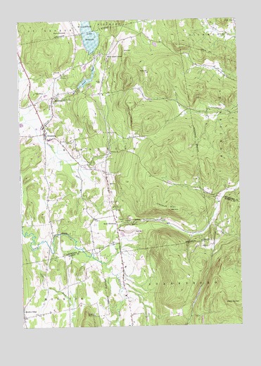
Hinesburg, VT USGS Topographic Map
Click on map above to begin viewing in our Map Viewer.

This topographic map contains these locations and features:
Feature Name Type Latitude Longitude GNIS ID View Map
Annettes Playschool IlSchoolN44.3450°W73.1056°2427437View Map
Barker CemeteryCemeteryN44.3503°W73.0773°1456253View Map
Champlain Valley Union High SchoolSchoolN44.3446°W73.1100°2427393View Map
Dow HillSummitN44.3623°W73.0643°1457188View Map
Fred Johnson Wildlife Management AreaParkN44.2981°W73.0579°1918687View Map
High RockSummitN44.3453°W73.1157°1457819View Map
HinesburgPopulated PlaceN44.3292°W73.1107°1457839View Map
Hinesburg CemeteryCemeteryN44.3412°W73.1032°1918703View Map
Hinesburg Census Designated PlaceCensusN44.3299°W73.1062°2586640View Map
Hinesburg Community SchoolSchoolN44.3263°W73.1082°1918704View Map
Hinesburg Fire DepartmentBuildingN44.3332°W73.1122°2121388View Map
Hinesburg Police DepartmentBuildingN44.3336°W73.1121°2752749View Map
Hinesburg Post OfficePost OfficeN44.3344°W73.1081°1918705View Map
Hogback MountainSummitN44.2551°W73.0882°1457855View Map
Hollow BrookStreamN44.2756°W73.0773°1457872View Map
Lake IroquoisReservoirN44.3701°W73.0844°1458145View Map
Lake Iroquois DamDamN44.3617°W73.0812°1766399View Map
Lincoln HillSummitN44.3001°W73.0485°1458222View Map
Lower PondReservoirN44.3510°W73.0854°1458304View Map
Lower Pond DamDamN44.3478°W73.0910°1766397View Map
McDonough CemeteryCemeteryN44.2867°W73.0696°1918764View Map
MechanicsvillePopulated PlaceN44.3439°W73.1054°1458412View Map
Monkton Post OfficePost OfficeN44.2555°W73.1116°1918172View Map
Monkton RidgePopulated PlaceN44.2545°W73.1243°1458517View Map
Monkton Ridge CemeteryCemeteryN44.2541°W73.1246°1459188View Map
Monkton Volunteer Fire DepartmentBuildingN44.2554°W73.1115°2121358View Map
Mount PritchardSummitN44.3703°W73.1046°1458584View Map
Owls HeadSummitN44.3739°W73.0073°1458864View Map
Patrick BrookStreamN44.3317°W73.1165°1458904View Map
Pond BrookStreamN44.2820°W73.1182°1461290View Map
Red RockSummitN44.2978°W73.0404°1459155View Map
Rhode Island CornerPopulated PlaceN44.3612°W73.0740°1459171View Map
Sarah Carpenter Memorial LibraryBuildingN44.3276°W73.1140°1918866View Map
Shaker MountainSummitN44.2584°W73.0060°1459456View Map
Sherman Hollow Ski Touring CenterLocaleN44.3567°W73.0248°1918882View Map
South HinesburgPopulated PlaceN44.2923°W73.0698°1459593View Map
Texas HillSummitN44.3539°W73.0551°1459839View Map
Town of HinesburgCivilN44.3245°W73.0901°1462119View Map
Tracy CemeteryCemeteryN44.3053°W73.0749°1918913View Map

Note: Coordinates in the location and feature list above are referenced to NAD83 datum.


Copyright (C) 2008-2025 Ryan Niemi / Sunset Dynamics ... All Rights Reserved