TopoQuest Logo
Do you find TopoQuest useful?
Help keep TopoQuest running and adding new maps/features by donating!
Bitcoin:  19c7KJd3qBynnjoSw5npx9KScwjBe4ifkT
Litecoin:  LXs6TkuXGGXo1vDsWCkWVdjQX94eUKd6ui
Home View Maps Find Maps Find Places Resources & Links


Adobe Downs Ranch, New Mexico Topographic Map

USGS Map Title: Adobe Downs Ranch, NM
USGS Map MRC: 36108H1
DRG (GeoTIFF) Download: o36108h1.tif


Neighboring USGS Topographic Map Quads:


  Redmesa, CO  
37108A2
 

  Pinkerton Mesa, CO  
37108A1
 

  Long Mountain, CO  
37107A8
 

  La Plata, NM  
36108H2
 

  Adobe Downs Ranch, NM  
36108H1
 

  Cedar Hill, NM  
36107H8
 

  Farmington North, NM  
36108G2
 

  Flora Vista, NM  
36108G1
 

  Aztec, NM  
36107G8


Map MRC Location:

N37°
W109°
N37°
W108°
H8 H7 H6 H5 H4 H3 H2 H1
G8 G7 G6 G5 G4 G3 G2 G1
F8 F7 F6 F5 F4 F3 F2 F1
E8 E7 E6 E5 E4 E3 E2 E1
D8 D7 D6 D5 D4 D3 D2 D1
C8 C7 C6 C5 C4 C3 C2 C1
B8 B7 B6 B5 B4 B3 B2 B1
A8 A7 A6 A5 A4 A3 A2 A1
N36°
W109°
N36°
W108°

Adobe Downs Ranch, NM USGS 1:24K Topographic Map Preview:
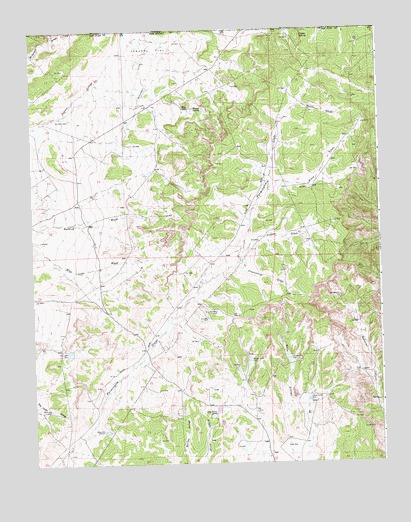
Adobe Downs Ranch, NM USGS Topographic Map
Click on map above to begin viewing in our Map Viewer.

This topographic map contains these locations and features:
Feature Name Type Latitude Longitude GNIS ID View Map
Adobe Downs RanchLocaleN36.8889°W108.0619°899359View Map
Black GladeStreamN36.9536°W108.0401°899368View Map
Camel Hump DamDamN36.8931°W108.0265°899378View Map
Coyote SpringSpringN36.9981°W108.0273°899385View Map
Drip Pee Wee DamDamN36.9186°W108.0595°899389View Map
Dusenberry GladeStreamN36.9333°W108.0503°899390View Map
Hedges North DamDamN36.9047°W108.0473°899416View Map
Jaquez FlatFlatN36.9944°W108.0803°899422View Map
Knob Rock DamDamN36.9069°W108.1129°899425View Map
Lawson GladeStreamN36.9356°W108.0495°899428View Map
Martin GladeStreamN36.9775°W108.0298°899435View Map
McDermott DitchCanalN36.9856°W108.0842°899439View Map
Mosley SpringSpringN36.9772°W108.0662°899444View Map
New Mexico MineMineN36.9708°W108.0845°916382View Map
North Light Plant Census Designated PlaceCensusN36.8752°W108.0458°2584166View Map
Oliver DikeLeveeN36.8800°W108.0306°899449View Map
Painted Hills DamDamN36.9050°W108.0334°899450View Map
Pee Wee DamDamN36.9169°W108.0623°899453View Map
Vee DamDamN36.9106°W108.0662°899483View Map
White Hill DamDamN36.8911°W108.1201°899485View Map
Wilson RanchLocaleN36.9772°W108.0681°899488View Map
Zebra Hills DamDamN36.8847°W108.0998°899490View Map

Note: Coordinates in the location and feature list above are referenced to NAD83 datum.


Copyright (C) 2008-2025 Ryan Niemi / Sunset Dynamics ... All Rights Reserved