TopoQuest Logo
Do you find TopoQuest useful?
Help keep TopoQuest running and adding new maps/features by donating!
Bitcoin:  19c7KJd3qBynnjoSw5npx9KScwjBe4ifkT
Litecoin:  LXs6TkuXGGXo1vDsWCkWVdjQX94eUKd6ui
Home View Maps Find Maps Find Places Resources & Links


Hogansburg, New York Topographic Map

USGS Map Title: Hogansburg, NY
USGS Map MRC: 44074H6
DRG (GeoTIFF) Download: o44074h6.tif


Neighboring USGS Topographic Map Quads:


  Cornwall West, ON  
45074A7


  Raquette River, NY  
44074H7
 

  Hogansburg, NY  
44074H6
 

  Bombay, NY  
44074H5
 

  Brasher Falls, NY  
44074G7
 

  North Lawrence, NY  
44074G6
 

  Brushton, NY  
44074G5


Map MRC Location:

N45°
W75°
N45°
W74°
H8 H7 H6 H5 H4 H3 H2 H1
G8 G7 G6 G5 G4 G3 G2 G1
F8 F7 F6 F5 F4 F3 F2 F1
E8 E7 E6 E5 E4 E3 E2 E1
D8 D7 D6 D5 D4 D3 D2 D1
C8 C7 C6 C5 C4 C3 C2 C1
B8 B7 B6 B5 B4 B3 B2 B1
A8 A7 A6 A5 A4 A3 A2 A1
N44°
W75°
N44°
W74°

Hogansburg, NY USGS 1:24K Topographic Map Preview:
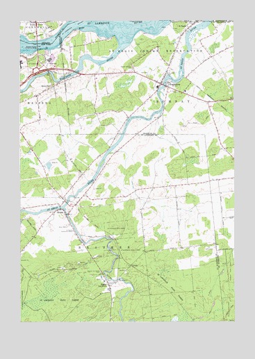
Hogansburg, NY USGS Topographic Map
Click on map above to begin viewing in our Map Viewer.

This topographic map contains these locations and features:
Feature Name Type Latitude Longitude GNIS ID View Map
Akwesasne Mohawk CasinoBuildingN44.9706°W74.6419°2374249View Map
Brasher Iron WorksPopulated PlaceN44.8901°W74.6980°976019View Map
Brasher Iron Works CemeteryCemeteryN44.8957°W74.7027°976020View Map
Deer RiverStreamN44.9220°W74.7241°977219View Map
Deer River BridgeBridgeN44.9197°W74.7223°2614891View Map
HelenaPopulated PlaceN44.9217°W74.7263°976427View Map
HogansburgPopulated PlaceN44.9739°W74.6632°952950View Map
Hogansburg Akwesasne Volunteer Fire DepartmentBuildingN44.9676°W74.6502°2734918View Map
Hogansburg Post OfficePost OfficeN44.9747°W74.6673°2617967View Map
IrontonPopulated PlaceN44.8984°W74.6855°976480View Map
Massena-Cornwall International BridgeBridgeN44.9895°W74.7396°976641View Map
Mohawk Memorial CemeteryCemeteryN44.9802°W74.6839°957472View Map
Raquette PointCapeN44.9964°W74.7163°979979View Map
Raquette RiverStreamN44.9900°W74.6913°977242View Map
RooseveltownPopulated PlaceN44.9728°W74.7310°976907View Map
Rooseveltown Post OfficePost OfficeN44.9727°W74.7314°2599018View Map
Saint Joseph CemeteryCemeteryN44.9788°W74.6634°963705View Map
Saint Patrick CemeteryCemeteryN44.9705°W74.6579°964047View Map
Saint Patrick Community CenterLocaleN44.9128°W74.7191°976954View Map
Saint RegisPopulated PlaceN44.9973°W74.6510°964189View Map
Saint Regis Mohawk ReservationCivilN44.9788°W74.6430°979449View Map
Saint Regis Mohawk SchoolSchoolN44.9729°W74.6696°2669099View Map
School Number 3 (historical)SchoolN44.9064°W74.6547°2495288View Map
School Number 3 (historical)SchoolN44.9756°W74.6950°2495290View Map
School Number 4 (historical)SchoolN44.8869°W74.6736°2495281View Map
School Number 4 (historical)SchoolN44.9500°W74.6867°2495283View Map
School Number 4 (historical)SchoolN44.9831°W74.6400°2495298View Map
School Number 5 (historical)SchoolN44.9294°W74.6744°2495282View Map
School Number 6 (historical)SchoolN44.9600°W74.6944°2495289View Map
School Number 6 (historical)SchoolN44.9900°W74.7117°2495291View Map
School Number 7 (historical)SchoolN44.9675°W74.6253°2495297View Map
School Number 8 (historical)SchoolN44.9611°W74.7383°2495284View Map
Three Nations CrossingBridgeN44.9903°W74.7395°2419920View Map
Town of BrasherCivilN44.8763°W74.7315°978750View Map

Note: Coordinates in the location and feature list above are referenced to NAD83 datum.


Copyright (C) 2008-2025 Ryan Niemi / Sunset Dynamics ... All Rights Reserved