TopoQuest Logo
Do you find TopoQuest useful?
Help keep TopoQuest running and adding new maps/features by donating!
Bitcoin:  19c7KJd3qBynnjoSw5npx9KScwjBe4ifkT
Litecoin:  LXs6TkuXGGXo1vDsWCkWVdjQX94eUKd6ui
Home View Maps Find Maps Find Places Resources & Links


Bombay, New York Topographic Map

USGS Map Title: Bombay, NY
USGS Map MRC: 44074H5
DRG (GeoTIFF) Download: o44074h5.tif


Neighboring USGS Topographic Map Quads:


  Hogansburg, NY  
44074H6
 

  Bombay, NY  
44074H5
 

  Fort Covington, NY  
44074H4
 

  North Lawrence, NY  
44074G6
 

  Brushton, NY  
44074G5
 

  Bangor, NY  
44074G4


Map MRC Location:

N45°
W75°
N45°
W74°
H8 H7 H6 H5 H4 H3 H2 H1
G8 G7 G6 G5 G4 G3 G2 G1
F8 F7 F6 F5 F4 F3 F2 F1
E8 E7 E6 E5 E4 E3 E2 E1
D8 D7 D6 D5 D4 D3 D2 D1
C8 C7 C6 C5 C4 C3 C2 C1
B8 B7 B6 B5 B4 B3 B2 B1
A8 A7 A6 A5 A4 A3 A2 A1
N44°
W75°
N44°
W74°

Bombay, NY USGS 1:24K Topographic Map Preview:
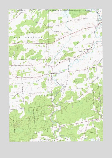
Bombay, NY USGS Topographic Map
Click on map above to begin viewing in our Map Viewer.

This topographic map contains these locations and features:
Feature Name Type Latitude Longitude GNIS ID View Map
BombayPopulated PlaceN44.9389°W74.5677°944413View Map
Bombay Fire DepartmentBuildingN44.9389°W74.5725°2718538View Map
Bombay Post OfficePost OfficeN44.9383°W74.5671°2617825View Map
Farrington BrookStreamN44.8789°W74.5507°949927View Map
Fort Covington Hamlet Census Designated PlaceCensusN44.9761°W74.5097°2584256View Map
Fort Covington Port of EntryLocaleN44.9958°W74.5047°2615008View Map
Franklin State Forest Number FourForestN44.8967°W74.5930°950632View Map
Franklin State Forest Number TwoForestN44.8875°W74.6169°950631View Map
Hillside Rest CemeteryCemeteryN44.9398°W74.5657°952862View Map
Little Salmon RiverStreamN44.9912°W74.5016°970307View Map
Saint Josephs CemeteryCemeteryN44.9154°W74.5672°963741View Map
Saint Marys CemeteryCemeteryN44.9846°W74.5035°963926View Map
Salmon River SchoolSchoolN44.9617°W74.5196°964327View Map
Sand Hill CemeteryCemeteryN44.9079°W74.5651°964378View Map
School Number 2 (historical)SchoolN44.9381°W74.6200°2495296View Map
School Number 2 (historical)SchoolN44.9681°W74.5917°2495299View Map
School Number 3 (historical)SchoolN44.9733°W74.5456°2495319View Map
School Number 4 (historical)SchoolN44.9889°W74.5533°2495318View Map
School Number 5 (historical)SchoolN44.9444°W74.5100°2495317View Map
School Number 7 (historical)SchoolN44.8922°W74.5361°2495307View Map
School Number 8 (historical)SchoolN44.9867°W74.5831°2495300View Map
School Number 8 (historical)SchoolN44.9256°W74.5206°2495309View Map
School Number 9 (historical)SchoolN44.9189°W74.5544°2495308View Map
South BombayPopulated PlaceN44.8900°W74.5544°965686View Map
Town of BombayCivilN44.9203°W74.5795°978742View Map

Note: Coordinates in the location and feature list above are referenced to NAD83 datum.


Copyright (C) 2008-2025 Ryan Niemi / Sunset Dynamics ... All Rights Reserved