TopoQuest Logo
Do you find TopoQuest useful?
Help keep TopoQuest running and adding new maps/features by donating!
Bitcoin:  19c7KJd3qBynnjoSw5npx9KScwjBe4ifkT
Litecoin:  LXs6TkuXGGXo1vDsWCkWVdjQX94eUKd6ui
Home View Maps Find Maps Find Places Resources & Links


Brushton, New York Topographic Map

USGS Map Title: Brushton, NY
USGS Map MRC: 44074G5
DRG (GeoTIFF) Download: o44074g5.tif


Neighboring USGS Topographic Map Quads:


  Hogansburg, NY  
44074H6
 

  Bombay, NY  
44074H5
 

  Fort Covington, NY  
44074H4
 

  North Lawrence, NY  
44074G6
 

  Brushton, NY  
44074G5
 

  Bangor, NY  
44074G4
 

  Nicholville, NY  
44074F6
 

  Saint Regis Falls, NY  
44074F5
 

  Santa Clara, NY  
44074F4


Map MRC Location:

N45°
W75°
N45°
W74°
H8 H7 H6 H5 H4 H3 H2 H1
G8 G7 G6 G5 G4 G3 G2 G1
F8 F7 F6 F5 F4 F3 F2 F1
E8 E7 E6 E5 E4 E3 E2 E1
D8 D7 D6 D5 D4 D3 D2 D1
C8 C7 C6 C5 C4 C3 C2 C1
B8 B7 B6 B5 B4 B3 B2 B1
A8 A7 A6 A5 A4 A3 A2 A1
N44°
W75°
N44°
W74°

Brushton, NY USGS 1:24K Topographic Map Preview:
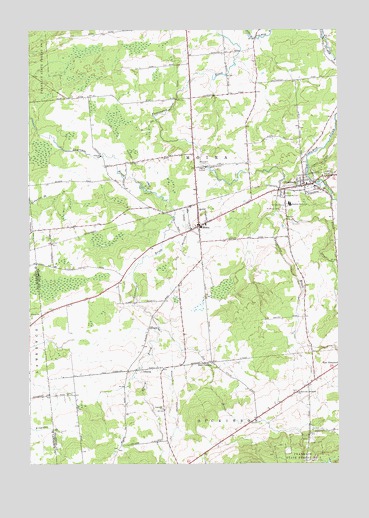
Brushton, NY USGS Topographic Map
Click on map above to begin viewing in our Map Viewer.

This topographic map contains these locations and features:
Feature Name Type Latitude Longitude GNIS ID View Map
AlburgPopulated PlaceN44.7773°W74.5816°942250View Map
Alburg BrookStreamN44.7892°W74.5721°942251View Map
BrushtonPopulated PlaceN44.8303°W74.5135°944982View Map
Brushton Post OfficePost OfficeN44.8302°W74.5151°2617833View Map
Brushton Volunteer Fire DepartmentBuildingN44.8286°W74.5213°2718684View Map
Brushton-Moira SchoolSchoolN44.8251°W74.5196°944983View Map
East Dickinson CemeteryCemeteryN44.7711°W74.5168°2559766View Map
Evangelical Wesleyan ChurchChurchN44.8521°W74.5594°2615895View Map
First Christian ChurchChurchN44.8312°W74.5140°2615969View Map
Irish CornersLocaleN44.7792°W74.5510°953756View Map
Joy BrookStreamN44.7895°W74.5721°954208View Map
MoiraPopulated PlaceN44.8181°W74.5557°957491View Map
Moira Community CemeteryCemeteryN44.8185°W74.5605°2559765View Map
Moira Post OfficePost OfficeN44.8192°W74.5534°2618024View Map
Moira Volunteer Fire DepartmentBuildingN44.8179°W74.5558°2735008View Map
North Dickinson CemeteryCemeteryN44.7655°W74.5700°2559762View Map
Potter School (historical)SchoolN44.7639°W74.5331°2495302View Map
Saint Mary's ChurchChurchN44.8331°W74.5062°2616973View Map
Saint Mary's Parish CenterChurchN44.8256°W74.5218°2616977View Map
Saint Marys CemeteryCemeteryN44.8234°W74.5221°963924View Map
Saint Peters CemeteryCemeteryN44.8243°W74.5215°964149View Map
Sand Hill ChurchChurchN44.7659°W74.5710°964379View Map
School Number 10 (historical)SchoolN44.7700°W74.6072°2495292View Map
School Number 10 (historical)SchoolN44.8061°W74.5172°2495306View Map
School Number 11 (historical)SchoolN44.8561°W74.6017°2495301View Map
School Number 3 (historical)SchoolN44.8572°W74.5333°2495304View Map
School Number 5 (historical)SchoolN44.8011°W74.5658°2495303View Map
School Number 6 (historical)SchoolN44.7978°W74.6006°2495293View Map
School Number 7 (historical)SchoolN44.8178°W74.6133°2495294View Map
School Number 8 (historical)SchoolN44.8356°W74.5939°2495295View Map
School Number 9 (historical)SchoolN44.8697°W74.5600°2495305View Map
Stony BrookStreamN44.8223°W74.5252°970668View Map
Sunnyside CemeteryCemeteryN44.8273°W74.5218°966816View Map
Town of MoiraCivilN44.8296°W74.5588°979228View Map
Ursone Airport (historical)AirportN44.8070°W74.5107°977928View Map
Village of BrushtonCivilN44.8307°W74.5119°2391567View Map

Note: Coordinates in the location and feature list above are referenced to NAD83 datum.


Copyright (C) 2008-2025 Ryan Niemi / Sunset Dynamics ... All Rights Reserved