TopoQuest Logo
Do you find TopoQuest useful?
Help keep TopoQuest running and adding new maps/features by donating!
Bitcoin:  19c7KJd3qBynnjoSw5npx9KScwjBe4ifkT
Litecoin:  LXs6TkuXGGXo1vDsWCkWVdjQX94eUKd6ui
Home View Maps Find Maps Find Places Resources & Links


Hollenbeck Draw, Montana Topographic Map

USGS Map Title: Hollenbeck Draw, MT
USGS Map MRC: 45109A1
DRG (GeoTIFF) Download: o45109a1.tif


Neighboring USGS Topographic Map Quads:


  Red Lodge East, MT  
45109B2
 

  Belfry, MT  
45109B1
 

  Hatcher Pass, MT  
45108B8
 

  Tolman Flat, MT  
45109A2
 

  Hollenbeck Draw, MT  
45109A1
 

  Long Draw, MT  
45108A8
 

  Clark, WY  
44109H2
 

  Badger Basin, WY  
44109H1
 

  Elk Basin NW, WY  
44108H8


Map MRC Location:

N46°
W110°
N46°
W109°
H8 H7 H6 H5 H4 H3 H2 H1
G8 G7 G6 G5 G4 G3 G2 G1
F8 F7 F6 F5 F4 F3 F2 F1
E8 E7 E6 E5 E4 E3 E2 E1
D8 D7 D6 D5 D4 D3 D2 D1
C8 C7 C6 C5 C4 C3 C2 C1
B8 B7 B6 B5 B4 B3 B2 B1
A8 A7 A6 A5 A4 A3 A2 A1
N45°
W110°
N45°
W109°

Hollenbeck Draw, MT USGS 1:24K Topographic Map Preview:
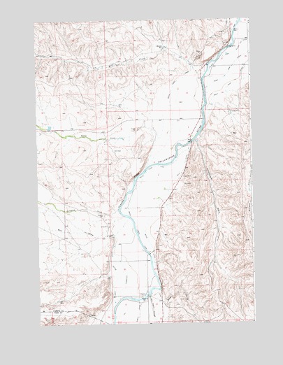
Hollenbeck Draw, MT USGS Topographic Map
Click on map above to begin viewing in our Map Viewer.

This topographic map contains these locations and features:
Feature Name Type Latitude Longitude GNIS ID View Map
08S22E27ACCC01 WellWellN45.1097°W109.0163°807951View Map
08S22E28DDAD01 WellWellN45.1041°W109.0274°807928View Map
08S22E32DDAD01 WellWellN45.0899°W109.0474°807857View Map
08S22E34CCCB01 WellWellN45.0886°W109.0260°807845View Map
09S22E05DBBC01 WellWellN45.0794°W109.0568°807771View Map
09S22E17ACCD01 WellWellN45.0519°W109.0549°807559View Map
09S22E19ADBD01 WellWellN45.0394°W109.0701°807479View Map
09S22E20CDCD01 WellWellN45.0297°W109.0601°807407View Map
09S22E30BADD01 WellWellN45.0261°W109.0782°807385View Map
09S22E31ADAA01 WellWellN45.0111°W109.0679°807306View Map
Belfry CemeteryCemeteryN45.1203°W109.0100°768670View Map
Big Reservoir DamDamN45.0549°W109.0024°795675View Map
Big Sand CouleeValleyN45.0119°W109.0604°768823View Map
Bridger Bend Fishing Access SiteLocaleN45.1172°W109.0063°1744553View Map
ChancePopulated PlaceN45.0119°W109.0632°769749View Map
Chance Mountain View CemeteryCemeteryN45.0447°W109.0862°769750View Map
Chance Post Office (historical)Post OfficeN45.0119°W109.0632°1726663View Map
Chance School (historical)SchoolN45.0277°W109.0626°1726819View Map
Clarks Fork and Silver Tip DitchCanalN45.1114°W109.0086°768048View Map
Dilworth CreekStreamN45.0469°W109.0782°782383View Map
Doctor DitchCanalN45.0166°W109.0813°770684View Map
Grove CreekStreamN45.0641°W109.0626°784393View Map
Grove Creek CanalCanalN45.0436°W109.0690°772018View Map
Grove Creek CanalCanalN45.0844°W109.0451°772019View Map
Hollenbeck DrawValleyN45.0758°W109.0313°772478View Map
Interstate DitchCanalN45.0247°W109.0763°772709View Map
Limberger DamDamN45.0816°W109.1174°798726View Map
Mill DrawValleyN45.0424°W109.0804°787380View Map
Monroe ReservoirReservoirN45.1138°W109.0505°774337View Map
Riverview Post Office (historical)Post OfficeN45.1041°W109.0229°1726780View Map
Riverview School (historical)SchoolN45.1041°W109.0229°1726842View Map
Rocky Point DitchCanalN45.0652°W109.0479°775896View Map
Rocky Point DitchCanalN45.0986°W109.0099°775897View Map
Sand CouleeValleyN45.0094°W109.0524°776162View Map
Sirrine DitchCanalN45.0052°W109.0663°776584View Map
V O ReservoirReservoirN45.0865°W109.0122°777957View Map
Wills DitchCanalN45.0436°W109.0599°778558View Map
Wills Ditch BridgeBridgeN45.0138°W109.0621°1726629View Map
Wolf CreekStreamN45.1027°W109.0263°793450View Map

Note: Coordinates in the location and feature list above are referenced to NAD83 datum.


Copyright (C) 2008-2025 Ryan Niemi / Sunset Dynamics ... All Rights Reserved