TopoQuest Logo
Do you find TopoQuest useful?
Help keep TopoQuest running and adding new maps/features by donating!
Bitcoin:  19c7KJd3qBynnjoSw5npx9KScwjBe4ifkT
Litecoin:  LXs6TkuXGGXo1vDsWCkWVdjQX94eUKd6ui
Home View Maps Find Maps Find Places Resources & Links


Badger Basin, Wyoming Topographic Map

USGS Map Title: Badger Basin, WY
USGS Map MRC: 44109H1
DRG (GeoTIFF) Download: o44109h1.tif


Neighboring USGS Topographic Map Quads:


  Tolman Flat, MT  
45109A2
 

  Hollenbeck Draw, MT  
45109A1
 

  Long Draw, MT  
45108A8
 

  Clark, WY  
44109H2
 

  Badger Basin, WY  
44109H1
 

  Elk Basin NW, WY  
44108H8
 

  Chapman Bench, WY  
44109G2
 

  Badlands Hills, WY  
44109G1
 

  Elk Basin SW, WY  
44108G8


Map MRC Location:

N45°
W110°
N45°
W109°
H8 H7 H6 H5 H4 H3 H2 H1
G8 G7 G6 G5 G4 G3 G2 G1
F8 F7 F6 F5 F4 F3 F2 F1
E8 E7 E6 E5 E4 E3 E2 E1
D8 D7 D6 D5 D4 D3 D2 D1
C8 C7 C6 C5 C4 C3 C2 C1
B8 B7 B6 B5 B4 B3 B2 B1
A8 A7 A6 A5 A4 A3 A2 A1
N44°
W110°
N44°
W109°

Badger Basin, WY USGS 1:24K Topographic Map Preview:
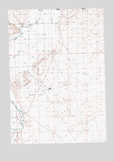
Badger Basin, WY USGS Topographic Map
Click on map above to begin viewing in our Map Viewer.

This topographic map contains these locations and features:
Feature Name Type Latitude Longitude GNIS ID View Map
Badger BasinPopulated PlaceN44.9258°W109.0732°1597207View Map
Badger BasinBasinN44.9213°W109.0924°1585023View Map
Big Sand CouleeValleyN44.9999°W109.0579°1585500View Map
Buck Springs Detention DamDamN44.9333°W109.0590°1608234View Map
Buck Springs ReservoirReservoirN44.9333°W109.0590°1608235View Map
Chapman Creek PitMineN44.8819°W109.1182°1725952View Map
Chesarek RanchLocaleN44.9916°W109.0813°1586622View Map
Clark DitchCanalN44.9697°W109.0879°1586735View Map
Doctor DitchCanalN44.9799°W109.1101°1587679View Map
Interstate DitchCanalN44.9908°W109.0860°1589933View Map
Little Sand CouleeValleyN44.8827°W109.1160°1590864View Map
Park County Fire Protection District 4BuildingN44.9774°W109.0775°2673595View Map
Pioneer SchoolSchoolN44.9730°W109.0846°1592848View Map
Simpson DitchCanalN44.9552°W109.1115°1594363View Map
Sirrine DitchCanalN44.9722°W109.0921°1594387View Map
State DitchCanalN44.9036°W109.1163°1594987View Map
Walker RanchLocaleN44.9913°W109.0899°1596003View Map

Note: Coordinates in the location and feature list above are referenced to NAD83 datum.


Copyright (C) 2008-2025 Ryan Niemi / Sunset Dynamics ... All Rights Reserved