TopoQuest Logo
Do you find TopoQuest useful?
Help keep TopoQuest running and adding new maps/features by donating!
Bitcoin:  19c7KJd3qBynnjoSw5npx9KScwjBe4ifkT
Litecoin:  LXs6TkuXGGXo1vDsWCkWVdjQX94eUKd6ui
Home View Maps Find Maps Find Places Resources & Links


Holley, New York Topographic Map

USGS Map Title: Holley, NY
USGS Map MRC: 43078B1
DRG (GeoTIFF) Download: o43078b1.tif


Neighboring USGS Topographic Map Quads:


  Kent, NY  
43078C2
 

  Kendall, NY  
43078C1
 

  Hamlin, NY  
43077C8
 

  Albion, NY  
43078B2
 

  Holley, NY  
43078B1
 

  Brockport, NY  
43077B8
 

  Batavia North, NY  
43078A2
 

  Byron, NY  
43078A1
 

  Churchville, NY  
43077A8


Map MRC Location:

N44°
W79°
N44°
W78°
H8 H7 H6 H5 H4 H3 H2 H1
G8 G7 G6 G5 G4 G3 G2 G1
F8 F7 F6 F5 F4 F3 F2 F1
E8 E7 E6 E5 E4 E3 E2 E1
D8 D7 D6 D5 D4 D3 D2 D1
C8 C7 C6 C5 C4 C3 C2 C1
B8 B7 B6 B5 B4 B3 B2 B1
A8 A7 A6 A5 A4 A3 A2 A1
N43°
W79°
N43°
W78°

Holley, NY USGS 1:24K Topographic Map Preview:
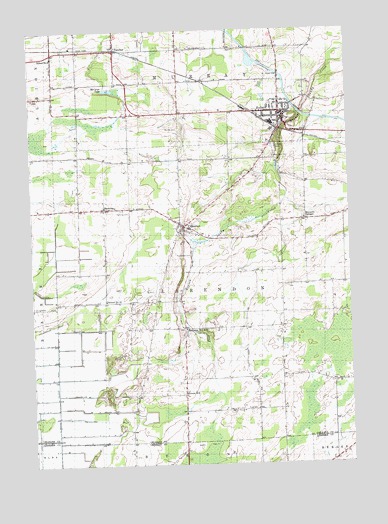
Holley, NY USGS Topographic Map
Click on map above to begin viewing in our Map Viewer.

This topographic map contains these locations and features:
Feature Name Type Latitude Longitude GNIS ID View Map
Bennetts CornersPopulated PlaceN43.1951°W78.0172°943686View Map
Brockport Country ClubLocaleN43.2376°W78.0011°2615353View Map
Christopher FarmLocaleN43.2094°W78.0644°2559224View Map
ClarendonPopulated PlaceN43.1934°W78.0647°946741View Map
Clarendon Post OfficePost OfficeN43.1933°W78.0651°2617863View Map
Clarendon QuarryMineN43.1875°W78.0642°2567158View Map
Clarendon Volunteer Fire CompanyBuildingN43.1977°W78.0725°2700950View Map
Community Free LibraryBuildingN43.2255°W78.0252°2617252View Map
County Line Mobile Home ParkPopulated PlaceN43.2308°W78.0003°2487305View Map
Disciples United Methodist ChurchChurchN43.2002°W78.0546°2615846View Map
East Avenue Gulf Road BridgeBridgeN43.2286°W78.0217°2614896View Map
Erie Canal BridgeBridgeN43.2247°W78.0140°2614902View Map
FancherPopulated PlaceN43.2448°W78.0911°949900View Map
Fancher Post OfficePost OfficeN43.2447°W78.0939°2617912View Map
First Baptist ChurchChurchN43.2252°W78.0273°2615951View Map
First Presbyterian ChurchChurchN43.2263°W78.0257°2616006View Map
Glidden Burial GroundCemeteryN43.1644°W78.0520°2516254View Map
Groth Road BridgeBridgeN43.2496°W78.0462°2614913View Map
Hickory Ridge Golf and Country ClubLocaleN43.2356°W78.0992°2615410View Map
Hillside CemeteryCemeteryN43.2159°W78.0288°952848View Map
HolleyPopulated PlaceN43.2264°W78.0267°952995View Map
Holley Elementary SchoolSchoolN43.2311°W78.0285°2668861View Map
Holley Fire DepartmentBuildingN43.2244°W78.0255°2700857View Map
Holley Junior - Senior High SchoolSchoolN43.2342°W78.0290°2669037View Map
Holley Post OfficePost OfficeN43.2260°W78.0251°2617968View Map
Holy Cross CemeteryCemeteryN43.2137°W78.0295°953047View Map
Honest HillPopulated PlaceN43.1453°W78.0658°953138View Map
Kateland FarmsLocaleN43.2192°W78.0483°2559225View Map
ManningPopulated PlaceN43.1989°W78.0961°956366View Map
Maple Grove FarmLocaleN43.2011°W78.0292°2559213View Map
Maplewood CemeteryCemeteryN43.1857°W78.0626°956479View Map
Maxon FieldAirportN43.1795°W78.0402°978067View Map
McCargo LakeLakeN43.2331°W78.0937°956728View Map
Mele FarmsLocaleN43.2344°W78.0772°2559214View Map
New Covenant Worship CenterChurchN43.2304°W78.0270°2616775View Map
Old Paths Baptist ChurchChurchN43.1822°W78.0034°2616167View Map
Pettinghill CemeteryCemeteryN43.1978°W78.0864°956367View Map
Piedmonte Garlic FarmLocaleN43.2361°W78.0350°2559216View Map
Pioneer CemeteryCemeteryN43.2218°W78.0666°960618View Map
Robinson Burial GroundCemeteryN43.1639°W78.0657°2516253View Map
Robinson Hill School (historical)SchoolN43.1639°W78.0650°962669View Map
Root CemeteryCemeteryN43.1405°W78.0383°962885View Map
Saint Mary's Roman Catholic ChurchChurchN43.2258°W78.0270°2616978View Map
Saint Pauls Episcopal ChurchChurchN43.2233°W78.0269°2617003View Map
School Number 1 (historical)SchoolN43.1258°W78.0069°2108365View Map
School Number 11 (historical)SchoolN43.1989°W78.0961°2106185View Map
School Number 12 (historical)SchoolN43.1723°W78.0959°975041View Map
School Number 14 (historical)SchoolN43.1408°W78.0372°2106186View Map
School Number 4 (historical)SchoolN43.1450°W78.0650°2106184View Map
School Number 9 (historical)SchoolN43.2426°W78.1159°975657View Map
Sixth Day FarmLocaleN43.2017°W78.0197°2559226View Map
Sprague CemeteryCemeteryN43.2444°W78.0461°2516252View Map
Thomas Estates WestPopulated PlaceN43.1925°W78.0106°2495938View Map
Town of ClarendonCivilN43.1744°W78.0563°978830View Map
Village of HolleyCivilN43.2247°W78.0292°2390901View Map

Note: Coordinates in the location and feature list above are referenced to NAD83 datum.


Copyright (C) 2008-2025 Ryan Niemi / Sunset Dynamics ... All Rights Reserved