TopoQuest Logo
Do you find TopoQuest useful?
Help keep TopoQuest running and adding new maps/features by donating!
Bitcoin:  19c7KJd3qBynnjoSw5npx9KScwjBe4ifkT
Litecoin:  LXs6TkuXGGXo1vDsWCkWVdjQX94eUKd6ui
Home View Maps Find Maps Find Places Resources & Links


Churchville, New York Topographic Map

USGS Map Title: Churchville, NY
USGS Map MRC: 43077A8
DRG (GeoTIFF) Download: o43077a8.tif


Neighboring USGS Topographic Map Quads:


  Holley, NY  
43078B1
 

  Brockport, NY  
43077B8
 

  Spencerport, NY  
43077B7
 

  Byron, NY  
43078A1
 

  Churchville, NY  
43077A8
 

  Clifton, NY  
43077A7
 

  Stafford, NY  
42078H1
 

  Le Roy, NY  
42077H8
 

  Caledonia, NY  
42077H7


Map MRC Location:

N44°
W78°
N44°
W77°
H8 H7 H6 H5 H4 H3 H2 H1
G8 G7 G6 G5 G4 G3 G2 G1
F8 F7 F6 F5 F4 F3 F2 F1
E8 E7 E6 E5 E4 E3 E2 E1
D8 D7 D6 D5 D4 D3 D2 D1
C8 C7 C6 C5 C4 C3 C2 C1
B8 B7 B6 B5 B4 B3 B2 B1
A8 A7 A6 A5 A4 A3 A2 A1
N43°
W78°
N43°
W77°

Churchville, NY USGS 1:24K Topographic Map Preview:
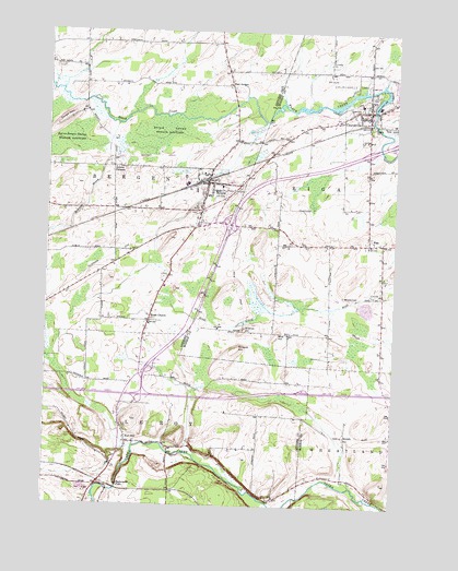
Churchville, NY USGS Topographic Map
Click on map above to begin viewing in our Map Viewer.

This topographic map contains these locations and features:
Feature Name Type Latitude Longitude GNIS ID View Map
Apple Tree Acres Corporate ParkLocaleN43.0721°W77.9407°2667553View Map
Barbary CoastPopulated PlaceN43.0689°W77.9625°2495961View Map
BergenPopulated PlaceN43.0853°W77.9422°943720View Map
Bergen Post OfficePost OfficeN43.0855°W77.9418°2617815View Map
Bergen United Methodist ChurchChurchN43.0831°W77.9425°2515575View Map
Bergen Volunteer Fire DepartmentBuildingN43.0893°W77.9420°2735013View Map
BeulahPopulated PlaceN43.0187°W77.8917°972229View Map
Blue HillSummitN43.0459°W77.9158°944307View Map
Buttermilk FallsFallsN43.0053°W77.9731°969943View Map
Calvary Chapel AgapeChurchN43.0850°W77.9427°2615664View Map
ChurchvillePopulated PlaceN43.1042°W77.8845°946690View Map
Churchville Golf CourseLocaleN43.1106°W77.8998°2615370View Map
Churchville ParkParkN43.1101°W77.8931°946691View Map
Churchville Post OfficePost OfficeN43.1029°W77.8838°2617862View Map
Creekside CemeteryCemeteryN43.1083°W77.8834°2615259View Map
East BergenPopulated PlaceN43.1109°W77.9347°972410View Map
East Bergen CemeteryCemeteryN43.1102°W77.9341°2516281View Map
Ely Air ParkAirportN43.0665°W77.9554°977913View Map
First Presbyterian ChurchChurchN43.0825°W77.9433°2515576View Map
Fort HillPopulated PlaceN43.0167°W77.9703°972494View Map
Fort Hill CemeteryCemeteryN43.0207°W77.9708°2516268View Map
Hidden MeadowsPopulated PlaceN43.0569°W77.9519°2495978View Map
Jericon CornersPopulated PlaceN43.0892°W77.9767°954005View Map
Lake Street Historic DistrictParkN43.0853°W77.9425°2649299View Map
Lei - Ti - Too CampgroundLocaleN43.0205°W77.9534°2615218View Map
LeRoy Toll PlazaLocaleN43.0320°W77.9645°2615147View Map
McPherson OrchardsLocaleN43.0167°W77.9469°2516693View Map
Mill Seat Solid Waste LandfillLocaleN43.0576°W77.9345°2668658View Map
Miller Brothers FarmLocaleN43.0253°W77.9158°2559201View Map
Mount Rest CemeteryCemeteryN43.0772°W77.9475°2516280View Map
North Bergen CemeteryCemeteryN43.1216°W77.9867°2516282View Map
North Branch Black CreekStreamN43.1092°W77.9947°958696View Map
North Le RoxyPopulated PlaceN43.0050°W77.9806°2105883View Map
Ontario Westbound Rest AreaLocaleN43.0309°W77.9067°2615122View Map
Pinnacle HillSummitN43.0414°W77.9308°960604View Map
RigaPopulated PlaceN43.0695°W77.8839°962519View Map
Riga CemeteryCemeteryN43.0709°W77.8833°2615284View Map
Robins BrookStreamN43.1006°W77.9753°962659View Map
Saint Bridget's ChurchChurchN43.0875°W77.9436°2515577View Map
Saint Brigid Catholic CemeteryCemeteryN43.0834°W77.9317°2516270View Map
School Number 2 (historical)SchoolN43.0556°W77.8797°2105977View Map
School Number 3 (historical)SchoolN43.1183°W77.9378°2105881View Map
School Number 3 (historical)SchoolN43.0167°W77.9708°2105882View Map
School Number 4 (historical)SchoolN43.1222°W77.9867°2105880View Map
School Number 9 (historical)SchoolN43.0464°W77.9292°2105978View Map
School Number 9 (historical)SchoolN43.0186°W77.8925°2105979View Map
Science HillSummitN43.0467°W77.9286°964646View Map
Stein FarmsLocaleN43.0142°W77.9331°2559200View Map
Stone ChurchPopulated PlaceN43.0489°W77.9628°966494View Map
Stone Church Presbyterian ChurchChurchN43.0475°W77.9625°2515578View Map
Stone Church Rural CemeteryCemeteryN43.0483°W77.9683°2516269View Map
Timberline Lake Park CampgroundLocaleN43.0298°W77.9369°2615246View Map
Torpy HillSummitN43.1020°W77.9931°967675View Map
Town of BergenCivilN43.0920°W77.9711°978725View Map
Town of RigaCivilN43.0802°W77.8752°979423View Map
Village of BergenCivilN43.0826°W77.9425°2391549View Map
Village of ChurchvilleCivilN43.1034°W77.8825°2391608View Map
Zastrocky FarmsLocaleN43.0831°W77.9214°2705220View Map

Note: Coordinates in the location and feature list above are referenced to NAD83 datum.


Copyright (C) 2008-2025 Ryan Niemi / Sunset Dynamics ... All Rights Reserved