TopoQuest Logo
Do you find TopoQuest useful?
Help keep TopoQuest running and adding new maps/features by donating!
Bitcoin:  19c7KJd3qBynnjoSw5npx9KScwjBe4ifkT
Litecoin:  LXs6TkuXGGXo1vDsWCkWVdjQX94eUKd6ui
Home View Maps Find Maps Find Places Resources & Links


Hollonville, Georgia Topographic Map

USGS Map Title: Hollonville, GA
USGS Map MRC: 33084B4
DRG (GeoTIFF) Download: o33084b4.tif


Neighboring USGS Topographic Map Quads:


  Senoia, GA  
33084C5
 

  Brooks, GA  
33084C4
 

  Griffin North, GA  
33084C3
 

  Haralson, GA  
33084B5
 

  Hollonville, GA  
33084B4
 

  Griffin South, GA  
33084B3
 

  Gay, GA  
33084A5
 

  Concord, GA  
33084A4
 

  Zebulon, GA  
33084A3


Map MRC Location:

N34°
W85°
N34°
W84°
H8 H7 H6 H5 H4 H3 H2 H1
G8 G7 G6 G5 G4 G3 G2 G1
F8 F7 F6 F5 F4 F3 F2 F1
E8 E7 E6 E5 E4 E3 E2 E1
D8 D7 D6 D5 D4 D3 D2 D1
C8 C7 C6 C5 C4 C3 C2 C1
B8 B7 B6 B5 B4 B3 B2 B1
A8 A7 A6 A5 A4 A3 A2 A1
N33°
W85°
N33°
W84°

Hollonville, GA USGS 1:24K Topographic Map Preview:
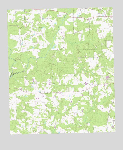
Hollonville, GA USGS Topographic Map
Click on map above to begin viewing in our Map Viewer.

This topographic map contains these locations and features:
Feature Name Type Latitude Longitude GNIS ID View Map
Ackiss CemeteryCemeteryN33.1432°W84.4869°346389View Map
Alexander Memorial AirportAirportN33.1842°W84.3792°351954View Map
Anderson CemeteryCemeteryN33.1971°W84.4310°354306View Map
B & L StripAirportN33.1560°W84.4316°326818View Map
Beeks (historical)Populated PlaceN33.1687°W84.4080°346393View Map
Bethany CemeteryCemeteryN33.2007°W84.3921°352976View Map
Bethany ChurchChurchN33.2007°W84.3924°354572View Map
Blanton CemeteryCemeteryN33.2265°W84.4274°311521View Map
Blantons MillPopulated PlaceN33.2207°W84.4344°326187View Map
Blantons Mill Division (historical)CensusN33.2396°W84.4038°1936116View Map
Coggin CemeteryCemeteryN33.1504°W84.4185°312803View Map
Crosspointe Christian AcademySchoolN33.1660°W84.4605°2545509View Map
Digbey DivisionCivilN33.2293°W84.4716°1936226View Map
Driver CemeteryCemeteryN33.1559°W84.4021°313628View Map
Fairfield CemeteryCemeteryN33.1568°W84.4621°346403View Map
Fairfield ChurchChurchN33.1571°W84.4613°355753View Map
Fairfield School (historical)SchoolN33.1571°W84.4616°346404View Map
Fairview ChurchChurchN33.2340°W84.4699°314049View Map
Flat CreekStreamN33.2196°W84.4446°314184View Map
Flat Rock CemeteryCemeteryN33.1510°W84.4624°346408View Map
Flat Rock Methodist Church (historical)ChurchN33.1512°W84.4627°346409View Map
Friendship CemeteryCemeteryN33.1260°W84.4771°346411View Map
Friendship ChurchChurchN33.1254°W84.4769°355939View Map
HollonvillePopulated PlaceN33.1657°W84.4605°315549View Map
Hollonville CemeteryCemeteryN33.1626°W84.4560°346416View Map
Hollonville ChurchChurchN33.1660°W84.4602°346417View Map
Johnson LakeReservoirN33.1818°W84.3849°340066View Map
Johnson Lake DamDamN33.1818°W84.3849°340065View Map
Johnston CemeteryCemeteryN33.1948°W84.4488°316194View Map
Line CreekStreamN33.1835°W84.4971°316906View Map
Mount Hebron ChurchChurchN33.2001°W84.4024°346431View Map
Mount Zion ChurchChurchN33.2482°W84.3885°319002View Map
Mount Zion ChurchChurchN33.2382°W84.3819°353035View Map
Pike County Volunteer Fire Department Hollonville StationBuildingN33.1656°W84.4604°2604615View Map
Powers Airport (historical)AirportN33.1765°W84.4796°351796View Map
ReidsboroPopulated PlaceN33.1376°W84.3835°332827View Map
Shade Tree AirportAirportN33.1626°W84.4458°351719View Map
Shoal Creek CemeteryCemeteryN33.1657°W84.4494°346465View Map
Shoal Creek ChurchChurchN33.1660°W84.4496°322939View Map
Shoal Creek School (historical)SchoolN33.1657°W84.4496°346466View Map
Spalding County Fire Department Station 5BuildingN33.2446°W84.4299°2604647View Map
Sullivans Bridge (historical)BridgeN33.1826°W84.4980°346919View Map
Syes LakeLakeN33.2312°W84.4580°323857View Map
Vintage FieldAirportN33.1338°W84.3773°351964View Map
Williamson DivisionCivilN33.1643°W84.4387°1936649View Map
Wilson CemeteryCemeteryN33.1759°W84.4683°325425View Map
Winship Lake DamDamN33.1268°W84.4433°340067View Map
ZetellaPopulated PlaceN33.2410°W84.3821°325664View Map

Note: Coordinates in the location and feature list above are referenced to NAD83 datum.


Copyright (C) 2008-2024 Ryan Niemi / Sunset Dynamics ... All Rights Reserved