TopoQuest Logo
Do you find TopoQuest useful?
Help keep TopoQuest running and adding new maps/features by donating!
Bitcoin:  19c7KJd3qBynnjoSw5npx9KScwjBe4ifkT
Litecoin:  LXs6TkuXGGXo1vDsWCkWVdjQX94eUKd6ui
Home View Maps Find Maps Find Places Resources & Links


Zebulon, Georgia Topographic Map

USGS Map Title: Zebulon, GA
USGS Map MRC: 33084A3
DRG (GeoTIFF) Download: o33084a3.tif


Neighboring USGS Topographic Map Quads:


  Hollonville, GA  
33084B4
 

  Griffin South, GA  
33084B3
 

  Orchard Hill, GA  
33084B2
 

  Concord, GA  
33084A4
 

  Zebulon, GA  
33084A3
 

  Barnesville, GA  
33084A2
 

  Sunset Village, GA  
32084H4
 

  Thomaston, GA  
32084H3
 

  Yatesville, GA  
32084H2


Map MRC Location:

N34°
W85°
N34°
W84°
H8 H7 H6 H5 H4 H3 H2 H1
G8 G7 G6 G5 G4 G3 G2 G1
F8 F7 F6 F5 F4 F3 F2 F1
E8 E7 E6 E5 E4 E3 E2 E1
D8 D7 D6 D5 D4 D3 D2 D1
C8 C7 C6 C5 C4 C3 C2 C1
B8 B7 B6 B5 B4 B3 B2 B1
A8 A7 A6 A5 A4 A3 A2 A1
N33°
W85°
N33°
W84°

Zebulon, GA USGS 1:24K Topographic Map Preview:
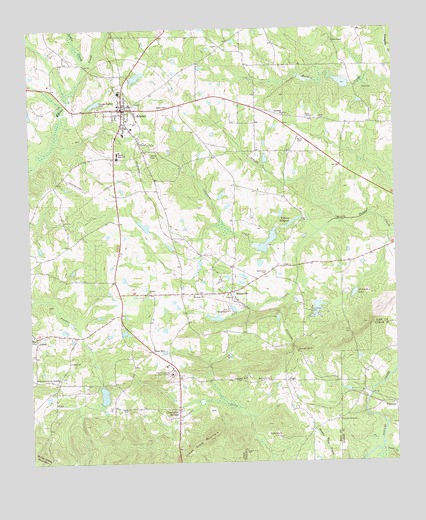
Zebulon, GA USGS Topographic Map
Click on map above to begin viewing in our Map Viewer.

This topographic map contains these locations and features:
Feature Name Type Latitude Longitude GNIS ID View Map
Bethlehem ChurchChurchN33.0243°W84.3019°311239View Map
Brown FieldAirportN33.0567°W84.3429°351966View Map
Bush CemeteryCemeteryN33.0993°W84.2780°312079View Map
Calvary Full Gospel ChurchChurchN33.0121°W84.2696°346397View Map
Century Nelson CemeteryCemeteryN33.0121°W84.2705°346398View Map
Century Nelson ChurchChurchN33.0121°W84.2699°355100View Map
Chapman CreekStreamN33.0668°W84.2758°312570View Map
City of MeansvilleCivilN33.0509°W84.3084°2405060View Map
City of ZebulonCivilN33.0944°W84.3424°2405075View Map
Clearwater SpringsPopulated PlaceN33.0154°W84.3246°331414View Map
Community ChurchChurchN33.0240°W84.2935°346399View Map
Cook CemeteryCemeteryN33.1077°W84.2603°312914View Map
Edwards LakeReservoirN33.1101°W84.3383°340544View Map
Edwards Lake DamDamN33.1101°W84.3383°340543View Map
Elder Institute (historical)SchoolN33.1001°W84.2871°346402View Map
Fincher CemeteryCemeteryN33.0479°W84.3369°346405View Map
Fincher ChurchChurchN33.0493°W84.3344°355793View Map
Fincher School (historical)SchoolN33.0490°W84.3349°346406View Map
First Church of the NazareneChurchN33.0240°W84.3658°314139View Map
Gola CreekStreamN33.0668°W84.2758°314668View Map
Hankins LakeReservoirN33.0218°W84.3499°337443View Map
Hankins Lake DamDamN33.0218°W84.3499°337442View Map
Harden LakeReservoirN33.1085°W84.2649°337458View Map
Hawkins LakeReservoirN33.0668°W84.3349°340707View Map
Hawkins Lake DamDamN33.0668°W84.3349°340706View Map
Hilltop Airport (historical)AirportN33.0843°W84.3433°346415View Map
Lamar County Fire and Rescue Station 5 PiedmontBuildingN33.0149°W84.2511°2605008View Map
Lewis CreekStreamN33.1151°W84.3549°316783View Map
Liberty CemeteryCemeteryN33.0293°W84.3618°346423View Map
Liberty ChurchChurchN33.0293°W84.3616°316810View Map
LifseyPopulated PlaceN33.0368°W84.3733°332212View Map
Lifsey Springs Volunteer Fire DepartmentBuildingN33.0364°W84.3728°2604902View Map
Little Potato CreekStreamN33.0037°W84.2552°317151View Map
McCards LakeReservoirN33.0486°W84.2640°317856View Map
McCards Lake DamDamN33.0487°W84.2641°340704View Map
MeansvillePopulated PlaceN33.0493°W84.3069°332364View Map
Meansville CemeteryCemeteryN33.0537°W84.2944°317988View Map
Meansville DivisionCivilN33.0319°W84.3294°1936400View Map
Meansville Volunteer Fire DepartmentBuildingN33.0481°W84.3069°2603814View Map
Middlebrooks LakeReservoirN33.0868°W84.2933°340333View Map
Middlebrooks Lake DamDamN33.0868°W84.2933°340332View Map
Mount Nebo ChurchChurchN33.0487°W84.3191°318712View Map
Mountain Gap ChurchChurchN33.0321°W84.2838°319072View Map
Mountain Gap Pentecostal Holiness CampgroundLocaleN33.0318°W84.2838°346433View Map
Mudbridge CemeteryCemeteryN33.0075°W84.2901°346435View Map
Mudbridge ChurchChurchN33.0074°W84.2905°319126View Map
Nazarene CemeteryCemeteryN33.0154°W84.3244°346436View Map
Nazarene ChurchChurchN33.0151°W84.3252°346437View Map
Nazareth CemeteryCemeteryN33.1006°W84.2875°346438View Map
Nazareth ChurchChurchN33.1004°W84.2877°319214View Map
Old Newman (historical)Populated PlaceN33.0487°W84.3235°346446View Map
Philadelphia ChurchChurchN33.0437°W84.3069°320434View Map
PiedmontPopulated PlaceN33.0171°W84.2508°332660View Map
Pike County CourthouseBuildingN33.1023°W84.3421°346449View Map
Pike County Elementary SchoolSchoolN33.0879°W84.3362°346450View Map
Pike County High SchoolSchoolN33.0874°W84.3393°346451View Map
Pike County JailBuildingN33.1034°W84.3420°2734213View Map
Pike County Middle SchoolSchoolN33.0802°W84.3389°346452View Map
Pike County Primary SchoolSchoolN33.0867°W84.3426°2545679View Map
Pike County Sheriff's DepartmentBuildingN33.1033°W84.3422°2733921View Map
Pine ChapelChurchN33.1212°W84.2702°320542View Map
Pine Chapel CemeteryCemeteryN33.1207°W84.2702°346453View Map
Pine Mountain Camp GroundLocaleN33.0154°W84.3235°346456View Map
Pine Mountain Childrens HomeBuildingN33.0260°W84.3269°320639View Map
Pine Mountain Springs Church (historical)ChurchN33.0362°W84.3735°346457View Map
Pine Valley CampLocaleN33.0437°W84.2794°320649View Map
Pine Valley Camp LakeReservoirN33.0451°W84.2766°337457View Map
Pine Valley Camp Lake DamDamN33.0451°W84.2766°337456View Map
Potato Creek Structure Number 33 DamDamN33.0418°W84.3099°337454View Map
Potato Creek Structure Number 33 LakeReservoirN33.0418°W84.3099°337455View Map
Potato Creek Structure Number 66 DamDamN33.0668°W84.2899°337450View Map
Potato Creek Structure Number 66 LakeReservoirN33.0668°W84.2899°337451View Map
Rehobeth Church (historical)ChurchN33.0201°W84.3666°346461View Map
Reid CemeteryCemeteryN33.0993°W84.2752°321512View Map
Ridgeview Farm AirportAirportN33.0801°W84.3584°351965View Map
Rose HillPopulated PlaceN33.0323°W84.3333°332916View Map
VegaPopulated PlaceN33.0235°W84.2885°333323View Map
Weaver (historical)Populated PlaceN33.1021°W84.2971°346471View Map
West Central Probation Detention CenterBuildingN33.1158°W84.3605°2735772View Map
William MillpondLakeN33.0693°W84.2847°325321View Map
Wood CemeteryCemeteryN33.0929°W84.2827°325519View Map
ZebulonPopulated PlaceN33.1023°W84.3427°333493View Map
Zebulon CemeteryCemeteryN33.0951°W84.3410°346479View Map
Zebulon CemeteryCemeteryN33.1059°W84.3450°346480View Map
Zebulon DivisionCivilN33.1231°W84.3197°1936664View Map
Zebulon Police DepartmentBuildingN33.0953°W84.3437°2733664View Map
Zebulon United Methodist ChurchChurchN33.0960°W84.3402°346481View Map
Zebulon Volunteer Fire DepartmentBuildingN33.0952°W84.3428°2603637View Map

Note: Coordinates in the location and feature list above are referenced to NAD83 datum.


Copyright (C) 2008-2025 Ryan Niemi / Sunset Dynamics ... All Rights Reserved