TopoQuest Logo
Do you find TopoQuest useful?
Help keep TopoQuest running and adding new maps/features by donating!
Bitcoin:  19c7KJd3qBynnjoSw5npx9KScwjBe4ifkT
Litecoin:  LXs6TkuXGGXo1vDsWCkWVdjQX94eUKd6ui
Home View Maps Find Maps Find Places Resources & Links


Holmen, Wisconsin Topographic Map

USGS Map Title: Holmen, WI
USGS Map MRC: 43091H3
DRG (GeoTIFF) Download: o43091h3.tif


Neighboring USGS Topographic Map Quads:


  Trempealeau, WI  
44091A4
 

  Galesville, WI  
44091A3
 

  Stevenstown, WI  
44091A2
 

  Pickwick, MN  
43091H4
 

  Holmen, WI  
43091H3
 

  Onalaska, WI  
43091H2
 

  Mound Prairie, MN  
43091G4
 

  La Crescent, MN  
43091G3
 

  La Crosse, WI  
43091G2


Map MRC Location:

N44°
W92°
N44°
W91°
H8 H7 H6 H5 H4 H3 H2 H1
G8 G7 G6 G5 G4 G3 G2 G1
F8 F7 F6 F5 F4 F3 F2 F1
E8 E7 E6 E5 E4 E3 E2 E1
D8 D7 D6 D5 D4 D3 D2 D1
C8 C7 C6 C5 C4 C3 C2 C1
B8 B7 B6 B5 B4 B3 B2 B1
A8 A7 A6 A5 A4 A3 A2 A1
N43°
W92°
N43°
W91°

Holmen, WI USGS 1:24K Topographic Map Preview:
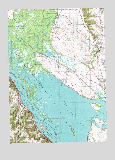
Holmen, WI USGS Topographic Map
Click on map above to begin viewing in our Map Viewer.

This topographic map contains these locations and features:
Feature Name Type Latitude Longitude GNIS ID View Map
Academy on the PrairieSchoolN43.9438°W91.3008°2715693View Map
Amsterdam PrairieFlatN43.9866°W91.2921°1560844View Map
Arrowhead IslandIslandN43.8995°W91.2865°2729552View Map
Asbury CemeteryCemeteryN43.9409°W91.3010°1562186View Map
Bell IslandIslandN43.8939°W91.2560°1561527View Map
Brice PrairiePopulated PlaceN43.9386°W91.2999°1867653View Map
Brice PrairieFlatN43.9361°W91.3026°1562185View Map
Brice Prairie Census Designated PlaceCensusN43.9375°W91.3074°2393345View Map
Brice Prairie EMS and RescueBuildingN43.9343°W91.2994°2736076View Map
Broken Gun IslandIslandN43.9132°W91.2894°2729551View Map
City of DakotaCivilN43.9123°W91.3582°2393705View Map
Cormorant IslandIslandN43.9032°W91.2982°2729550View Map
DakotaPopulated PlaceN43.9136°W91.3599°642598View Map
DakotaLocaleN43.9139°W91.3585°2052162View Map
Dakota City HallBuildingN43.9136°W91.3599°2052168View Map
Dakota CreekStreamN43.9169°W91.3599°642599View Map
Dakota Elementary SchoolSchoolN43.9086°W91.3601°2052167View Map
Dakota Fire and Rescue DepartmentBuildingN43.9121°W91.3625°2666166View Map
Dakota Post OfficePost OfficeN43.9117°W91.3619°2052163View Map
Dodge ChuteStreamN43.9414°W91.3524°1564022View Map
DresbachPopulated PlaceN43.8955°W91.3432°642922View Map
Dresbach (historical)LocaleN43.8955°W91.3432°2051980View Map
Dresbach CemeteryCemeteryN43.8869°W91.3393°642923View Map
Dresbach IslandIslandN43.8866°W91.3282°642924View Map
Dresbach Post Office (historical)Post OfficeN43.8955°W91.3432°2051979View Map
Dresbach SloughChannelN43.8836°W91.3301°642925View Map
Evergreen Elementary SchoolSchoolN43.9700°W91.2558°2715838View Map
Gibbs ChuteGutN43.9347°W91.3483°1565501View Map
Goose ChuteChannelN43.9163°W91.3460°2729545View Map
Grace Lutheran ChurchChurchN43.9136°W91.3599°2052166View Map
Green Mound CemeteryCemeteryN43.9959°W91.2830°1565827View Map
Halfway CreekStreamN43.9147°W91.2588°1565979View Map
Hammond ChuteStreamN43.9572°W91.3726°1566019View Map
HolmenPopulated PlaceN43.9633°W91.2563°1566559View Map
Holmen Area Fire DepartmentBuildingN43.9589°W91.2571°2698182View Map
Holmen High SchoolSchoolN43.9722°W91.2773°1843296View Map
Holmen Middle SchoolSchoolN43.9675°W91.2616°1843297View Map
Holmen Municipal Wastewater Treatment PlantLocaleN43.9419°W91.2656°2709731View Map
Holmen Police DepartmentBuildingN43.9598°W91.2584°2759453View Map
Holmen Square Shopping CenterLocaleN43.9680°W91.2654°1843298View Map
Holmen Village HallBuildingN43.9625°W91.2568°1843299View Map
Holy Cross ChurchChurchN43.9116°W91.3590°2052164View Map
Interchange 270CrossingN43.9144°W91.3635°2052193View Map
Interchange 272CrossingN43.8916°W91.3432°2052192View Map
Island Number Ninety-oneIslandN43.9272°W91.3582°1567004View Map
La Crosse Municipal AirportAirportN43.8753°W91.2635°1582040View Map
Lake OnalaskaReservoirN43.9124°W91.3111°1570819View Map
Lakeview (historical)Populated PlaceN43.8972°W91.2629°1843321View Map
Long Coulee CemeteryCemeteryN43.9751°W91.2533°1568522View Map
Long Coulee ParkParkN43.9955°W91.2560°1568523View Map
Louis Nelson County ParkParkN43.8944°W91.2707°1568697View Map
Lower Brice Prairie School (historical)SchoolN43.9119°W91.2699°1843327View Map
MidwayPopulated PlaceN43.9291°W91.2579°1569446View Map
Midway Railroad Prairie State Natural AreaParkN43.9227°W91.2521°2059238View Map
Midway School (historical)SchoolN43.9400°W91.2607°1843337View Map
Moe CouleeValleyN43.9966°W91.2556°1569628View Map
New AmsterdamPopulated PlaceN43.9827°W91.3165°1570198View Map
New ChannelStreamN43.9836°W91.3215°1570206View Map
No Name ChuteGutN43.9364°W91.3610°2729544View Map
Oak Grove Elementary SchoolSchoolN43.9439°W91.3010°1570629View Map
Old ChannelGutN43.8925°W91.3215°2761273View Map
Proudfoot SloughChannelN43.9037°W91.3359°2729549View Map
Red Oak RidgeIslandN43.8872°W91.2949°1572146View Map
Riverside United Methodist ChurchChurchN43.9133°W91.3604°2052165View Map
Rosebud IslandIslandN43.9072°W91.2618°1572603View Map
Shingle CreekStreamN43.9602°W91.3738°1574051View Map
Sommers ChuteChannelN43.9134°W91.3372°2729547View Map
South Wind Orchard DamDamN43.9083°W91.3735°1776780View Map
South Wind Orchard ReservoirReservoirN43.9090°W91.3743°1776781View Map
Sunset Point (historical)Populated PlaceN43.8958°W91.3251°1843426View Map
The Bullet ChuteStreamN43.9389°W91.3640°1575326View Map
Town of CampbellCivilN43.8766°W91.2903°1582912View Map
Town of OnalaskaCivilN43.9245°W91.2712°1583862View Map
Upper Mississippi River National Wildlife and Fish RefugeParkN43.8935°W91.3015°462497View Map
Village of HolmenCivilN43.9603°W91.2716°1583404View Map
Winters LandingLocaleN43.9416°W91.3668°1577343View Map
Winters LandingLocaleN43.9417°W91.3667°2652395View Map
WKBH-AM (Holmen)TowerN43.9255°W91.2674°1582554View Map

Note: Coordinates in the location and feature list above are referenced to NAD83 datum.


Copyright (C) 2008-2024 Ryan Niemi / Sunset Dynamics ... All Rights Reserved