TopoQuest Logo
Do you find TopoQuest useful?
Help keep TopoQuest running and adding new maps/features by donating!
Bitcoin:  19c7KJd3qBynnjoSw5npx9KScwjBe4ifkT
Litecoin:  LXs6TkuXGGXo1vDsWCkWVdjQX94eUKd6ui
Home View Maps Find Maps Find Places Resources & Links


Galesville, Wisconsin Topographic Map

USGS Map Title: Galesville, WI
USGS Map MRC: 44091A3
DRG (GeoTIFF) Download: o44091a3.tif


Neighboring USGS Topographic Map Quads:


  Tamarack, WI  
44091B4
 

  Ettrick, WI  
44091B3
 

  Hegg, WI  
44091B2
 

  Trempealeau, WI  
44091A4
 

  Galesville, WI  
44091A3
 

  Stevenstown, WI  
44091A2
 

  Pickwick, MN  
43091H4
 

  Holmen, WI  
43091H3
 

  Onalaska, WI  
43091H2


Map MRC Location:

N45°
W92°
N45°
W91°
H8 H7 H6 H5 H4 H3 H2 H1
G8 G7 G6 G5 G4 G3 G2 G1
F8 F7 F6 F5 F4 F3 F2 F1
E8 E7 E6 E5 E4 E3 E2 E1
D8 D7 D6 D5 D4 D3 D2 D1
C8 C7 C6 C5 C4 C3 C2 C1
B8 B7 B6 B5 B4 B3 B2 B1
A8 A7 A6 A5 A4 A3 A2 A1
N44°
W92°
N44°
W91°

Galesville, WI USGS 1:24K Topographic Map Preview:
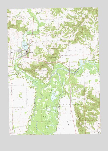
Galesville, WI USGS Topographic Map
Click on map above to begin viewing in our Map Viewer.

This topographic map contains these locations and features:
Feature Name Type Latitude Longitude GNIS ID View Map
0.65 ReservoirReservoirN44.0960°W91.3668°1793490View Map
Amsterdam Prairie School (historical)SchoolN44.0208°W91.2896°1843209View Map
Beaver CreekStreamN44.0377°W91.3368°1561446View Map
Berean Christian SchoolSchoolN44.1058°W91.3403°2715846View Map
Berean ChurchChurchN44.0744°W91.3554°1561580View Map
Bigelow School (historical)SchoolN44.0491°W91.3718°1851065View Map
Brick School (historical)SchoolN44.0347°W91.3513°1851070View Map
Butman CornersPopulated PlaceN44.0780°W91.2918°1562471View Map
Caledonia School (historical)SchoolN44.0491°W91.3718°1851074View Map
Castle Mound Country ClubLocaleN44.0336°W91.2896°1581189View Map
City of GalesvilleCivilN44.0834°W91.3583°1583254View Map
Council BayPopulated PlaceN44.0575°W91.2838°1563440View Map
Council Bay School (historical)SchoolN44.0494°W91.2718°1843242View Map
Crystal ValleyValleyN44.1093°W91.3247°1563604View Map
Crystal Valley School (historical)SchoolN44.1144°W91.3113°1851086View Map
Dale ValleyValleyN44.0673°W91.3664°1563673View Map
Decorah MoundSummitN44.0794°W91.3107°1563801View Map
Decorah PeakSummitN44.0761°W91.3163°1563802View Map
Decorah PrairieFlatN44.0816°W91.2854°1563803View Map
Decorah Prairie CemeteryCemeteryN44.0813°W91.2760°1563804View Map
Decorah Prairie School (historical)SchoolN44.0783°W91.2863°1851088View Map
Dutch CreekStreamN44.1094°W91.3310°1564208View Map
Flood CouleeValleyN44.1203°W91.3347°1565074View Map
French and Sacia G-6693 DamDamN44.0950°W91.3668°1793489View Map
Gale - Ettrick - Trempealeau High SchoolSchoolN44.0926°W91.3432°1851103View Map
GalesvillePopulated PlaceN44.0816°W91.3490°1565380View Map
Galesville Elementary SchoolSchoolN44.0861°W91.3630°2715777View Map
Galesville Fire DepartmentBuildingN44.0791°W91.3578°2697621View Map
Galesville Mill DamDamN44.0833°W91.3468°1791822View Map
Galesville Police DepartmentBuildingN44.0816°W91.3493°2759507View Map
Golf Course PondLakeN44.0986°W91.3529°2770841View Map
Goose LakeLakeN44.0071°W91.3233°1565653View Map
Grant CreekStreamN44.0686°W91.2501°1565736View Map
Grant School (historical)SchoolN44.0813°W91.2524°1851108View Map
Holland Air ParkAirportN44.0350°W91.2997°1582015View Map
King BluffCliffN44.0161°W91.2776°1567493View Map
Little Tamarack CreekStreamN44.0611°W91.3563°1568442View Map
Marinuka LakeReservoirN44.0883°W91.3514°1569040View Map
Parkway Farm StripAirportN44.0055°W91.3074°1582014View Map
Peacock HillRidgeN44.1227°W91.2613°1571117View Map
Pine Cliff CemeteryCemeteryN44.0838°W91.3457°1571423View Map
Pow Wow CampgroundLocaleN44.0630°W91.2857°1571851View Map
Queen BluffCliffN44.0675°W91.3324°1572000View Map
Silver CreekStreamN44.1000°W91.3382°1574102View Map
Silver Creek School (historical)SchoolN44.0925°W91.3218°1851172View Map
Town of CaledoniaCivilN44.0255°W91.3696°1582905View Map
Town of GaleCivilN44.1078°W91.2940°1583253View Map
Town of HollandCivilN44.0227°W91.2645°1583401View Map
Van Loon LakeLakeN44.0377°W91.3136°1576036View Map
Van Loon Wildlife AreaParkN44.0236°W91.3235°1576037View Map
WKBT-TV (La Crosse)TowerN44.0911°W91.3376°1582645View Map

Note: Coordinates in the location and feature list above are referenced to NAD83 datum.


Copyright (C) 2008-2024 Ryan Niemi / Sunset Dynamics ... All Rights Reserved