TopoQuest Logo
Do you find TopoQuest useful?
Help keep TopoQuest running and adding new maps/features by donating!
Bitcoin:  19c7KJd3qBynnjoSw5npx9KScwjBe4ifkT
Litecoin:  LXs6TkuXGGXo1vDsWCkWVdjQX94eUKd6ui
Home View Maps Find Maps Find Places Resources & Links


Holstein, Nebraska Topographic Map

USGS Map Title: Holstein, NE
USGS Map MRC: 40098D6
DRG (GeoTIFF) Download: o40098d6.tif


Neighboring USGS Topographic Map Quads:


  Heartwell, NE  
40098E7
 

  Kenesaw, NE  
40098E6
 

  Juniata, NE  
40098E5
 

  Norman, NE  
40098D7
 

  Holstein, NE  
40098D6
 

  Roseland, NE  
40098D5
 

  Upland SE, NE  
40098C7
 

  Campbell, NE  
40098C6
 

  Bladen, NE  
40098C5


Map MRC Location:

N41°
W99°
N41°
W98°
H8 H7 H6 H5 H4 H3 H2 H1
G8 G7 G6 G5 G4 G3 G2 G1
F8 F7 F6 F5 F4 F3 F2 F1
E8 E7 E6 E5 E4 E3 E2 E1
D8 D7 D6 D5 D4 D3 D2 D1
C8 C7 C6 C5 C4 C3 C2 C1
B8 B7 B6 B5 B4 B3 B2 B1
A8 A7 A6 A5 A4 A3 A2 A1
N40°
W99°
N40°
W98°

Holstein, NE USGS 1:24K Topographic Map Preview:
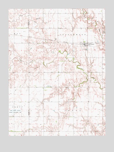
Holstein, NE USGS Topographic Map
Click on map above to begin viewing in our Map Viewer.

This topographic map contains these locations and features:
Feature Name Type Latitude Longitude GNIS ID View Map
Grace United Methodist ChurchChurchN40.4653°W98.6520°1884556View Map
Heartland Co-op ElevatorLocaleN40.4653°W98.6520°1884554View Map
HolsteinPopulated PlaceN40.4653°W98.6520°830066View Map
Holstein (historical)LocaleN40.4653°W98.6520°1884558View Map
Holstein CemeteryCemeteryN40.4661°W98.6381°830067View Map
Holstein Post OfficePost OfficeN40.4652°W98.6523°1884557View Map
Holstein Public SchoolSchoolN40.4661°W98.6476°1884559View Map
Holstein Rural Fire DepartmentBuildingN40.4647°W98.6485°2553471View Map
Jensen Lagoon National Wildlife Mgt AreaParkN40.3992°W98.7431°830364View Map
Logan CemeteryCemeteryN40.3928°W98.6662°830821View Map
Lukow DamDamN40.4952°W98.6395°1769664View Map
Lukow ReservoirReservoirN40.4958°W98.6399°1769665View Map
Morseville CemeteryCemeteryN40.3942°W98.7001°831433View Map
Saint Paul Lutheran ChurchChurchN40.4653°W98.6520°1884555View Map
South Branch Sand CreekStreamN40.4545°W98.6878°833557View Map
Sugarloaf HillPillarN40.4895°W98.7162°833883View Map
Tower HillPillarN40.4425°W98.7151°834136View Map
Township of CottonwoodCivilN40.4808°W98.6671°837941View Map
Township of LoganCivilN40.3938°W98.6671°838099View Map
Village of HolsteinCivilN40.4648°W98.6508°2398531View Map
West Ward CemeteryCemeteryN40.4806°W98.6862°834634View Map

Note: Coordinates in the location and feature list above are referenced to NAD83 datum.


Copyright (C) 2008-2024 Ryan Niemi / Sunset Dynamics ... All Rights Reserved