TopoQuest Logo
Do you find TopoQuest useful?
Help keep TopoQuest running and adding new maps/features by donating!
Bitcoin:  19c7KJd3qBynnjoSw5npx9KScwjBe4ifkT
Litecoin:  LXs6TkuXGGXo1vDsWCkWVdjQX94eUKd6ui
Home View Maps Find Maps Find Places Resources & Links


Juniata, Nebraska Topographic Map

USGS Map Title: Juniata, NE
USGS Map MRC: 40098E5
DRG (GeoTIFF) Download: o40098e5.tif


Neighboring USGS Topographic Map Quads:


  Denman, NE  
40098F6
 

  Prosser, NE  
40098F5
 

  Hastings NW, NE  
40098F4
 

  Kenesaw, NE  
40098E6
 

  Juniata, NE  
40098E5
 

  Hastings West, NE  
40098E4
 

  Holstein, NE  
40098D6
 

  Roseland, NE  
40098D5
 

  Ayr, NE  
40098D4


Map MRC Location:

N41°
W99°
N41°
W98°
H8 H7 H6 H5 H4 H3 H2 H1
G8 G7 G6 G5 G4 G3 G2 G1
F8 F7 F6 F5 F4 F3 F2 F1
E8 E7 E6 E5 E4 E3 E2 E1
D8 D7 D6 D5 D4 D3 D2 D1
C8 C7 C6 C5 C4 C3 C2 C1
B8 B7 B6 B5 B4 B3 B2 B1
A8 A7 A6 A5 A4 A3 A2 A1
N40°
W99°
N40°
W98°

Juniata, NE USGS 1:24K Topographic Map Preview:
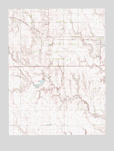
Juniata, NE USGS Topographic Map
Click on map above to begin viewing in our Map Viewer.

This topographic map contains these locations and features:
Feature Name Type Latitude Longitude GNIS ID View Map
Adams CountyCivilN40.5245°W98.5012°835823View Map
AssumptionPopulated PlaceN40.5100°W98.5723°827098View Map
Assumption Catholic ChurchChurchN40.5900°W98.5062°1884534View Map
Christ Lutheran ChurchChurchN40.5900°W98.5062°1884532View Map
Christ Lutheran SchoolSchoolN40.5900°W98.5062°1884531View Map
Detention Dam CDamN40.5719°W98.5996°1767097View Map
Detention Dam DDamN40.5551°W98.5806°1767095View Map
Detention Dam EDamN40.5450°W98.5729°1767089View Map
Flood Retarding Dam KDamN40.6201°W98.6024°1767099View Map
Heartland Co-op ElevatorLocaleN40.5900°W98.5062°1884533View Map
JuniataLocaleN40.5931°W98.5067°1884535View Map
JuniataPopulated PlaceN40.5900°W98.5062°830427View Map
Juniata CemeteryCemeteryN40.5889°W98.5290°830428View Map
Juniata Elementary SchoolSchoolN40.5883°W98.5015°1884538View Map
Juniata Post OfficePost OfficeN40.5920°W98.5060°1884536View Map
Juniata Rural Fire DistrictBuildingN40.5958°W98.5060°1884530View Map
Oregon Trail Historical MarkerParkN40.5672°W98.5587°1884572View Map
Roseland Assumption SchoolSchoolN40.5100°W98.5703°1884553View Map
Roseland LakeReservoirN40.5517°W98.5832°1884439View Map
Roseland Lake CampgroundLocaleN40.5542°W98.5859°1884440View Map
Thirty-Two Mile Creek ReservoirReservoirN40.5445°W98.5746°1767090View Map
Thirty-Two Mile Creek ReservoirReservoirN40.5720°W98.6013°1767098View Map
Thirty-Two Mile Creek ReservoirReservoirN40.6203°W98.6061°1767100View Map
Thirty-Two Mile Reservoir DReservoirN40.5550°W98.5803°1767096View Map
Township of JuniataCivilN40.5679°W98.5535°838075View Map
United Methodist ChurchChurchN40.5889°W98.5042°1884537View Map
Vieselmeyer DamDamN40.5383°W98.5853°1768916View Map
Vieselmeyer ReservoirReservoirN40.5374°W98.5851°1768917View Map
Village of JuniataCivilN40.5904°W98.5069°2398318View Map

Note: Coordinates in the location and feature list above are referenced to NAD83 datum.


Copyright (C) 2008-2025 Ryan Niemi / Sunset Dynamics ... All Rights Reserved