TopoQuest Logo
Do you find TopoQuest useful?
Help keep TopoQuest running and adding new maps/features by donating!
Bitcoin:  19c7KJd3qBynnjoSw5npx9KScwjBe4ifkT
Litecoin:  LXs6TkuXGGXo1vDsWCkWVdjQX94eUKd6ui
Home View Maps Find Maps Find Places Resources & Links


Holt, California Topographic Map

USGS Map Title: Holt, CA
USGS Map MRC: 37121H4
DRG (GeoTIFF) Download: o37121h4.tif


Neighboring USGS Topographic Map Quads:


  Bouldin Island, CA  
38121A5
 

  Terminous, CA  
38121A4
 

  Lodi South, CA  
38121A3
 

  Woodward Island, CA  
37121H5
 

  Holt, CA  
37121H4
 

  Stockton West, CA  
37121H3
 

  Clifton Court Forebay, CA  
37121G5
 

  Union Island, CA  
37121G4
 

  Lathrop, CA  
37121G3


Map MRC Location:

N38°
W122°
N38°
W121°
H8 H7 H6 H5 H4 H3 H2 H1
G8 G7 G6 G5 G4 G3 G2 G1
F8 F7 F6 F5 F4 F3 F2 F1
E8 E7 E6 E5 E4 E3 E2 E1
D8 D7 D6 D5 D4 D3 D2 D1
C8 C7 C6 C5 C4 C3 C2 C1
B8 B7 B6 B5 B4 B3 B2 B1
A8 A7 A6 A5 A4 A3 A2 A1
N37°
W122°
N37°
W121°

Holt, CA USGS 1:24K Topographic Map Preview:
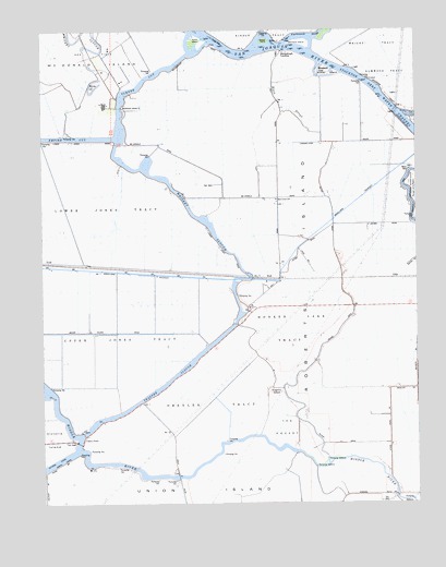
Holt, CA USGS Topographic Map
Click on map above to begin viewing in our Map Viewer.

This topographic map contains these locations and features:
Feature Name Type Latitude Longitude GNIS ID View Map
Acker IslandIslandN37.9974°W121.4488°253647View Map
Black SloughGutN37.9808°W121.4208°219407View Map
Blackslough LandingPopulated PlaceN37.9944°W121.4188°1658074View Map
Buckley CoveBayN37.9769°W121.3752°220068View Map
Buckley Cove ParkParkN37.9749°W121.3755°1827582View Map
Burns CutoffStreamN37.9624°W121.3758°220213View Map
Christensen LandingLocaleN37.9735°W121.4727°1665991View Map
Drexler TractCivilN37.9019°W121.4427°222593View Map
Eldorado LandingLocaleN37.9860°W121.3941°1665996View Map
Elmwood TractCivilN37.9896°W121.3805°223172View Map
Fish Camp LandingLocaleN37.8813°W121.4555°1665997View Map
GillisPopulated PlaceN37.9341°W121.3830°1658611View Map
Heritage FieldAirportN37.9926°W121.4923°2770478View Map
HoltPopulated PlaceN37.9344°W121.4272°252690View Map
Holt Elementary SchoolSchoolN37.9551°W121.4227°225474View Map
Holt Union School (historical)SchoolN37.9802°W121.4788°1666000View Map
Honker Lake TractCivilN37.9210°W121.4186°225522View Map
Kingston SchoolSchoolN37.9046°W121.4255°226614View Map
Lacto (historical)Populated PlaceN37.9380°W121.4794°1666001View Map
Lower Jones TractCivilN37.9544°W121.4938°227773View Map
McDonald Island FerryLocaleN37.9796°W121.4750°228347View Map
Mokelumne AqueductCanalN37.9355°W121.4683°246067View Map
Quito (historical)Populated PlaceN37.9366°W121.4761°1666009View Map
Roberts IslandIslandN37.9049°W121.3852°234574View Map
Stockton DivisionCivilN37.9407°W121.3797°1935329View Map
The PocketFlatN37.8949°W121.4199°236214View Map
Trapper SloughGutN37.9074°W121.4588°236518View Map
Turner CutCanalN37.9858°W121.4683°236654View Map
Union PointLocaleN37.8927°W121.4872°236836View Map
Upper Jones TractCivilN37.9199°W121.4763°236893View Map
Vulcan IslandIslandN37.9891°W121.4061°237134View Map
Windmill CoveBayN37.9896°W121.4086°252535View Map
Wright TractCivilN37.9988°W121.3897°238201View Map

Note: Coordinates in the location and feature list above are referenced to NAD83 datum.


Copyright (C) 2008-2025 Ryan Niemi / Sunset Dynamics ... All Rights Reserved