TopoQuest Logo
Do you find TopoQuest useful?
Help keep TopoQuest running and adding new maps/features by donating!
Bitcoin:  19c7KJd3qBynnjoSw5npx9KScwjBe4ifkT
Litecoin:  LXs6TkuXGGXo1vDsWCkWVdjQX94eUKd6ui
Home View Maps Find Maps Find Places Resources & Links


Lathrop, California Topographic Map

USGS Map Title: Lathrop, CA
USGS Map MRC: 37121G3
DRG (GeoTIFF) Download: o37121g3.tif


Neighboring USGS Topographic Map Quads:


  Holt, CA  
37121H4
 

  Stockton West, CA  
37121H3
 

  Stockton East, CA  
37121H2
 

  Union Island, CA  
37121G4
 

  Lathrop, CA  
37121G3
 

  Manteca, CA  
37121G2
 

  Tracy, CA  
37121F4
 

  Vernalis, CA  
37121F3
 

  Ripon, CA  
37121F2


Map MRC Location:

N38°
W122°
N38°
W121°
H8 H7 H6 H5 H4 H3 H2 H1
G8 G7 G6 G5 G4 G3 G2 G1
F8 F7 F6 F5 F4 F3 F2 F1
E8 E7 E6 E5 E4 E3 E2 E1
D8 D7 D6 D5 D4 D3 D2 D1
C8 C7 C6 C5 C4 C3 C2 C1
B8 B7 B6 B5 B4 B3 B2 B1
A8 A7 A6 A5 A4 A3 A2 A1
N37°
W122°
N37°
W121°

Lathrop, CA USGS 1:24K Topographic Map Preview:
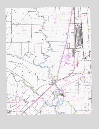
Lathrop, CA USGS Topographic Map
Click on map above to begin viewing in our Map Viewer.

This topographic map contains these locations and features:
Feature Name Type Latitude Longitude GNIS ID View Map
Alegre PitMineN37.7769°W121.3117°2649944View Map
BantaPopulated PlaceN37.7544°W121.3708°218652View Map
Banta Elementary SchoolSchoolN37.7549°W121.3747°1827382View Map
Banta Post OfficePost OfficeN37.7533°W121.3724°1827383View Map
Big Valley Factory Stores Shopping CenterLocaleN37.8096°W121.2872°1827384View Map
Brandt BridgeBridgeN37.8644°W121.3227°252010View Map
Brandts Ferry (historical)CrossingN37.8646°W121.3230°1827385View Map
City of LathropCivilN37.8162°W121.3126°2411633View Map
Defense Logistics Agency SharpBuildingN37.8492°W121.2694°2624195View Map
Dos Reis County ParkParkN37.8280°W121.3094°1827393View Map
Garden SchoolSchoolN37.8346°W121.3430°224053View Map
Green Belt ParkParkN37.8277°W121.2774°1827401View Map
Highlight Church of God and ChristChurchN37.8266°W121.2855°1827403View Map
Horizon ParkParkN37.8146°W121.2816°1827404View Map
ITT Technical InstituteSchoolN37.8096°W121.2946°2370536View Map
Kisst DairyLocaleN37.7803°W121.3464°2704862View Map
KSGO-FM (Tracy)TowerN37.7810°W121.3613°1663117View Map
LathropPopulated PlaceN37.8227°W121.2766°1658948View Map
Lathrop - Manteca Fire Protection District Station 31 Lathrop J StreetBuildingN37.8224°W121.2808°2623823View Map
Lathrop - Manteca Fire Protection District Station 34 Lathrop MossdaleBuildingN37.8114°W121.3033°2624196View Map
Lathrop City HallBuildingN37.8113°W121.2772°1827406View Map
Lathrop Elementary SchoolSchoolN37.8180°W121.2791°1827407View Map
Lathrop Lighthouse of the Cross ChurchChurchN37.8230°W121.2783°1827408View Map
Lathrop Police DepartmentBuildingN37.8206°W121.2759°2755863View Map
Lathrop Post OfficePost OfficeN37.8212°W121.2759°1827409View Map
Libby-Mingo ParkParkN37.8127°W121.2852°1827410View Map
Manteca WaterslideParkN37.7758°W121.2894°1827414View Map
MossdalePopulated PlaceN37.7846°W121.3086°1659185View Map
Mossdale County ParkParkN37.7874°W121.3066°1827415View Map
Mossdale MarinaLocaleN37.7860°W121.3083°1827416View Map
Mossdale School (historical)SchoolN37.7896°W121.3019°1662187View Map
Oakwood LakeReservoirN37.7773°W121.2921°1827420View Map
Oakwood Lake ResortLocaleN37.7791°W121.2886°1827421View Map
Paradise CutGutN37.7916°W121.3636°234429View Map
Paradise DamDamN37.7599°W121.3094°234430View Map
Rustic SchoolSchoolN37.7680°W121.2519°232054View Map
San Joaquin Depot SharpeMilitaryN37.8410°W121.2686°2512000View Map
Sharpe Army DepotMilitaryN37.8396°W121.2683°1654431View Map
Shepherds Ferry (historical)CrossingN37.7874°W121.3083°1827430View Map
Stewart TractCivilN37.8035°W121.3480°235469View Map
Tracy Fire Department Station 92BuildingN37.7544°W121.3726°2624672View Map
Valverde ParkParkN37.8202°W121.2797°1827435View Map
Walthall SloughStreamN37.7763°W121.2988°237219View Map
Weatherbee LakeLakeN37.7719°W121.2908°237371View Map
West MantecaPopulated PlaceN37.7971°W121.2519°1660147View Map
Woodfield ParkParkN37.8269°W121.2811°1827436View Map
Yosemite Elementary SchoolSchoolN37.7955°W121.2758°1827437View Map

Note: Coordinates in the location and feature list above are referenced to NAD83 datum.


Copyright (C) 2008-2025 Ryan Niemi / Sunset Dynamics ... All Rights Reserved