TopoQuest Logo
Do you find TopoQuest useful?
Help keep TopoQuest running and adding new maps/features by donating!
Bitcoin:  19c7KJd3qBynnjoSw5npx9KScwjBe4ifkT
Litecoin:  LXs6TkuXGGXo1vDsWCkWVdjQX94eUKd6ui
Home View Maps Find Maps Find Places Resources & Links


Holtville NE, California Topographic Map

USGS Map Title: Holtville NE, CA
USGS Map MRC: 32115H3
DRG (GeoTIFF) Download: o32115h3.tif


Neighboring USGS Topographic Map Quads:


  Wiest, CA  
33115A4
 

  Amos, CA  
33115A3
 

  Acolita, CA  
33115A2
 

  Alamorio, CA  
32115H4
 

  Holtville NE, CA  
32115H3
 

  Glamis NW, CA  
32115H2
 

  Holtville West, CA  
32115G4
 

  Holtville East, CA  
32115G3
 

  Glamis SW, CA  
32115G2


Map MRC Location:

N33°
W116°
N33°
W115°
H8 H7 H6 H5 H4 H3 H2 H1
G8 G7 G6 G5 G4 G3 G2 G1
F8 F7 F6 F5 F4 F3 F2 F1
E8 E7 E6 E5 E4 E3 E2 E1
D8 D7 D6 D5 D4 D3 D2 D1
C8 C7 C6 C5 C4 C3 C2 C1
B8 B7 B6 B5 B4 B3 B2 B1
A8 A7 A6 A5 A4 A3 A2 A1
N32°
W116°
N32°
W115°

Holtville NE, CA USGS 1:24K Topographic Map Preview:
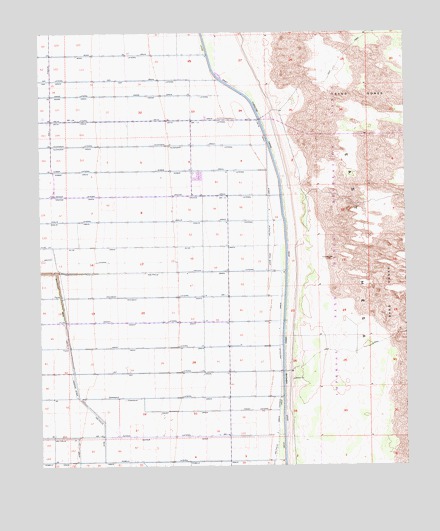
Holtville NE, CA USGS Topographic Map
Click on map above to begin viewing in our Map Viewer.

This topographic map contains these locations and features:
Feature Name Type Latitude Longitude GNIS ID View Map
Highline School (historical)SchoolN32.9098°W115.3133°1693406View Map
Holtville Eight DrainCanalN32.8820°W115.3633°243567View Map
Holtville Main DrainCanalN32.8789°W115.3544°243575View Map
Holtville Seven DrainCanalN32.9164°W115.2944°243566View Map
Holtville Six DrainCanalN32.9306°W115.3211°243565View Map
Holtville Three DrainCanalN32.8823°W115.2953°243564View Map
Oak DrainCanalN32.9862°W115.3711°246718View Map
Oak LateralCanalN32.9867°W115.3719°246742View Map
Oasis DrainCanalN32.9092°W115.3328°246778View Map
Oasis LateralCanalN32.9095°W115.3391°246779View Map
Oat DrainCanalN32.9017°W115.3322°246785View Map
Oat LateralCanalN32.9025°W115.3391°246791View Map
Occident DrainCanalN32.9237°W115.3336°246795View Map
Occident LateralCanalN32.9239°W115.3375°246796View Map
Ohmar DrainCanalN32.9525°W115.3619°246820View Map
Ohmar LateralCanalN32.9606°W115.3650°246821View Map
Oleander DrainCanalN32.9673°W115.3628°246866View Map
Oleander LateralCanalN32.9678°W115.3650°246867View Map
Olive DrainCanalN32.9381°W115.3566°246876View Map
Orange DrainCanalN32.9525°W115.3619°246935View Map
Orange LateralCanalN32.9534°W115.3641°246942View Map
Orchid LateralCanalN32.9339°W115.3605°246949View Map
Orient DrainCanalN32.9162°W115.3341°246961View Map
Orient LateralCanalN32.9170°W115.3416°246962View Map
Orita DrainCanalN32.9709°W115.3000°246965View Map
Orita DrainCanalN32.9745°W115.3639°246966View Map
Orita LateralCanalN32.9750°W115.3661°246967View Map
Osage DrainCanalN32.9817°W115.3647°246989View Map
Osage LateralCanalN32.9823°W115.3658°246990View Map
Oxalis DrainCanalN32.9456°W115.3636°247053View Map
Oxalis LateralCanalN32.9462°W115.3661°247054View Map
Pansy DrainCanalN32.8906°W115.3253°247220View Map
Pansy LateralCanalN32.8909°W115.3028°247221View Map
Pepper DrainCanalN32.8834°W115.3283°247377View Map
Pepper LateralCanalN32.8839°W115.3347°247379View Map
Pomelo LateralCanalN32.8767°W115.3405°247671View Map
Township DrainCanalN32.8945°W115.3225°250569View Map
Township LateralCanalN32.8950°W115.3339°250570View Map

Note: Coordinates in the location and feature list above are referenced to NAD83 datum.


Copyright (C) 2008-2025 Ryan Niemi / Sunset Dynamics ... All Rights Reserved