TopoQuest Logo
Do you find TopoQuest useful?
Help keep TopoQuest running and adding new maps/features by donating!
Bitcoin:  19c7KJd3qBynnjoSw5npx9KScwjBe4ifkT
Litecoin:  LXs6TkuXGGXo1vDsWCkWVdjQX94eUKd6ui
Home View Maps Find Maps Find Places Resources & Links


Holtville West, California Topographic Map

USGS Map Title: Holtville West, CA
USGS Map MRC: 32115G4
DRG (GeoTIFF) Download: o32115g4.tif


Neighboring USGS Topographic Map Quads:


  Brawley, CA  
32115H5
 

  Alamorio, CA  
32115H4
 

  Holtville NE, CA  
32115H3
 

  El Centro, CA  
32115G5
 

  Holtville West, CA  
32115G4
 

  Holtville East, CA  
32115G3
 

  Heber, CA  
32115F5
 

  Calexico, CA  
32115F4
 

  Bonds Corner, CA  
32115F3


Map MRC Location:

N33°
W116°
N33°
W115°
H8 H7 H6 H5 H4 H3 H2 H1
G8 G7 G6 G5 G4 G3 G2 G1
F8 F7 F6 F5 F4 F3 F2 F1
E8 E7 E6 E5 E4 E3 E2 E1
D8 D7 D6 D5 D4 D3 D2 D1
C8 C7 C6 C5 C4 C3 C2 C1
B8 B7 B6 B5 B4 B3 B2 B1
A8 A7 A6 A5 A4 A3 A2 A1
N32°
W116°
N32°
W115°

Holtville West, CA USGS 1:24K Topographic Map Preview:
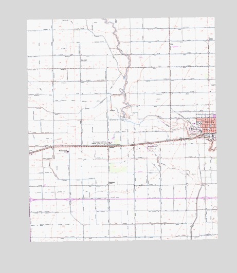
Holtville West, CA USGS Topographic Map
Click on map above to begin viewing in our Map Viewer.

This topographic map contains these locations and features:
Feature Name Type Latitude Longitude GNIS ID View Map
Acacia CanalCanalN32.7637°W115.4711°238398View Map
Acacia DrainCanalN32.7748°W115.4736°238399View Map
Acacia Five A DrainCanalN32.7776°W115.4919°253981View Map
Acacia FIve B DrainCanalN32.7664°W115.4944°253982View Map
Acacia Five DrainCanalN32.7517°W115.4664°253980View Map
Acacia Lateral EightCanalN32.7967°W115.4886°253990View Map
Acacia Lateral FiveCanalN32.7595°W115.4869°253986View Map
Acacia Lateral Five ACanalN32.7812°W115.4819°253987View Map
Acacia Lateral FourCanalN32.7595°W115.4780°253985View Map
Acacia Lateral NineCanalN32.8092°W115.4653°253991View Map
Acacia Lateral SixCanalN32.7895°W115.4739°253988View Map
Acacia Lateral Six ACanalN32.7887°W115.4905°253989View Map
Acacia Lateral TenCanalN32.8039°W115.4930°253983View Map
Acacia Lateral ThreeCanalN32.7523°W115.4700°253984View Map
Acacia SchoolSchoolN32.7820°W115.4905°238400View Map
Acacia Twelve LateralCanalN32.8209°W115.4967°253978View Map
Acacia Twelve LateralCanalN32.8148°W115.4930°253979View Map
Alamitos School (historical)SchoolN32.7662°W115.4133°1693392View Map
AnzaPopulated PlaceN32.8003°W115.4983°1660258View Map
Ash DrainCanalN32.7589°W115.4133°238799View Map
Ash Drain ThirtysevenCanalN32.7778°W115.4611°255319View Map
Ash Fifteen DrainCanalN32.7512°W115.4222°255310View Map
Ash Lateral FifteenCanalN32.7520°W115.4350°255322View Map
Ash Lateral FortyCanalN32.7734°W115.4194°255330View Map
Ash Lateral FortyfiveCanalN32.8001°W115.4305°255333View Map
Ash Lateral FortyoneCanalN32.7812°W115.4225°255331View Map
Ash Lateral FortysixCanalN32.8051°W115.4394°255334View Map
Ash Lateral FortytwoCanalN32.7962°W115.4150°255332View Map
Ash Lateral Lateral ThirtyeightCanalN32.7812°W115.4655°255337View Map
Ash Lateral ThirteenCanalN32.7764°W115.3964°255321View Map
Ash Lateral ThirtyCanalN32.7964°W115.4292°255324View Map
Ash Lateral ThirtyfourCanalN32.7748°W115.4308°255326View Map
Ash Lateral ThirtynineCanalN32.7667°W115.4178°255329View Map
Ash Lateral ThirtysevenCanalN32.7742°W115.4567°255328View Map
Ash Lateral ThirtysixCanalN32.7670°W115.4539°255327View Map
Ash Lateral ThirtythreeCanalN32.7812°W115.4567°255325View Map
Ash Lateral TwelveCanalN32.7526°W115.3967°255320View Map
Ash Lateral TwentyfiveCanalN32.7598°W115.4155°255323View Map
Ash Main CanalCanalN32.7626°W115.3900°238801View Map
Ash Thirty A DrainCanalN32.7778°W115.4219°255314View Map
Ash Thirty B DrainCanalN32.7759°W115.4130°255315View Map
Ash Thirty DrainCanalN32.7739°W115.4047°255313View Map
Ash Thirtyfour DrainCanalN32.7801°W115.4300°255316View Map
Barbara Worth Country ClubLocaleN32.8020°W115.4183°1654552View Map
Barbara Worth DrainCanalN32.7853°W115.3928°238974View Map
Central DrainCanalN32.8237°W115.4883°240417View Map
Central Drain TwoCanalN32.7937°W115.4822°255442View Map
Central Drain Two ACanalN32.7706°W115.4567°255443View Map
Central Drain Two CCanalN32.7731°W115.4647°255444View Map
Church of ChristChurchN32.8131°W115.3792°1868257View Map
Church of the NazareneChurchN32.8164°W115.3819°1868261View Map
City of HoltvilleCivilN32.8129°W115.3781°2410780View Map
Earl Walker County ParkParkN32.8064°W115.3869°1868268View Map
Eastside School (historical)SchoolN32.8623°W115.3878°1693398View Map
Eleventh Street DitchCanalN32.8220°W115.3886°241952View Map
First Assembly of God ChurchChurchN32.8167°W115.3805°1868282View Map
First Baptist ChurchChurchN32.8145°W115.3780°1868285View Map
FullerPopulated PlaceN32.8603°W115.4061°1660657View Map
Graeser DrainCanalN32.8723°W115.4569°242878View Map
Holiville Schenk Eleven DrainCanalN32.7637°W115.3836°243536View Map
Holt ParkParkN32.8120°W115.3861°243563View Map
HoltvillePopulated PlaceN32.8112°W115.3803°1660761View Map
Holtville Branch Imperial County Free LibraryBuildingN32.8131°W115.3800°1868296View Map
Holtville Chamber of CommerceBuildingN32.8117°W115.3808°1868297View Map
Holtville Christian SchoolSchoolN32.8131°W115.3792°1868298View Map
Holtville City HallBuildingN32.8117°W115.3808°1868299View Map
Holtville Fire DepartmentBuildingN32.8117°W115.3794°2664563View Map
Holtville High SchoolSchoolN32.8153°W115.3856°250788View Map
Holtville Police DepartmentBuildingN32.8126°W115.3791°2756453View Map
Holtville Post OfficePost OfficeN32.8115°W115.3787°1868301View Map
KGBA-FM (Holtville)TowerN32.8028°W115.4989°1662897View Map
Lateral EighteenCanalN32.7962°W115.3911°255562View Map
Lateral ElevenCanalN32.7670°W115.3814°255557View Map
Lateral FourtythreeCanalN32.7853°W115.4222°255583View Map
Lateral TenCanalN32.7526°W115.3794°255556View Map
Lateral ThreeCanalN32.8692°W115.4869°255577View Map
Lateral TwelveCanalN32.7648°W115.3797°255558View Map
McCall DrainCanalN32.8545°W115.4919°245639View Map
McKim BridgeBridgeN32.8545°W115.4355°252069View Map
McKim DrainCanalN32.8614°W115.4742°245689View Map
Meadows Union Elementary SchoolSchoolN32.8006°W115.4743°245738View Map
MelolandPopulated PlaceN32.8031°W115.4475°1661005View Map
Meloland DrainCanalN32.8153°W115.4600°245754View Map
Meloland SidingLocaleN32.8037°W115.4433°1693411View Map
Mesquite Drain 3CanalN32.8745°W115.4725°245817View Map
Mesquite Drain FiveCanalN32.8401°W115.4717°245819View Map
Mesquite Drain FourCanalN32.8470°W115.4683°245818View Map
Mesquite Drain SevenCanalN32.8542°W115.4658°245820View Map
Ninth Street DitchCanalN32.8184°W115.4053°246557View Map
Palmer DrainCanalN32.7742°W115.4439°247149View Map
Pear CanalCanalN32.8256°W115.4067°247329View Map
Perrys CornerPopulated PlaceN32.8617°W115.3800°1661215View Map
Redwood CanalCanalN32.8578°W115.4458°248100View Map
Redwood Lateral OneCanalN32.8692°W115.4658°255701View Map
Redwood Lateral TenCanalN32.8617°W115.4525°255702View Map
RicoPopulated PlaceN32.8067°W115.3975°1661310View Map
Rose LateralCanalN32.8367°W115.4839°248383View Map
Rose SchoolSchoolN32.8512°W115.4653°248387View Map
Roselle CanalCanalN32.8287°W115.4592°248395View Map
Rositas CanalCanalN32.8326°W115.4453°248404View Map
Rositas DamDamN32.8192°W115.4366°248405View Map
Rositas WasteCanalN32.8320°W115.4411°248406View Map
Rubber CanalCanalN32.8401°W115.4558°248447View Map
Rubber Lateral OneCanalN32.8434°W115.4480°255737View Map
Rubber Lateral SixCanalN32.8578°W115.4658°255739View Map
Rubber Lateral TwoCanalN32.8431°W115.4739°255738View Map
Sam Webb High SchoolSchoolN32.8163°W115.3857°1868336View Map
Schenk Ten DrainCanalN32.7523°W115.3853°254223View Map
South Central Drain FourCanalN32.8109°W115.4430°254278View Map
South Central Drain OneCanalN32.8178°W115.4478°254275View Map
Tenth Street DitchCanalN32.8203°W115.3811°250342View Map
Terrace Park CemeteryCemeteryN32.8128°W115.4014°250355View Map
University of California Imperial Valley FirSchoolN32.8048°W115.4472°250815View Map
Van Der Linden FieldParkN32.8070°W115.3792°250937View Map
Watermans CornerPopulated PlaceN32.7812°W115.4478°1661654View Map

Note: Coordinates in the location and feature list above are referenced to NAD83 datum.


Copyright (C) 2008-2024 Ryan Niemi / Sunset Dynamics ... All Rights Reserved