TopoQuest Logo
Do you find TopoQuest useful?
Help keep TopoQuest running and adding new maps/features by donating!
Bitcoin:  19c7KJd3qBynnjoSw5npx9KScwjBe4ifkT
Litecoin:  LXs6TkuXGGXo1vDsWCkWVdjQX94eUKd6ui
Home View Maps Find Maps Find Places Resources & Links


Alamorio, California Topographic Map

USGS Map Title: Alamorio, CA
USGS Map MRC: 32115H4
DRG (GeoTIFF) Download: o32115h4.tif


Neighboring USGS Topographic Map Quads:


  Westmorland East, CA  
33115A5
 

  Wiest, CA  
33115A4
 

  Amos, CA  
33115A3
 

  Brawley, CA  
32115H5
 

  Alamorio, CA  
32115H4
 

  Holtville NE, CA  
32115H3
 

  El Centro, CA  
32115G5
 

  Holtville West, CA  
32115G4
 

  Holtville East, CA  
32115G3


Map MRC Location:

N33°
W116°
N33°
W115°
H8 H7 H6 H5 H4 H3 H2 H1
G8 G7 G6 G5 G4 G3 G2 G1
F8 F7 F6 F5 F4 F3 F2 F1
E8 E7 E6 E5 E4 E3 E2 E1
D8 D7 D6 D5 D4 D3 D2 D1
C8 C7 C6 C5 C4 C3 C2 C1
B8 B7 B6 B5 B4 B3 B2 B1
A8 A7 A6 A5 A4 A3 A2 A1
N32°
W116°
N32°
W115°

Alamorio, CA USGS 1:24K Topographic Map Preview:
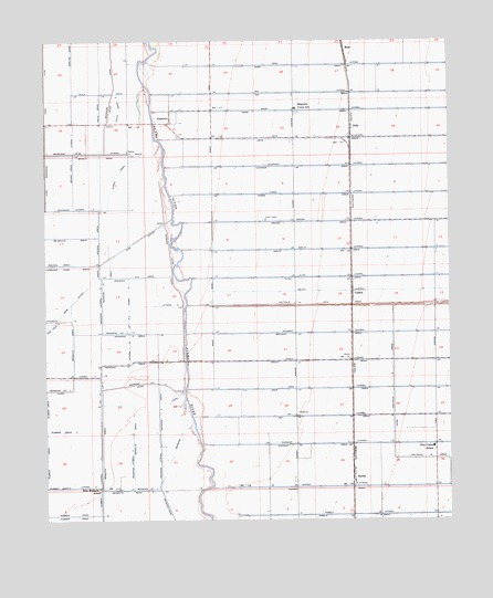
Alamorio, CA USGS Topographic Map
Click on map above to begin viewing in our Map Viewer.

This topographic map contains these locations and features:
Feature Name Type Latitude Longitude GNIS ID View Map
AlamorioPopulated PlaceN32.9792°W115.4614°1656420View Map
Brawley DivisionCivilN32.9811°W115.4711°1935030View Map
Bryant DrainCanalN32.9703°W115.4842°239750View Map
Bryant Drain OneCanalN32.9662°W115.4919°255376View Map
CurlewPopulated PlaceN32.9334°W115.4055°1656473View Map
De Moulin DrainCanalN32.9489°W115.4925°241308View Map
Lateral EightCanalN32.9164°W115.4653°255599View Map
Lateral Eight-ACanalN32.9270°W115.4747°255600View Map
Lateral FiveCanalN32.8839°W115.4872°255586View Map
Lateral FiveCanalN32.9125°W115.4872°255587View Map
Lateral NineCanalN32.9312°W115.4608°255603View Map
Lateral OneCanalN32.9756°W115.4917°255554View Map
Lateral SixCanalN32.9073°W115.4839°255593View Map
Lateral TwoCanalN32.9712°W115.4761°255568View Map
Magnolia Union Elementary SchoolSchoolN32.9824°W115.4230°245378View Map
Mesquite DrainCanalN32.8948°W115.4833°245814View Map
Mesquite Drain OneCanalN32.8964°W115.4739°245815View Map
Mesquite Drain TwoCanalN32.8825°W115.4753°245816View Map
MossPopulated PlaceN32.9978°W115.4078°1656577View Map
Moss DrainCanalN32.9934°W115.4197°246243View Map
Moss LateralCanalN32.9937°W115.4069°246244View Map
Olive LateralCanalN32.9387°W115.4125°246882View Map
OritaPopulated PlaceN32.9773°W115.4053°1656591View Map
Pine Elementary SchoolSchoolN32.8940°W115.3811°247521View Map
Pomelo DrainCanalN32.8759°W115.4064°247670View Map
Redwood Eight DrainCanalN32.9234°W115.4755°255699View Map
Redwood Five DrainCanalN32.9156°W115.4736°255698View Map
Redwood Four DrainCanalN32.9028°W115.4655°255697View Map
Redwood Lateral EightCanalN32.9303°W115.4830°255707View Map
Redwood Lateral FiveCanalN32.9106°W115.4700°255705View Map
Redwood Lateral FourCanalN32.8931°W115.4653°255704View Map
Redwood Lateral ThreeCanalN32.8831°W115.4694°255703View Map
Redwood Nine DrainCanalN32.9348°W115.4747°246547View Map
Redwood Nine-A DrainCanalN32.9384°W115.4739°255700View Map
Rockwood Lateral FourCanalN32.9564°W115.4919°255722View Map
Rose Mesquite SchoolSchoolN32.8831°W115.4844°248384View Map
Rose OutletCanalN32.9317°W115.4925°248385View Map
Rubber CanalCanalN32.8764°W115.4925°248448View Map
Rubber Drain ThreeCanalN32.8981°W115.4958°255736View Map
Rubber Drain TwoCanalN32.8831°W115.4967°248450View Map
Rubber LateralCanalN32.8848°W115.4839°248451View Map
SandiaPopulated PlaceN32.8856°W115.4058°1656616View Map
Stevens DrainCanalN32.9487°W115.4839°249918View Map
Sunset Springs School (historical)SchoolN32.8942°W115.4161°1693416View Map
Wills DrainCanalN32.9862°W115.4825°251669View Map
Wills Drain OneCanalN32.9820°W115.4836°255876View Map
Wills Drain TwoCanalN32.9820°W115.4772°255877View Map
Wores DrainCanalN32.9650°W115.4780°251809View Map

Note: Coordinates in the location and feature list above are referenced to NAD83 datum.


Copyright (C) 2008-2024 Ryan Niemi / Sunset Dynamics ... All Rights Reserved