TopoQuest Logo
Do you find TopoQuest useful?
Help keep TopoQuest running and adding new maps/features by donating!
Bitcoin:  19c7KJd3qBynnjoSw5npx9KScwjBe4ifkT
Litecoin:  LXs6TkuXGGXo1vDsWCkWVdjQX94eUKd6ui
Home View Maps Find Maps Find Places Resources & Links


Badger Lake, Oregon Topographic Map

USGS Map Title: Badger Lake, OR
USGS Map MRC: 45121C5
DRG (GeoTIFF) Download: o45121c5.tif


Neighboring USGS Topographic Map Quads:


  Mount Hood North, OR  
45121D6
 

  Dog River, OR  
45121D5
 

  Fivemile Butte, OR  
45121D4
 

  Mount Hood South, OR  
45121C6
 

  Badger Lake, OR  
45121C5
 

  Flag Point, OR  
45121C4
 

  Wapinitia Pass, OR  
45121B6
 

  Post Point, OR  
45121B5
 

  Rock Creek Reservoir, OR  
45121B4


Map MRC Location:

N46°
W122°
N46°
W121°
H8 H7 H6 H5 H4 H3 H2 H1
G8 G7 G6 G5 G4 G3 G2 G1
F8 F7 F6 F5 F4 F3 F2 F1
E8 E7 E6 E5 E4 E3 E2 E1
D8 D7 D6 D5 D4 D3 D2 D1
C8 C7 C6 C5 C4 C3 C2 C1
B8 B7 B6 B5 B4 B3 B2 B1
A8 A7 A6 A5 A4 A3 A2 A1
N45°
W122°
N45°
W121°

Badger Lake, OR USGS 1:24K Topographic Map Preview:
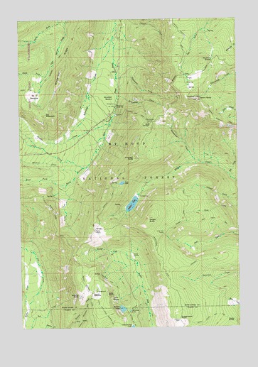
Badger Lake, OR USGS Topographic Map
Click on map above to begin viewing in our Map Viewer.

This topographic map contains these locations and features:
Feature Name Type Latitude Longitude GNIS ID View Map
Badger ButteSummitN45.2943°W121.5526°1137390View Map
Badger LakeReservoirN45.2998°W121.5620°1137400View Map
Badger Lake DamDamN45.3028°W121.5593°1153947View Map
Badger Lake Recreation SiteLocaleN45.3035°W121.5584°1162058View Map
Bluegrass RidgeRidgeN45.3643°W121.5965°1138340View Map
Bonney ButteSummitN45.2629°W121.5931°1138425View Map
Bonney MeadowsFlatN45.2632°W121.5834°1138428View Map
Bonney Meadows Recreation SiteLocaleN45.2651°W121.5829°1162057View Map
Boulder LakeLakeN45.2575°W121.5683°1138483View Map
Boulder Lake Recreation SiteLocaleN45.2593°W121.5695°1926230View Map
Boulder Lake TrailTrailN45.2585°W121.5598°1138484View Map
Boulder Lake Way TrailTrailN45.2673°W121.5737°1138485View Map
Buck DrawValleyN45.2521°W121.5959°1138784View Map
Camp Windy Recreation SiteLocaleN45.2887°W121.5834°1139277View Map
Clark CreekStreamN45.3146°W121.5904°1139754View Map
Crane PrairieFlatN45.2790°W121.5623°1140383View Map
Dog River SpringsSpringN45.3581°W121.5155°1141146View Map
Echo PointSummitN45.2635°W121.5767°1141667View Map
Elk MeadowsFlatN45.3440°W121.6173°1141784View Map
Elk Meadows TrailTrailN45.3621°W121.6015°1141786View Map
Elk MountainSummitN45.3358°W121.6117°1141790View Map
Engineers CreekStreamN45.3510°W121.5706°1141879View Map
Flag Point TrailTrailN45.3196°W121.5115°1142216View Map
Grasshopper PointSummitN45.2533°W121.5358°1142965View Map
Gumjuwac CreekStreamN45.3162°W121.5248°1143154View Map
Gumjuwac SaddleGapN45.3332°W121.5495°1143155View Map
Gunsight ButteSummitN45.3183°W121.5606°1143158View Map
Hellroaring CreekStreamN45.3437°W121.5704°1143465View Map
High PrairieFlatN45.3496°W121.5279°1143577View Map
Horsethief MeadowsFlatN45.3423°W121.5774°1143821View Map
Iron CreekStreamN45.2593°W121.6226°1144114View Map
Jack SpringsSpringN45.3320°W121.5512°1144175View Map
Jalland CreekStreamN45.3012°W121.5001°1144215View Map
Jean LakeReservoirN45.3085°W121.5676°1144235View Map
Kane SpringsSpringN45.2613°W121.5700°1144484View Map
Lookout MountainSummitN45.3423°W121.5242°1145473View Map
Lookout Mountain TrailTrailN45.3315°W121.5034°1145475View Map
Lunch CreekStreamN45.3635°W121.5715°1153313View Map
Meadows CreekStreamN45.3123°W121.5934°1146068View Map
Mine CreekStreamN45.3335°W121.5734°1153312View Map
Newton CreekStreamN45.3323°W121.5745°1146818View Map
Nottingham CampgroundLocaleN45.3687°W121.5694°1153311View Map
Pine Creek TrailTrailN45.2935°W121.5128°1147704View Map
Pocket CreekStreamN45.3079°W121.5998°1147812View Map
Robinhood CreekStreamN45.3668°W121.5729°1148546View Map
Robinhood Guard StationLocaleN45.3398°W121.5709°1148547View Map
Robinhood QuarryMineN45.3359°W121.5707°2754376View Map
Robinhood Recreation SiteLocaleN45.3407°W121.5712°1153310View Map
Rocky ButteSummitN45.2522°W121.5032°1148656View Map
Rocky Butte Way TrailTrailN45.2540°W121.5173°1148657View Map
Senecal SpringSpringN45.3428°W121.5223°1126741View Map
South Fork Cold Spring CreekStreamN45.3526°W121.6101°1149956View Map
Spinning LakeReservoirN45.2566°W121.5635°1150126View Map
Tolo CreekStreamN45.3110°W121.5056°1151307View Map
Valley View CabinLocaleN45.2882°W121.5442°1151717View Map

Note: Coordinates in the location and feature list above are referenced to NAD83 datum.


Copyright (C) 2008-2025 Ryan Niemi / Sunset Dynamics ... All Rights Reserved