TopoQuest Logo
Do you find TopoQuest useful?
Help keep TopoQuest running and adding new maps/features by donating!
Bitcoin:  19c7KJd3qBynnjoSw5npx9KScwjBe4ifkT
Litecoin:  LXs6TkuXGGXo1vDsWCkWVdjQX94eUKd6ui
Home View Maps Find Maps Find Places Resources & Links


Flag Point, Oregon Topographic Map

USGS Map Title: Flag Point, OR
USGS Map MRC: 45121C4
DRG (GeoTIFF) Download: o45121c4.tif


Neighboring USGS Topographic Map Quads:


  Dog River, OR  
45121D5
 

  Fivemile Butte, OR  
45121D4
 

  Wolf Run, OR  
45121D3
 

  Badger Lake, OR  
45121C5
 

  Flag Point, OR  
45121C4
 

  Friend, OR  
45121C3
 

  Post Point, OR  
45121B5
 

  Rock Creek Reservoir, OR  
45121B4
 

  Wamic, OR  
45121B3


Map MRC Location:

N46°
W122°
N46°
W121°
H8 H7 H6 H5 H4 H3 H2 H1
G8 G7 G6 G5 G4 G3 G2 G1
F8 F7 F6 F5 F4 F3 F2 F1
E8 E7 E6 E5 E4 E3 E2 E1
D8 D7 D6 D5 D4 D3 D2 D1
C8 C7 C6 C5 C4 C3 C2 C1
B8 B7 B6 B5 B4 B3 B2 B1
A8 A7 A6 A5 A4 A3 A2 A1
N45°
W122°
N45°
W121°

Flag Point, OR USGS 1:24K Topographic Map Preview:
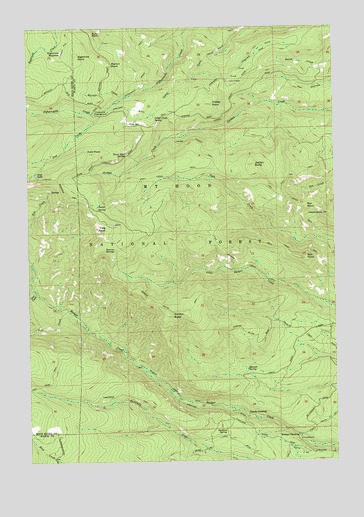
Flag Point, OR USGS Topographic Map
Click on map above to begin viewing in our Map Viewer.

This topographic map contains these locations and features:
Feature Name Type Latitude Longitude GNIS ID View Map
Badger Creek TrailTrailN45.2715°W121.4442°1137397View Map
Badger Creek WildernessReserveN45.3063°W121.4851°1156238View Map
Ball PointSummitN45.3081°W121.3883°1137482View Map
Ball Point TrailTrailN45.3096°W121.3928°1137483View Map
Bennett SpringSpringN45.2767°W121.4127°1137928View Map
Bird SpringSpringN45.3676°W121.4731°1153326View Map
Bonney CrossingLocaleN45.2573°W121.3920°1138427View Map
Bonney Crossing Recreation SiteLocaleN45.2560°W121.3906°1155880View Map
Bulo PointCapeN45.3732°W121.4745°1138948View Map
Camp FriendLocaleN45.3590°W121.4184°1139245View Map
Cedar Creek SpringSpringN45.3486°W121.4491°1139517View Map
Cold PointSummitN45.3387°W121.4740°1139919View Map
Cold SpringSpringN45.3475°W121.4595°1139948View Map
Denest SpringSpringN45.3582°W121.4703°1153325View Map
Drop CreekStreamN45.2993°W121.4990°1141258View Map
Eightmile MeadowFlatN45.3679°W121.4870°1141706View Map
Eightmile PointSummitN45.3663°W121.4802°1141707View Map
Fifteen Mile Recreation SiteLocaleN45.3504°W121.4728°1142086View Map
Flag PointCapeN45.3171°W121.4692°1142215View Map
Frailey PointSummitN45.3527°W121.4261°1142401View Map
Frailey Point TrailTrailN45.3737°W121.4159°1142402View Map
Fret CreekStreamN45.3504°W121.4703°1142479View Map
Goat CreekStreamN45.2982°W121.4973°1142782View Map
Gordon ButteSummitN45.2915°W121.4426°1142867View Map
Gordon Butte TrailTrailN45.2935°W121.4442°1142868View Map
Hootnanny PointSummitN45.3215°W121.3793°1143718View Map
Jordan ButteSummitN45.3353°W121.4091°1144390View Map
Jordan Cutoff TrailTrailN45.3407°W121.4298°1144396View Map
Little Badger Creek TrailTrailN45.3046°W121.4081°1145074View Map
Marion CreekStreamN45.3546°W121.4615°1145811View Map
Marion PointSummitN45.3640°W121.4670°1145816View Map
Oval LakeLakeN45.3329°W121.4977°1147299View Map
Owl QuarryMineN45.3616°W121.3800°2754377View Map
Pen PointSummitN45.3226°W121.3878°1147576View Map
Pen Way TrailTrailN45.3318°W121.3906°1147577View Map
Pine CreekStreamN45.2935°W121.4853°1147698View Map
Shadley SpringSpringN45.3444°W121.4644°2765163View Map
Springer DitchCanalN45.3512°W121.4573°1158502View Map
Springer RidgeRidgeN45.3735°W121.3945°1153324View Map
Steeds CrossingLocaleN45.2632°W121.4123°1150385View Map
Stockton SpringSpringN45.2588°W121.4215°1150442View Map
Sunrise SpringsSpringN45.3111°W121.4660°1150671View Map
Sunset SpringSpringN45.3230°W121.4735°1150682View Map
Three Bear SpringSpringN45.3384°W121.4605°1151146View Map
Threemile TrailTrailN45.2682°W121.4728°1151197View Map
Tygh Creek TrailTrailN45.3343°W121.4295°1151628View Map

Note: Coordinates in the location and feature list above are referenced to NAD83 datum.


Copyright (C) 2008-2025 Ryan Niemi / Sunset Dynamics ... All Rights Reserved