TopoQuest Logo
Do you find TopoQuest useful?
Help keep TopoQuest running and adding new maps/features by donating!
Bitcoin:  19c7KJd3qBynnjoSw5npx9KScwjBe4ifkT
Litecoin:  LXs6TkuXGGXo1vDsWCkWVdjQX94eUKd6ui
Home View Maps Find Maps Find Places Resources & Links


Fivemile Butte, Oregon Topographic Map

USGS Map Title: Fivemile Butte, OR
USGS Map MRC: 45121D4
DRG (GeoTIFF) Download: o45121d4.tif


Neighboring USGS Topographic Map Quads:


  Parkdale, OR  
45121E5
 

  Ketchum Reservoir, OR  
45121E4
 

  Brown Creek, OR  
45121E3
 

  Dog River, OR  
45121D5
 

  Fivemile Butte, OR  
45121D4
 

  Wolf Run, OR  
45121D3
 

  Badger Lake, OR  
45121C5
 

  Flag Point, OR  
45121C4
 

  Friend, OR  
45121C3


Map MRC Location:

N46°
W122°
N46°
W121°
H8 H7 H6 H5 H4 H3 H2 H1
G8 G7 G6 G5 G4 G3 G2 G1
F8 F7 F6 F5 F4 F3 F2 F1
E8 E7 E6 E5 E4 E3 E2 E1
D8 D7 D6 D5 D4 D3 D2 D1
C8 C7 C6 C5 C4 C3 C2 C1
B8 B7 B6 B5 B4 B3 B2 B1
A8 A7 A6 A5 A4 A3 A2 A1
N45°
W122°
N45°
W121°

Fivemile Butte, OR USGS 1:24K Topographic Map Preview:
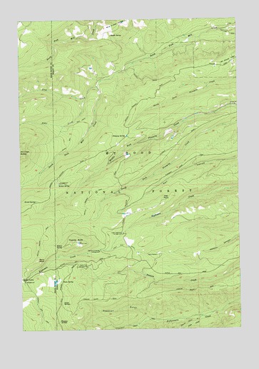
Fivemile Butte, OR USGS Topographic Map
Click on map above to begin viewing in our Map Viewer.

This topographic map contains these locations and features:
Feature Name Type Latitude Longitude GNIS ID View Map
Alder CreekStreamN45.4679°W121.4640°1137081View Map
Bascom SpringSpringN45.4346°W121.4662°1153323View Map
Birdseye SpringSpringN45.3993°W121.4948°1153322View Map
Bottle Prairie TrailTrailN45.4212°W121.4737°1138455View Map
Camp BaldwinLocaleN45.4048°W121.4226°1139199View Map
Camp Baldwin LakeReservoirN45.4057°W121.4220°1158675View Map
Cedar CreekStreamN45.3798°W121.3978°1139515View Map
Crow CreekStreamN45.4729°W121.4567°1140485View Map
Crow Creek DamDamN45.4748°W121.4529°1155546View Map
Crow Creek ReservoirReservoirN45.4736°W121.4560°1155547View Map
Deadman GulchValleyN45.3801°W121.4298°1140740View Map
Eightmile Crossing Recreation SiteLocaleN45.4062°W121.4567°1162591View Map
Fifteenmile Creek TrailTrailN45.3785°W121.4220°1142089View Map
Fivemile ButteSummitN45.4104°W121.4712°1142201View Map
Glade SpringSpringN45.3921°W121.4781°1153321View Map
Hillary GradeSlopeN45.4762°W121.4298°1156997View Map
Jacket SpringsSpringN45.3860°W121.4782°1144184View Map
Joe's Point QuarryMineN45.4228°W121.4329°2740142View Map
Joes PointSummitN45.4273°W121.4201°1144298View Map
Johns Mill TrailTrailN45.4548°W121.4712°1144317View Map
Knebal SpringSpringN45.4336°W121.4793°1144679View Map
Knebal Spring Recreation SiteLocaleN45.4343°W121.4787°1153320View Map
Lower Eightmile Crossing Recreation SiteLocaleN45.4137°W121.4426°1145618View Map
Pebble Ford Recreation SiteLocaleN45.4001°W121.4640°1147550View Map
Perry PointSummitN45.4032°W121.4929°1147603View Map
Pollywog SpringSpringN45.4530°W121.4403°1147866View Map
Puma SpringSpringN45.3946°W121.4787°1148034View Map
Saddle SpringSpringN45.4935°W121.4483°1148915View Map
Skyline QuarryMineN45.4408°W121.4620°2754371View Map
Station SpringSpringN45.4095°W121.4803°1150370View Map
Stroud SpringsSpringN45.4269°W121.4922°1150498View Map
Underhill Recreation SiteLocaleN45.3971°W121.4220°1167362View Map
Wampus SpringsSpringN45.3783°W121.4801°1151873View Map

Note: Coordinates in the location and feature list above are referenced to NAD83 datum.


Copyright (C) 2008-2025 Ryan Niemi / Sunset Dynamics ... All Rights Reserved