TopoQuest Logo
Do you find TopoQuest useful?
Help keep TopoQuest running and adding new maps/features by donating!
Bitcoin:  19c7KJd3qBynnjoSw5npx9KScwjBe4ifkT
Litecoin:  LXs6TkuXGGXo1vDsWCkWVdjQX94eUKd6ui
Home View Maps Find Maps Find Places Resources & Links


Hopkins Ridge, Washington Topographic Map

USGS Map Title: Hopkins Ridge, WA
USGS Map MRC: 46117C6
DRG (GeoTIFF) Download: o46117c6.tif


Neighboring USGS Topographic Map Quads:


  Turner, WA  
46117D7
 

  Zumwalt, WA  
46117D6
 

  Pomeroy, WA  
46117D5
 

  Cahill Mountain, WA  
46117C7
 

  Hopkins Ridge, WA  
46117C6
 

  Rose Springs, WA  
46117C5
 

  Eckler Mountain, WA  
46117B7
 

  Panjab Creek, WA  
46117B6
 

  Stentz Spring, WA  
46117B5


Map MRC Location:

N47°
W118°
N47°
W117°
H8 H7 H6 H5 H4 H3 H2 H1
G8 G7 G6 G5 G4 G3 G2 G1
F8 F7 F6 F5 F4 F3 F2 F1
E8 E7 E6 E5 E4 E3 E2 E1
D8 D7 D6 D5 D4 D3 D2 D1
C8 C7 C6 C5 C4 C3 C2 C1
B8 B7 B6 B5 B4 B3 B2 B1
A8 A7 A6 A5 A4 A3 A2 A1
N46°
W118°
N46°
W117°

Hopkins Ridge, WA USGS 1:24K Topographic Map Preview:
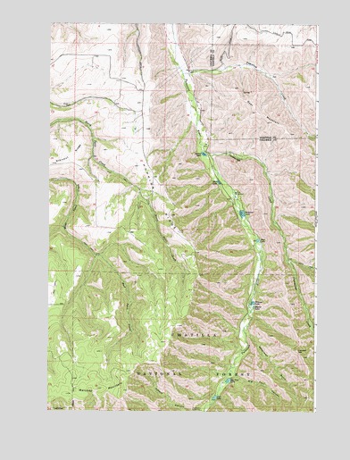
Hopkins Ridge, WA USGS Topographic Map
Click on map above to begin viewing in our Map Viewer.

This topographic map contains these locations and features:
Feature Name Type Latitude Longitude GNIS ID View Map
Beaver LakeLakeN46.2835°W117.6542°1503262View Map
Big Four CanyonValleyN46.2629°W117.6641°1503346View Map
Big Four LakeLakeN46.2597°W117.6664°1513896View Map
Big Four Lake DamDamN46.2599°W117.6644°1532515View Map
Blue LakeLakeN46.3243°W117.6707°1503451View Map
Blue Lake DamDamN46.3249°W117.6710°1532880View Map
Cummings CreekStreamN46.3326°W117.6746°1504300View Map
Curl LakeReservoirN46.2545°W117.6720°1513912View Map
Curl Lake DamDamN46.2549°W117.6727°1532866View Map
Deer LakeReservoirN46.3052°W117.6525°1513915View Map
Deer Lake DamDamN46.3049°W117.6527°1532868View Map
Goat MountainSummitN46.3463°W117.6535°1512243View Map
Hopkins RidgeRidgeN46.3079°W117.6894°1505602View Map
Jumpoff JoeCliffN46.2696°W117.6338°1505881View Map
Maloney MountainSummitN46.2571°W117.7269°1512424View Map
Rainbow LakeReservoirN46.3138°W117.6599°1507703View Map
Rainbow Lake DamDamN46.3149°W117.6610°1532343View Map
Spring LakeReservoirN46.3330°W117.6781°1513481View Map
Spring Lake DamDamN46.3332°W117.6777°1532879View Map
Tucannon Fish HatcheryParkN46.3202°W117.6630°2765537View Map
Tucannon Guard StationLocaleN46.2504°W117.6785°1509098View Map
Tumalum CreekStreamN46.3588°W117.6874°1513228View Map
Waterman GulchValleyN46.2751°W117.6571°1509329View Map
Watson LakeReservoirN46.2849°W117.6548°1513489View Map
Watson Lake DamDamN46.2865°W117.6560°1532516View Map
Wooten Game ReserveParkN46.3263°W117.6363°1513791View Map
Wooten State Fish HatcheryLocaleN46.3207°W117.6630°1514037View Map
Wooten State Wildlife Recreation AreaParkN46.3074°W117.6366°1514606View Map

Note: Coordinates in the location and feature list above are referenced to NAD83 datum.


Copyright (C) 2008-2025 Ryan Niemi / Sunset Dynamics ... All Rights Reserved