TopoQuest Logo
Do you find TopoQuest useful?
Help keep TopoQuest running and adding new maps/features by donating!
Bitcoin:  19c7KJd3qBynnjoSw5npx9KScwjBe4ifkT
Litecoin:  LXs6TkuXGGXo1vDsWCkWVdjQX94eUKd6ui
Home View Maps Find Maps Find Places Resources & Links


Panjab Creek, Washington Topographic Map

USGS Map Title: Panjab Creek, WA
USGS Map MRC: 46117B6
DRG (GeoTIFF) Download: o46117b6.tif


Neighboring USGS Topographic Map Quads:


  Cahill Mountain, WA  
46117C7
 

  Hopkins Ridge, WA  
46117C6
 

  Rose Springs, WA  
46117C5
 

  Eckler Mountain, WA  
46117B7
 

  Panjab Creek, WA  
46117B6
 

  Stentz Spring, WA  
46117B5
 

  Godman Spring, WA  
46117A7
 

  Oregon Butte, WA  
46117A6
 

  Diamond Peak, WA  
46117A5


Map MRC Location:

N47°
W118°
N47°
W117°
H8 H7 H6 H5 H4 H3 H2 H1
G8 G7 G6 G5 G4 G3 G2 G1
F8 F7 F6 F5 F4 F3 F2 F1
E8 E7 E6 E5 E4 E3 E2 E1
D8 D7 D6 D5 D4 D3 D2 D1
C8 C7 C6 C5 C4 C3 C2 C1
B8 B7 B6 B5 B4 B3 B2 B1
A8 A7 A6 A5 A4 A3 A2 A1
N46°
W118°
N46°
W117°

Panjab Creek, WA USGS 1:24K Topographic Map Preview:
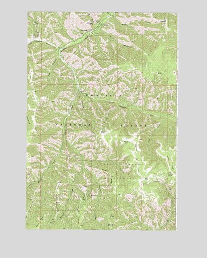
Panjab Creek, WA USGS Topographic Map
Click on map above to begin viewing in our Map Viewer.

This topographic map contains these locations and features:
Feature Name Type Latitude Longitude GNIS ID View Map
Al Williams RidgeRidgeN46.1557°W117.6799°1502957View Map
Alnus SpringSpringN46.1811°W117.6853°1503010View Map
Bear SpringSpringN46.1757°W117.7457°1511466View Map
Big Turkey TailRidgeN46.1451°W117.7230°1513066View Map
Bullfrog SpringSpringN46.1580°W117.6324°1511491View Map
Camp Wooten Environmental Learning CenterLocaleN46.2382°W117.6974°1513728View Map
Camp Wooten State ParkParkN46.2382°W117.6977°1503752View Map
Cascara SpringSpringN46.2443°W117.6905°1503842View Map
Cold CreekStreamN46.1907°W117.6310°1504057View Map
Cow CanyonValleyN46.2240°W117.7230°1504208View Map
Dunlap SpringSpringN46.1524°W117.6510°1504589View Map
Green RidgeRidgeN46.1304°W117.7366°1505276View Map
Grub CanyonValleyN46.2471°W117.6796°1505319View Map
Hixon CanyonValleyN46.2396°W117.6930°1505532View Map
Horse RidgeRidgeN46.1590°W117.6269°1505613View Map
Indian CorralLocaleN46.1549°W117.6524°1505709View Map
Little Tucannon RiverStreamN46.2285°W117.7227°1506235View Map
Meadow CreekStreamN46.1765°W117.7191°1506596View Map
Mill CanyonValleyN46.2421°W117.6932°1506682View Map
Mill Canyon SpringSpringN46.2435°W117.6957°1506684View Map
Mount Misery TrailTrailN46.1579°W117.6274°1533271View Map
Panjab CampgroundLocaleN46.2049°W117.7074°1507275View Map
Panjab CreekStreamN46.2046°W117.7066°1507276View Map
Panjab TrailTrailN46.1649°W117.6824°1510543View Map
Panjab TrailheadLocaleN46.1763°W117.7207°1514038View Map
Rattlesnake TrailTrailN46.1776°W117.6791°1507740View Map
Red Fir SpringSpringN46.1751°W117.6652°1507752View Map
Salter TrailTrailN46.2174°W117.6866°1508061View Map
School CanyonValleyN46.2482°W117.6807°1508153View Map
Table CampLocaleN46.1276°W117.6794°1508890View Map
Tablecamp SpringSpringN46.1276°W117.6788°1514013View Map
Tallow FlatFlatN46.2107°W117.7460°1508903View Map
The WheatfieldFlatN46.2465°W117.6352°1508979View Map
Tucannon CampgroundLocaleN46.2432°W117.6891°1509097View Map
Tucannon Game ReserveParkN46.2463°W117.6357°1513720View Map
Tucannon SpringSpringN46.2038°W117.7059°1509100View Map
Turkey CreekStreamN46.1613°W117.7030°1509123View Map
Turkey Creek TrailTrailN46.1504°W117.7124°1510544View Map
West Butte RidgeRidgeN46.1357°W117.7069°1509387View Map
Willow SpringSpringN46.2155°W117.6428°1509559View Map

Note: Coordinates in the location and feature list above are referenced to NAD83 datum.


Copyright (C) 2008-2024 Ryan Niemi / Sunset Dynamics ... All Rights Reserved