TopoQuest Logo
Do you find TopoQuest useful?
Help keep TopoQuest running and adding new maps/features by donating!
Bitcoin:  19c7KJd3qBynnjoSw5npx9KScwjBe4ifkT
Litecoin:  LXs6TkuXGGXo1vDsWCkWVdjQX94eUKd6ui
Home View Maps Find Maps Find Places Resources & Links


Horse Ridge, Utah Topographic Map

USGS Map Title: Horse Ridge, UT
USGS Map MRC: 41111C4
DRG (GeoTIFF) Download: o41111c4.tif


Neighboring USGS Topographic Map Quads:


  Monte Cristo Peak, UT  
41111D5
 

  Dairy Ridge, UT  
41111D4
 

  Meachum Ridge, UT  
41111D3
 

  Causey Dam, UT  
41111C5
 

  Horse Ridge, UT  
41111C4
 

  Peck Canyon, UT  
41111C3
 

  Bybee Knoll, UT  
41111B5
 

  Lost Creek Dam, UT  
41111B4
 

  Francis Canyon, UT  
41111B3


Map MRC Location:

N42°
W112°
N42°
W111°
H8 H7 H6 H5 H4 H3 H2 H1
G8 G7 G6 G5 G4 G3 G2 G1
F8 F7 F6 F5 F4 F3 F2 F1
E8 E7 E6 E5 E4 E3 E2 E1
D8 D7 D6 D5 D4 D3 D2 D1
C8 C7 C6 C5 C4 C3 C2 C1
B8 B7 B6 B5 B4 B3 B2 B1
A8 A7 A6 A5 A4 A3 A2 A1
N41°
W112°
N41°
W111°

Horse Ridge, UT USGS 1:24K Topographic Map Preview:
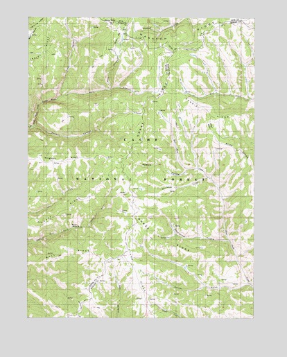
Horse Ridge, UT USGS Topographic Map
Click on map above to begin viewing in our Map Viewer.

This topographic map contains these locations and features:
Feature Name Type Latitude Longitude GNIS ID View Map
Bull RidgeRidgeN41.2763°W111.4802°1439274View Map
Condie RidgeRidgeN41.3344°W111.3794°1439913View Map
Frost CanyonValleyN41.3424°W111.4821°1441247View Map
Hornet GulchValleyN41.2638°W111.3780°1428818View Map
Horse RidgeRidgeN41.2797°W111.4255°1428863View Map
Horse RidgeRidgeN41.3416°W111.4291°1428864View Map
Howard HollowValleyN41.3119°W111.4130°1428919View Map
Knighton RidgeRidgeN41.3161°W111.4935°1442345View Map
Lake RidgeRidgeN41.2883°W111.4974°1442420View Map
Lightning RidgeRidgeN41.3736°W111.4930°1442589View Map
Monument CreekStreamN41.3086°W111.4013°1430446View Map
Pine CanyonValleyN41.3449°W111.4552°1431245View Map
Sawmill CanyonValleyN41.3297°W111.4969°1432254View Map
Squaw ButteSummitN41.3733°W111.4552°1432876View Map
Squaw FlatFlatN41.3663°W111.4491°1432882View Map
Stark RidgeRidgeN41.2524°W111.4327°1446097View Map
Wasatch RidgeRidgeN41.3649°W111.4233°1447009View Map
Weed BasinBasinN41.3299°W111.4002°1434030View Map
Wheatgrass HollowValleyN41.2822°W111.3888°1434140View Map
Wonder SpringSpringN41.2881°W111.4729°1437289View Map

Note: Coordinates in the location and feature list above are referenced to NAD83 datum.


Copyright (C) 2008-2025 Ryan Niemi / Sunset Dynamics ... All Rights Reserved