TopoQuest Logo
Do you find TopoQuest useful?
Help keep TopoQuest running and adding new maps/features by donating!
Bitcoin:  19c7KJd3qBynnjoSw5npx9KScwjBe4ifkT
Litecoin:  LXs6TkuXGGXo1vDsWCkWVdjQX94eUKd6ui
Home View Maps Find Maps Find Places Resources & Links


Bridger Lakes, Wyoming Topographic Map

USGS Map Title: Bridger Lakes, WY
USGS Map MRC: 43109A6
DRG (GeoTIFF) Download: o43109a6.tif


Neighboring USGS Topographic Map Quads:


  Squaretop Mountain, WY  
43109B7
 

  Gannett Peak, WY  
43109B6
 

  Fremont Peak North, WY  
43109B5
 

  Fremont Lake North, WY  
43109A7
 

  Bridger Lakes, WY  
43109A6
 

  Fremont Peak South, WY  
43109A5
 

  Fremont Lake South, WY  
42109H7
 

  Fayette Lake, WY  
42109H6
 

  Horseshoe Lake, WY  
42109H5


Map MRC Location:

N44°
W110°
N44°
W109°
H8 H7 H6 H5 H4 H3 H2 H1
G8 G7 G6 G5 G4 G3 G2 G1
F8 F7 F6 F5 F4 F3 F2 F1
E8 E7 E6 E5 E4 E3 E2 E1
D8 D7 D6 D5 D4 D3 D2 D1
C8 C7 C6 C5 C4 C3 C2 C1
B8 B7 B6 B5 B4 B3 B2 B1
A8 A7 A6 A5 A4 A3 A2 A1
N43°
W110°
N43°
W109°

Bridger Lakes, WY USGS 1:24K Topographic Map Preview:
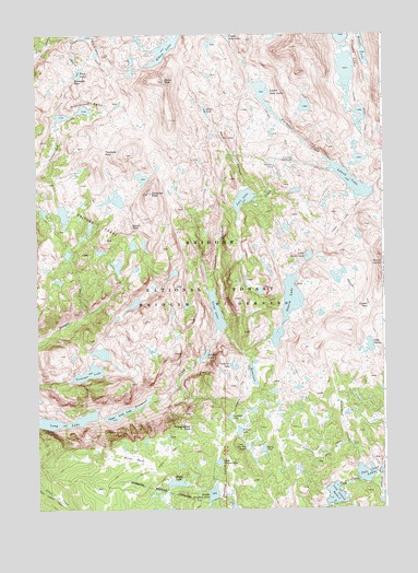
Bridger Lakes, WY USGS Topographic Map
Click on map above to begin viewing in our Map Viewer.

This topographic map contains these locations and features:
Feature Name Type Latitude Longitude GNIS ID View Map
1000 Island LakeLakeN43.0036°W109.6434°1596708View Map
Barbara LakeLakeN43.0243°W109.6810°1585111View Map
Big Water SlideSwampN43.0902°W109.6640°1585525View Map
Bridger LakesLakeN43.0743°W109.7309°1585918View Map
Duran PeakSummitN43.0747°W109.7154°1587935View Map
Eklund LakeLakeN43.0206°W109.6779°1588199View Map
Elbow CreekStreamN43.1236°W109.7443°1599557View Map
Elbow LakeLakeN43.1218°W109.7030°1599560View Map
Elbow PeakSummitN43.1127°W109.7035°1588202View Map
Fremont CrossingCrossingN43.0919°W109.6610°1597323View Map
Gorge LakeLakeN43.0519°W109.6856°1588984View Map
Guiterrez PeakSummitN43.0830°W109.7093°1589187View Map
Gunsight PassGapN43.1130°W109.7363°1589194View Map
Hobbs LakeLakeN43.0354°W109.6727°1589593View Map
Indian Pass TrailTrailN43.0908°W109.6299°1600507View Map
Island LakeLakeN43.0862°W109.6368°1589980View Map
Lake NelsonLakeN43.0431°W109.6303°1592009View Map
Lester PassGapN43.0530°W109.6304°1590652View Map
Little Seneca LakeLakeN43.0665°W109.6522°1590874View Map
Long LakeLakeN43.0223°W109.7394°2785652View Map
Lost LakeLakeN43.0816°W109.6756°1591045View Map
Lower Jean LakeLakeN43.1088°W109.6676°1591090View Map
Marys LakeLakeN43.0157°W109.6692°1591252View Map
Middle Sweeney LakeLakeN43.0041°W109.6872°1591558View Map
Miller LakeLakeN43.0069°W109.7007°1591611View Map
Miller ParkFlatN43.0136°W109.7160°1591614View Map
Miner LakeLakeN43.1047°W109.6887°1591639View Map
Mistake LakeLakeN43.1250°W109.6329°1601494View Map
Mistake LakeLakeN43.1204°W109.6318°1591659View Map
Monument CreekStreamN43.0119°W109.6346°1591699View Map
Moya CanyonValleyN43.0844°W109.6738°1591820View Map
Pass LakeLakeN43.1150°W109.7345°1592601View Map
Photographers PointSummitN43.0252°W109.6951°1592725View Map
Pole Creek LakesLakeN43.0092°W109.6323°1592928View Map
Pole Creek TrailTrailN43.0136°W109.7046°1602247View Map
Sapphire LakeLakeN43.0369°W109.6795°1593940View Map
Sauerkraut LakesLakeN43.1052°W109.7327°1593949View Map
Seneca LakeLakeN43.0536°W109.6596°1594099View Map
Seneca Lake TrailTrailN43.0444°W109.6729°1594100View Map
Suicide LakeLakeN43.0405°W109.6900°1595163View Map
Sweeney LakesLakeN43.0005°W109.6796°1603479View Map
Threlkeld PassGapN43.0941°W109.7249°1595552View Map
Titcomb Basin TrailTrailN43.1022°W109.6313°1595605View Map
Titcomb LakesLakeN43.1147°W109.6382°1603684View Map
Triangle LakeLakeN43.0359°W109.7318°1595697View Map
Twin LakesLakeN43.1224°W109.7296°1595797View Map
Two Top LakesLakeN43.0170°W109.6751°1595825View Map
Upper Long LakeLakeN43.0252°W109.7205°1595865View Map
Upper Sweeney LakeLakeN43.0125°W109.6852°1595885View Map

Note: Coordinates in the location and feature list above are referenced to NAD83 datum.


Copyright (C) 2008-2024 Ryan Niemi / Sunset Dynamics ... All Rights Reserved