TopoQuest Logo
Do you find TopoQuest useful?
Help keep TopoQuest running and adding new maps/features by donating!
Bitcoin:  19c7KJd3qBynnjoSw5npx9KScwjBe4ifkT
Litecoin:  LXs6TkuXGGXo1vDsWCkWVdjQX94eUKd6ui
Home View Maps Find Maps Find Places Resources & Links


Bagley, Minnesota Topographic Map

USGS Map Title: Bagley, MN
USGS Map MRC: 47095E4
DRG (GeoTIFF) Download: o47095e4.tif


Neighboring USGS Topographic Map Quads:


  Gonvick, MN  
47095F5
 

  Clearbrook, MN  
47095F4
 

  Leonard, MN  
47095F3
 

  Fosston SE, MN  
47095E5
 

  Bagley, MN  
47095E4
 

  Shevlin, MN  
47095E3
 

  Ebro, MN  
47095D5
 

  Zerkel NW, MN  
47095D4
 

  Upper Rice Lake, MN  
47095D3


Map MRC Location:

N48°
W96°
N48°
W95°
H8 H7 H6 H5 H4 H3 H2 H1
G8 G7 G6 G5 G4 G3 G2 G1
F8 F7 F6 F5 F4 F3 F2 F1
E8 E7 E6 E5 E4 E3 E2 E1
D8 D7 D6 D5 D4 D3 D2 D1
C8 C7 C6 C5 C4 C3 C2 C1
B8 B7 B6 B5 B4 B3 B2 B1
A8 A7 A6 A5 A4 A3 A2 A1
N47°
W96°
N47°
W95°

Bagley, MN USGS 1:24K Topographic Map Preview:
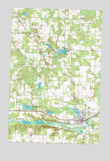
Bagley, MN USGS Topographic Map
Click on map above to begin viewing in our Map Viewer.

This topographic map contains these locations and features:
Feature Name Type Latitude Longitude GNIS ID View Map
BagleyPopulated PlaceN47.5216°W95.3983°639566View Map
Bagley CemeteryCemeteryN47.5341°W95.3925°639567View Map
Bagley Country ClubLocaleN47.5297°W95.3883°659779View Map
Bagley Fire DepartmentBuildingN47.5214°W95.3975°2081968View Map
Bagley Police DepartmentBuildingN47.5214°W95.3976°2082028View Map
Bagley Public LibraryBuildingN47.5222°W95.3989°2082027View Map
Calvary Evangelical Free ChurchChurchN47.5217°W95.4014°2081954View Map
City of BagleyCivilN47.5239°W95.4042°2394051View Map
Clearwater ClinicHospitalN47.5222°W95.4008°2081960View Map
Clearwater CountyCivilN47.5777°W95.3790°659460View Map
Clearwater County CourthouseBuildingN47.5244°W95.3986°2082030View Map
Clearwater County FairgroundLocaleN47.5306°W95.3992°2082031View Map
Clearwater County JailBuildingN47.5242°W95.3993°2758819View Map
Clearwater County Sheriff's OfficeBuildingN47.5243°W95.3992°2082029View Map
Clearwater Health Services HospitalHospitalN47.5261°W95.4022°2081962View Map
Concordia CemeteryCemeteryN47.6122°W95.4908°2076583View Map
Concordia ChurchChurchN47.6122°W95.4914°641438View Map
Emmanuel CemeteryCemeteryN47.6175°W95.4047°2076502View Map
Emmanuel ChurchChurchN47.6169°W95.4053°643364View Map
Faith Hill Assembly of God ChurchChurchN47.5194°W95.3978°2081955View Map
Faith Lutheran ChurchChurchN47.5225°W95.4006°2081952View Map
First LakeLakeN47.5187°W95.4572°643654View Map
Grace Lutheran ChurchChurchN47.5294°W95.3986°2081953View Map
Gran CemeteryCemeteryN47.5433°W95.4853°644321View Map
Greensview Care CenterHospitalN47.5289°W95.3936°2081961View Map
Hegre LakeLakeN47.6195°W95.4828°644838View Map
Kingdom Hall of Jehovah's WitnessesChurchN47.5167°W95.4047°2081951View Map
Lake LomondLakeN47.5299°W95.4071°647006View Map
Lone LakeLakeN47.5856°W95.4281°647012View Map
Lost LakeLakeN47.6111°W95.4846°647205View Map
MeritCare ClinicHospitalN47.5264°W95.4017°2081963View Map
Minnow LakeLakeN47.5316°W95.4749°647970View Map
Monson LakeLakeN47.5531°W95.4589°648042View Map
Mud LakeLakeN47.5116°W95.3995°648335View Map
Redeemer Lutheran ChurchChurchN47.5217°W95.4031°2081957View Map
Rice Free Lutheran ChurchChurchN47.5217°W95.3981°2081958View Map
Rusten Post Office (historical)Post OfficeN47.6194°W95.4333°2076597View Map
Sabe LakeLakeN47.5286°W95.4434°650446View Map
Saint Joseph CemeteryCemeteryN47.5327°W95.3936°650761View Map
Saint Joseph's ChurchChurchN47.5222°W95.4025°2081950View Map
Saint Phillips ChurchChurchN47.5217°W95.3981°2081959View Map
Second LakeLakeN47.5184°W95.4758°651822View Map
Stinar Whispering Pines Mobile Home ParkPopulated PlaceN47.5217°W95.3981°2081948View Map
Township of PoppleCivilN47.5434°W95.4898°665340View Map
Walker BrookStreamN47.5186°W95.3889°653732View Map
Willborg LakeLakeN47.5905°W95.4488°654159View Map
Zion CemeteryCemeteryN47.5878°W95.4625°2076582View Map
Zion ChurchChurchN47.5872°W95.4633°654486View Map

Note: Coordinates in the location and feature list above are referenced to NAD83 datum.


Copyright (C) 2008-2025 Ryan Niemi / Sunset Dynamics ... All Rights Reserved