TopoQuest Logo
Do you find TopoQuest useful?
Help keep TopoQuest running and adding new maps/features by donating!
Bitcoin:  19c7KJd3qBynnjoSw5npx9KScwjBe4ifkT
Litecoin:  LXs6TkuXGGXo1vDsWCkWVdjQX94eUKd6ui
Home View Maps Find Maps Find Places Resources & Links


Clearbrook, Minnesota Topographic Map

USGS Map Title: Clearbrook, MN
USGS Map MRC: 47095F4
DRG (GeoTIFF) Download: o47095f4.tif


Neighboring USGS Topographic Map Quads:


  Gonvick, MN  
47095F5
 

  Clearbrook, MN  
47095F4
 

  Leonard, MN  
47095F3
 

  Fosston SE, MN  
47095E5
 

  Bagley, MN  
47095E4
 

  Shevlin, MN  
47095E3


Map MRC Location:

N48°
W96°
N48°
W95°
H8 H7 H6 H5 H4 H3 H2 H1
G8 G7 G6 G5 G4 G3 G2 G1
F8 F7 F6 F5 F4 F3 F2 F1
E8 E7 E6 E5 E4 E3 E2 E1
D8 D7 D6 D5 D4 D3 D2 D1
C8 C7 C6 C5 C4 C3 C2 C1
B8 B7 B6 B5 B4 B3 B2 B1
A8 A7 A6 A5 A4 A3 A2 A1
N47°
W96°
N47°
W95°

Clearbrook, MN USGS 1:24K Topographic Map Preview:
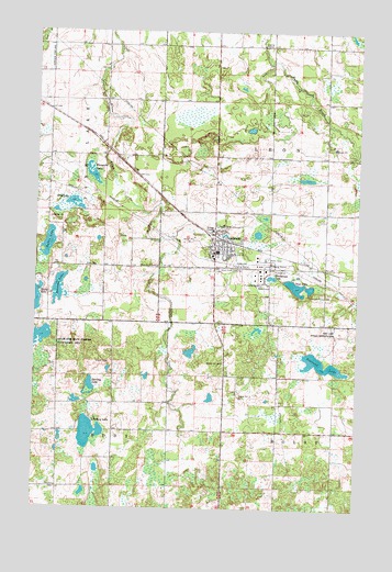
Clearbrook, MN USGS Topographic Map
Click on map above to begin viewing in our Map Viewer.

This topographic map contains these locations and features:
Feature Name Type Latitude Longitude GNIS ID View Map
Augustana CemeteryCemeteryN47.6886°W95.4536°639522View Map
City of ClearbrookCivilN47.6964°W95.4288°2393551View Map
ClearbrookPopulated PlaceN47.6919°W95.4311°641310View Map
Clearbrook (historical)LocaleN47.6958°W95.4261°2081936View Map
Clearbrook City Park CampgroundLocaleN47.6969°W95.4292°2081937View Map
Clearbrook Fire DepartmentBuildingN47.6936°W95.4288°2081945View Map
Clearbrook Gonvick SchoolSchoolN47.6922°W95.4300°2081941View Map
Clearbrook Police DepartmentBuildingN47.6921°W95.4302°2081946View Map
Clearbrook Post OfficePost OfficeN47.6872°W95.4269°2081938View Map
Clearwater Good Samaritan CenterHospitalN47.6914°W95.4314°2081940View Map
Deep LakeLakeN47.6832°W95.3981°642704View Map
Elim CemeteryCemeteryN47.6886°W95.4767°643246View Map
Elim Lutheran Brethren ChurchChurchN47.6922°W95.4308°2081942View Map
Erie LakeLakeN47.7047°W95.4862°643402View Map
First Baptist ChurchChurchN47.6919°W95.4308°2081943View Map
Johnson LakeLakeN47.6824°W95.4913°645707View Map
Klongerbo LakeLakeN47.7125°W95.4785°646194View Map
Leon Post Office (historical)Post OfficeN47.7444°W95.4292°2076605View Map
Lindberg LakeLakeN47.6448°W95.4787°646706View Map
Maple Hill CemeteryCemeteryN47.6633°W95.4272°647474View Map
Peterson LakeLakeN47.6630°W95.3896°649335View Map
Silver Creek CemeteryCemeteryN47.6880°W95.4214°652042View Map
Steenerson LakeLakeN47.6856°W95.4087°652604View Map
Sterling LakeLakeN47.6573°W95.4781°652623View Map
Taflin LakeLakeN47.6944°W95.4951°652980View Map
The Church of Jesus Christ of Latter Day SaintsChurchN47.6919°W95.4308°2081944View Map
Township of EddyCivilN47.6302°W95.4901°664040View Map
Township of LeonCivilN47.7174°W95.3871°664754View Map

Note: Coordinates in the location and feature list above are referenced to NAD83 datum.


Copyright (C) 2008-2024 Ryan Niemi / Sunset Dynamics ... All Rights Reserved