TopoQuest Logo
Do you find TopoQuest useful?
Help keep TopoQuest running and adding new maps/features by donating!
Bitcoin:  19c7KJd3qBynnjoSw5npx9KScwjBe4ifkT
Litecoin:  LXs6TkuXGGXo1vDsWCkWVdjQX94eUKd6ui
Home View Maps Find Maps Find Places Resources & Links


Shevlin, Minnesota Topographic Map

USGS Map Title: Shevlin, MN
USGS Map MRC: 47095E3
DRG (GeoTIFF) Download: o47095e3.tif


Neighboring USGS Topographic Map Quads:


  Clearbrook, MN  
47095F4
 

  Leonard, MN  
47095F3


  Bagley, MN  
47095E4
 

  Shevlin, MN  
47095E3


  Zerkel NW, MN  
47095D4
 

  Upper Rice Lake, MN  
47095D3


Map MRC Location:

N48°
W96°
N48°
W95°
H8 H7 H6 H5 H4 H3 H2 H1
G8 G7 G6 G5 G4 G3 G2 G1
F8 F7 F6 F5 F4 F3 F2 F1
E8 E7 E6 E5 E4 E3 E2 E1
D8 D7 D6 D5 D4 D3 D2 D1
C8 C7 C6 C5 C4 C3 C2 C1
B8 B7 B6 B5 B4 B3 B2 B1
A8 A7 A6 A5 A4 A3 A2 A1
N47°
W96°
N47°
W95°

Shevlin, MN USGS 1:24K Topographic Map Preview:
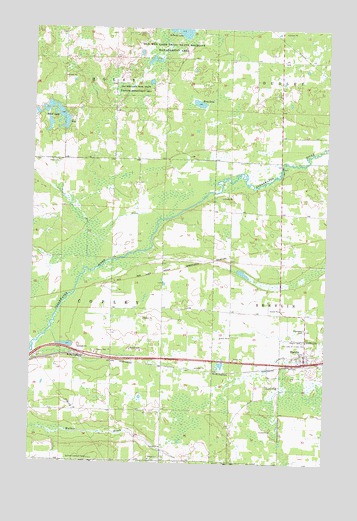
Shevlin, MN USGS Topographic Map
Click on map above to begin viewing in our Map Viewer.

This topographic map contains these locations and features:
Feature Name Type Latitude Longitude GNIS ID View Map
Bagley Municipal AirportAirportN47.5251°W95.3639°660046View Map
Berg LakeLakeN47.6035°W95.3052°639953View Map
Blair LakeLakeN47.5994°W95.3632°640250View Map
City of ShevlinCivilN47.5301°W95.2595°2395875View Map
Clearwater CemeteryCemeteryN47.5391°W95.2589°641313View Map
Clearwater Lutheran ChurchChurchN47.5303°W95.2583°2081933View Map
Landstad CemeteryCemeteryN47.5358°W95.2586°646469View Map
O J Mathison Mobile Home ParkPopulated PlaceN47.5303°W95.2583°2081929View Map
Old Red Lake Trail State Wildlife ManagementParkN47.6211°W95.3161°648932View Map
Our Lady of Victory CemeteryCemeteryN47.5349°W95.2589°649069View Map
ShevlinPopulated PlaceN47.5302°W95.2586°659763View Map
ShevlinLocaleN47.5289°W95.2600°2081934View Map
Shevlin CemeteryCemeteryN47.5352°W95.2600°651975View Map
Shevlin Fire DepartmentBuildingN47.5307°W95.2590°2081931View Map
Shevlin Post OfficePost OfficeN47.5303°W95.2583°2081932View Map
Solberg LakeLakeN47.6244°W95.3130°652230View Map
Summit Lookout TowerTowerN47.5013°W95.3497°659955View Map
The Last Resort Airport (historical)AirportN47.5663°W95.3142°660413View Map
Township of CopleyCivilN47.5450°W95.3594°663867View Map
Trinity Lutheran ChurchChurchN47.5303°W95.2583°2094131View Map
Trinity Lutheran ChurchChurchN47.5303°W95.2583°2081930View Map

Note: Coordinates in the location and feature list above are referenced to NAD83 datum.


Copyright (C) 2008-2025 Ryan Niemi / Sunset Dynamics ... All Rights Reserved