TopoQuest Logo
Do you find TopoQuest useful?
Help keep TopoQuest running and adding new maps/features by donating!
Bitcoin:  19c7KJd3qBynnjoSw5npx9KScwjBe4ifkT
Litecoin:  LXs6TkuXGGXo1vDsWCkWVdjQX94eUKd6ui
Home View Maps Find Maps Find Places Resources & Links


Bagwell, Texas Topographic Map

USGS Map Title: Bagwell, TX
USGS Map MRC: 33095F2
DRG (GeoTIFF) Download: o33095f2.tif


Neighboring USGS Topographic Map Quads:


  Woodland, TX  
33095G3
 

  Manchester, TX  
33095G2
 

  Negley, TX  
33095G1
 

  Detroit, TX  
33095F3
 

  Bagwell, TX  
33095F2
 

  Dimple, TX  
33095F1
 

  Deport, TX  
33095E3
 

  Line Branch, TX  
33095E2
 

  Clarksville, TX  
33095E1


Map MRC Location:

N34°
W96°
N34°
W95°
H8 H7 H6 H5 H4 H3 H2 H1
G8 G7 G6 G5 G4 G3 G2 G1
F8 F7 F6 F5 F4 F3 F2 F1
E8 E7 E6 E5 E4 E3 E2 E1
D8 D7 D6 D5 D4 D3 D2 D1
C8 C7 C6 C5 C4 C3 C2 C1
B8 B7 B6 B5 B4 B3 B2 B1
A8 A7 A6 A5 A4 A3 A2 A1
N33°
W96°
N33°
W95°

Bagwell, TX USGS 1:24K Topographic Map Preview:
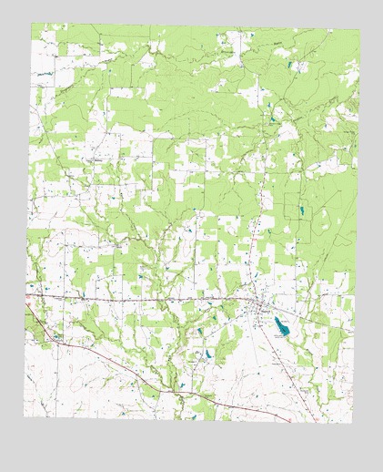
Bagwell, TX USGS Topographic Map
Click on map above to begin viewing in our Map Viewer.

This topographic map contains these locations and features:
Feature Name Type Latitude Longitude GNIS ID View Map
BagwellPopulated PlaceN33.6621°W95.1608°1351403View Map
Bagwell Community Volunteer Fire DepartmentBuildingN33.6628°W95.1647°2655403View Map
Bagwell Post OfficePost OfficeN33.6618°W95.1614°2731170View Map
Blanton Creek CemeteryCemeteryN33.7193°W95.1597°1352410View Map
BluffLocaleN33.6796°W95.2163°1352505View Map
Brooks LakeReservoirN33.6548°W95.1523°1352941View Map
Brooks Lake DamDamN33.6518°W95.1502°1860363View Map
Coal CreekStreamN33.6546°W95.1916°1354695View Map
Dean CemeteryCemeteryN33.6501°W95.2363°1355786View Map
Detroit DivisionCivilN33.6637°W95.2317°1938683View Map
Freeman CreekStreamN33.6548°W95.2424°1357717View Map
Liberty ChurchChurchN33.7068°W95.2258°1361158View Map
Longstreet CemeteryCemeteryN33.6626°W95.2358°1361778View Map
MidwayPopulated PlaceN33.7073°W95.2252°1380194View Map
Shamrock CemeteryCemeteryN33.6354°W95.1416°1368051View Map
Ward CemeteryCemeteryN33.6732°W95.2049°1370847View Map
Ward CreekStreamN33.6362°W95.1941°1370848View Map
Youngs Chapel CemeteryCemeteryN33.7171°W95.1263°1372067View Map

Note: Coordinates in the location and feature list above are referenced to NAD83 datum.


Copyright (C) 2008-2025 Ryan Niemi / Sunset Dynamics ... All Rights Reserved