TopoQuest Logo
Do you find TopoQuest useful?
Help keep TopoQuest running and adding new maps/features by donating!
Bitcoin:  19c7KJd3qBynnjoSw5npx9KScwjBe4ifkT
Litecoin:  LXs6TkuXGGXo1vDsWCkWVdjQX94eUKd6ui
Home View Maps Find Maps Find Places Resources & Links


Howard Reef, North Carolina Topographic Map

USGS Map Title: Howard Reef, NC
USGS Map MRC: 35075B8
DRG (GeoTIFF) Download: o35075b8.tif


Neighboring USGS Topographic Map Quads:


  Howard Reef, NC  
35075B8
 

  Green Island, NC  
35075B7
 

  Portsmouth, NC  
35076A1
 

  Ocracoke, NC  
35075A8


Map MRC Location:

N36°
W76°
N36°
W75°
H8 H7 H6 H5 H4 H3 H2 H1
G8 G7 G6 G5 G4 G3 G2 G1
F8 F7 F6 F5 F4 F3 F2 F1
E8 E7 E6 E5 E4 E3 E2 E1
D8 D7 D6 D5 D4 D3 D2 D1
C8 C7 C6 C5 C4 C3 C2 C1
B8 B7 B6 B5 B4 B3 B2 B1
A8 A7 A6 A5 A4 A3 A2 A1
N35°
W76°
N35°
W75°

Howard Reef, NC USGS 1:24K Topographic Map Preview:
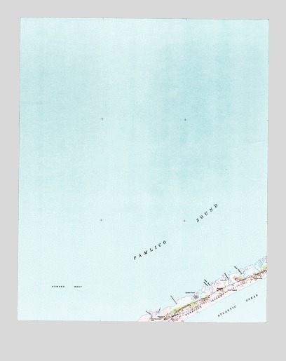
Howard Reef, NC USGS Topographic Map
Click on map above to begin viewing in our Map Viewer.

This topographic map contains these locations and features:
Feature Name Type Latitude Longitude GNIS ID View Map
Cass Williams CampLocaleN35.1346°W75.9096°982733View Map
Clark ReefBarN35.1605°W75.8924°1008352View Map
Dicks CampLocaleN35.1416°W75.8954°984173View Map
Hammock OaksAreaN35.1266°W75.9257°986339View Map
Howard ReefBarN35.1391°W75.9738°987183View Map
Island CreekStreamN35.1293°W75.9285°987418View Map
Knoll CedarsSummitN35.1380°W75.8921°1021064View Map
Knoll House CreekStreamN35.1463°W75.8888°988050View Map
Little Swash OpeningBayN35.1396°W75.9027°988786View Map
Ocracoke Census Designated PlaceCensusN35.1280°W75.9153°2403368View Map
Ocracoke IslandIslandN35.1321°W75.9052°991515View Map
Old Hammock CreekStreamN35.1329°W75.9202°991562View Map
Parkers HillSummitN35.1385°W75.8971°1021811View Map
Quokes PointCapeN35.1371°W75.9102°992956View Map
Sand Hole CreekStreamN35.1285°W75.9338°994226View Map
The KnollSummitN35.1435°W75.8807°995984View Map
Township of OcracokeCivilN35.1408°W75.8939°1026810View Map
Try Yard CreekStreamN35.1449°W75.8943°996283View Map

Note: Coordinates in the location and feature list above are referenced to NAD83 datum.


Copyright (C) 2008-2024 Ryan Niemi / Sunset Dynamics ... All Rights Reserved