TopoQuest Logo
Do you find TopoQuest useful?
Help keep TopoQuest running and adding new maps/features by donating!
Bitcoin:  19c7KJd3qBynnjoSw5npx9KScwjBe4ifkT
Litecoin:  LXs6TkuXGGXo1vDsWCkWVdjQX94eUKd6ui
Home View Maps Find Maps Find Places Resources & Links


Ocracoke, North Carolina Topographic Map

USGS Map Title: Ocracoke, NC
USGS Map MRC: 35075A8
DRG (GeoTIFF) Download: o35075a8.tif


Neighboring USGS Topographic Map Quads:


  Howard Reef, NC  
35075B8
 

  Green Island, NC  
35075B7
 

  Portsmouth, NC  
35076A1
 

  Ocracoke, NC  
35075A8


Map MRC Location:

N36°
W76°
N36°
W75°
H8 H7 H6 H5 H4 H3 H2 H1
G8 G7 G6 G5 G4 G3 G2 G1
F8 F7 F6 F5 F4 F3 F2 F1
E8 E7 E6 E5 E4 E3 E2 E1
D8 D7 D6 D5 D4 D3 D2 D1
C8 C7 C6 C5 C4 C3 C2 C1
B8 B7 B6 B5 B4 B3 B2 B1
A8 A7 A6 A5 A4 A3 A2 A1
N35°
W76°
N35°
W75°

Ocracoke, NC USGS 1:24K Topographic Map Preview:
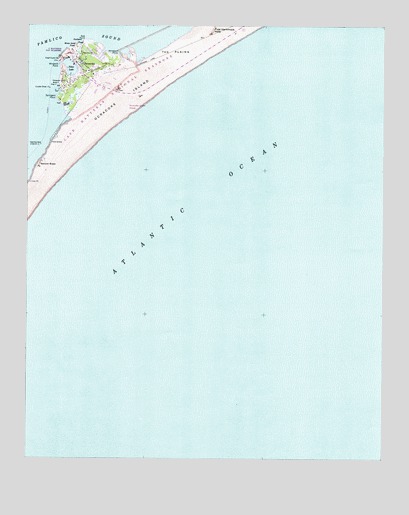
Ocracoke, NC USGS Topographic Map
Click on map above to begin viewing in our Map Viewer.

This topographic map contains these locations and features:
Feature Name Type Latitude Longitude GNIS ID View Map
Anchorage InnLocaleN35.1149°W75.9838°1003071View Map
Assembly of God ChurchChurchN35.1068°W75.9871°1003076View Map
British CemeteryCemeteryN35.1160°W75.9730°1003067View Map
Cockle Shoal LightTowerN35.1071°W75.9921°983326View Map
Ferry OfficeLocaleN35.1168°W75.9866°1003069View Map
First GrassSummitN35.0916°W75.9905°1020251View Map
First Hammock HillsSummitN35.1238°W75.9355°985090View Map
Gap PointCapeN35.1204°W75.9799°985543View Map
Horsepen PointCapeN35.1166°W75.9682°987139View Map
Jackson DunesPopulated PlaceN35.1121°W75.9682°1003063View Map
Mary Anns PondBayN35.1193°W75.9835°989415View Map
Northern PondBayN35.1204°W75.9813°991295View Map
OcracokePopulated PlaceN35.1146°W75.9810°1021718View Map
Ocracoke Island AirportAirportN35.1041°W75.9627°997887View Map
Ocracoke Island Emergency Medical Services District 2BuildingN35.1126°W75.9787°2720695View Map
Ocracoke Light HouseLocaleN35.1091°W75.9860°1003937View Map
Ocracoke Post OfficePost OfficeN35.1069°W75.9724°1003072View Map
Ocracoke Volunteer Fire DepartmentBuildingN35.1118°W75.9774°2638341View Map
Okracoke Fire HallLocaleN35.1118°W75.9774°1003073View Map
Okracoke Sheriffs OfficeLocaleN35.1068°W75.9727°1003078View Map
Old SloughGutN35.1027°W75.9849°991607View Map
Oyster CreekPopulated PlaceN35.1182°W75.9755°1003065View Map
Pamlico ShoresPopulated PlaceN35.1188°W75.9843°1003066View Map
Raleigh BayBayN35.0002°W75.9996°1002796View Map
Second GrassSummitN35.0852°W75.9955°1022534View Map
Silver LakeHarborN35.1135°W75.9852°994817View Map
Sound ShoresPopulated PlaceN35.1154°W75.9724°1003064View Map
Springers PointCapeN35.1041°W75.9891°995364View Map
Teaches Hole ChannelChannelN35.1116°W75.9896°1003075View Map
Teaches Hole Channel LightTowerN35.0907°W75.9949°995907View Map
The PlainsPlainN35.1185°W75.9480°996005View Map
United States Park Service CampgroundsLocaleN35.1088°W75.9530°1003062View Map
United States Park Service DocksLocaleN35.1154°W75.9863°1003068View Map
Widgen WoodsPopulated PlaceN35.1074°W75.9413°1003077View Map
Windmill PointCapeN35.1135°W75.9885°997472View Map

Note: Coordinates in the location and feature list above are referenced to NAD83 datum.


Copyright (C) 2008-2024 Ryan Niemi / Sunset Dynamics ... All Rights Reserved